
Delta Rapidly Intensifies Into A Hurricane
Just 24 hours after being designated as a tropical cyclone, Delta became the 10th hurricane of the Atlantic season last night after hurricane hunters found winds above 75 mph. The storm has since continued to rapidly intensify and has maximum winds of 100 mph as of the 5 AM EDT NHC advisory.
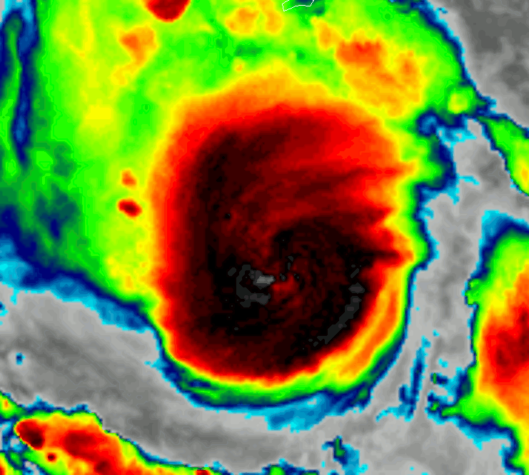
Satellite imagery this morning doesn’t yet show an eye, but radar data from the Cayman Islands and recon plane observations confirm its existence. I suspect we’ll see an eye pop out on satellite imagery later this morning. Regardless of when exactly the eye decides to make an appearance, the storm is still rapidly strengthening and should continue to do so today. The environment over the NW Caribbean is about as favorable for intense hurricanes as possible with very low shear, no dry air in sight, and some of the warmest water on Earth. There’s no reason to believe Delta won’t continue rapidly intensifying until it makes landfall in the northeastern Yucatan Peninsula early tomorrow morning.
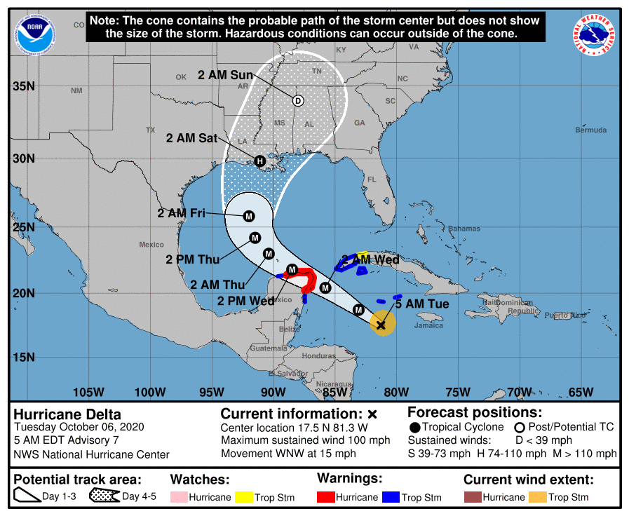
The current NHC forecast calls for Delta to continue moving northwest until Thursday, passing over or very near Cancun tomorrow morning. As the storm moves into the central Gulf of Mexico, it will turn to the north and northeast in response to an upper-level trough over Texas. While future shifts in track are certainly possible, the presence of this trough leads to higher-than-usual confidence in a track somewhere along the Louisiana coastline. That said, anyone from the Upper Texas coast to the Florida Panhandle needs to be watching Delta carefully. Regardless of where the eye makes landfall, impacts will extend far from the center.
-Jack
Issued: 10/6/2020