10/21/25 - Tropical Storm Melissa Forms In The Caribbean
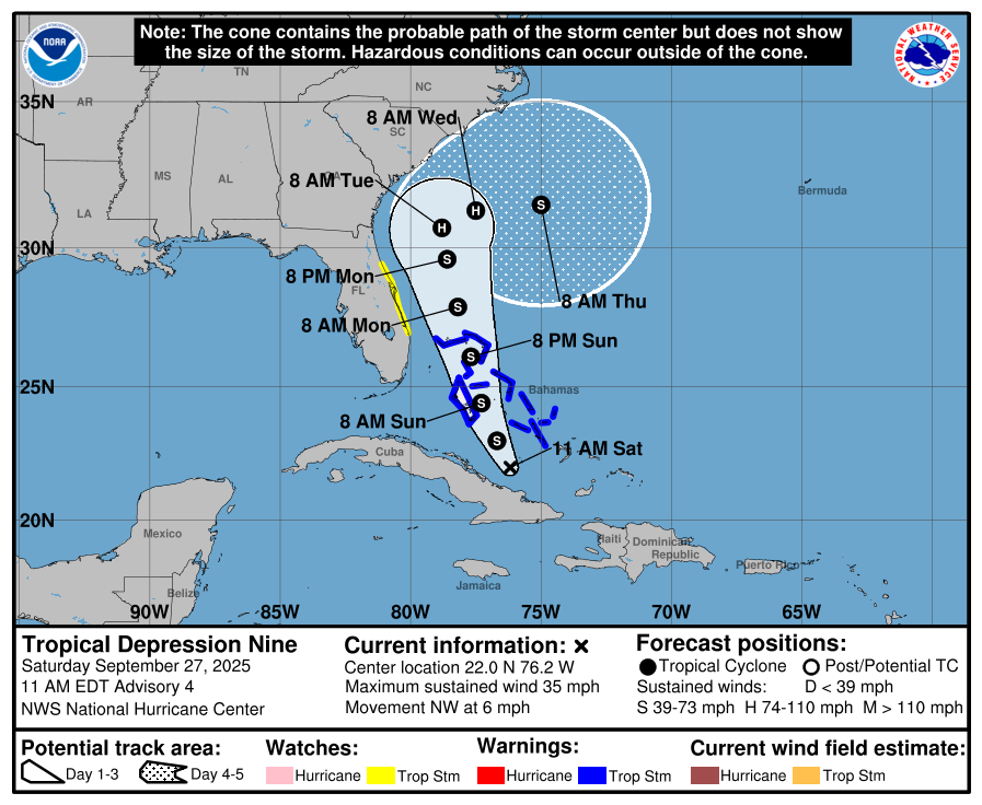
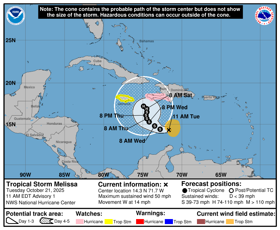
Tropical Storm Melissa has formed in the central Caribbean. It’s forecasted by the NHC to become the next hurricane. The track forecast is uncertain at this time. Melissa will eventually be pulled to the north/northeast, but the question at this time is how far west will it track before the turn occurs? Impacts are likely for portions of the central Caribbean and the Bahamas within the next week. While impacts to Florida can’t be completely ruled out, that threat appears low at this time. Premium graphics will be available to subscribers once our servers ingest the NHC data and process the images. Always click on “current storms'“ down below for the latest on Melissa. Stay tuned for updates as needed.

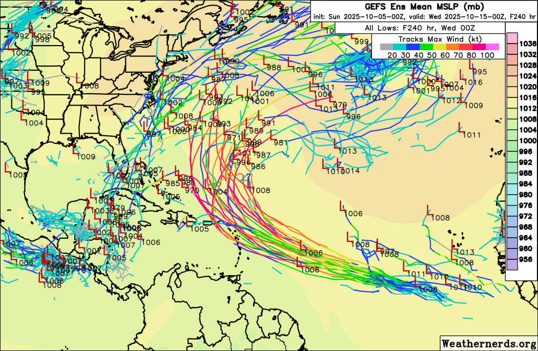
The latest European ensembles as of 0Z 10/21/25
IMPORTANT NOTE FOR OUR USERS:
We have had a lot of premium cancellations this season due to the lack of inactivity in the tropics this season. We certainly understand the reasoning and will never tell a user they can’t cancel. However, our app and server costs are supported heavily by our premium user base. We make this app free on the App Store. If you have not signed up for premium, and love this app, and would like to see it keep going into the future - please consider signing up here. You can also donate any amount here. Thanks for your support in helping keep Hurricane Tracker alive and well!
GO HI-RES! If you are not already a premium graphics subscriber, sign up today and take full advantage of what Hurricane Tracker has to offer. Details here > Premium Graphics Info. Thank you for being a Hurricane Tracker App user and supporting our passion for tracking tropical cyclones! We couldn’t do this without your support! 2025 will be our 15th year of tracking tropical systems!
Details here > Premium Graphics Info.
Thanks for your ongoing support and helping to keep this app active!