TS Dorian May Impact FL/NW Bahamas As A Powerful Hurricane
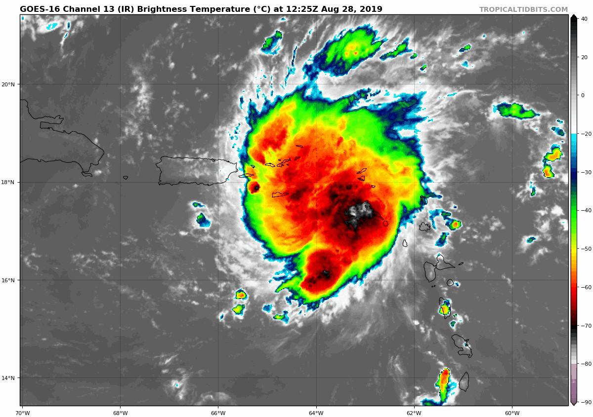
Summary: Today, Tropical Storm Dorian is a strong tropical storm and is on the verge of becoming a hurricane. The US Virgin Islands are under a hurricane warning and Puerto Rico is under a tropical storm warning as the storm will move through the region today. Once Dorian is north of Puerto Rico, it is forecasted to become a hurricane as the environment will be conducive for strengthening. A building ridge of high pressure over the Southwest Atlantic will likely turn Dorian towards the Northwest Bahamas and Florida early next week. A track into the Gulf of Mexico early next week is also possible and cannot be ruled out.
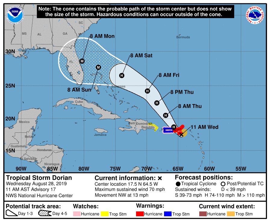
Track: It is highly unlikely that Tropical Storm Dorian will make a right turn and head out to sea. A strong ridge of high pressure is forecasted to build north of the storm in a few days and will cause Dorian to make a left turn towards the NW Bahamas and the FL coastline. While models have varied a little day to day, there haven’t been any wild swings in the model data. All models and ensembles agree on a turn west towards the NW Bahamas & FL. Unfortunately, chances are high that the NW Bahamas and somewhere along the FL Peninsula will see direct impacts from Dorian early next week. However, it is too soon to know exactly where landfall will occur this far out. Beyond Monday, it is possible that Dorian could slip into the eastern Gulf of Mexico if the ridge of high pressure is stronger than currently forecasted.
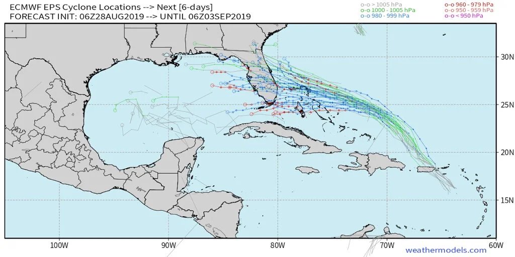
06Z European ensemble model guidance.
Intensity: Model guidance is picking up on the favorable environment and warm waters in the Southwest Atlantic which should lead to Dorian becoming a major hurricane in about 3 days. The NHC states: “All indications are that by this Labor Day weekend, a powerful hurricane will be near the Florida or southeastern coast of the United States.” There is nothing in the forecast at this time that will greatly hinder Dorian from becoming a powerful hurricane. The NHC currently forecasts the peak intensity to be near 115 mph (category 3). Take this system very seriously if you are in the NHC’s cone.
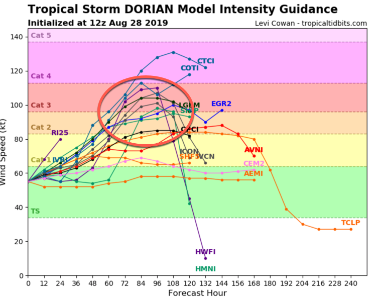
The latest intensity models forecast a powerful hurricane.
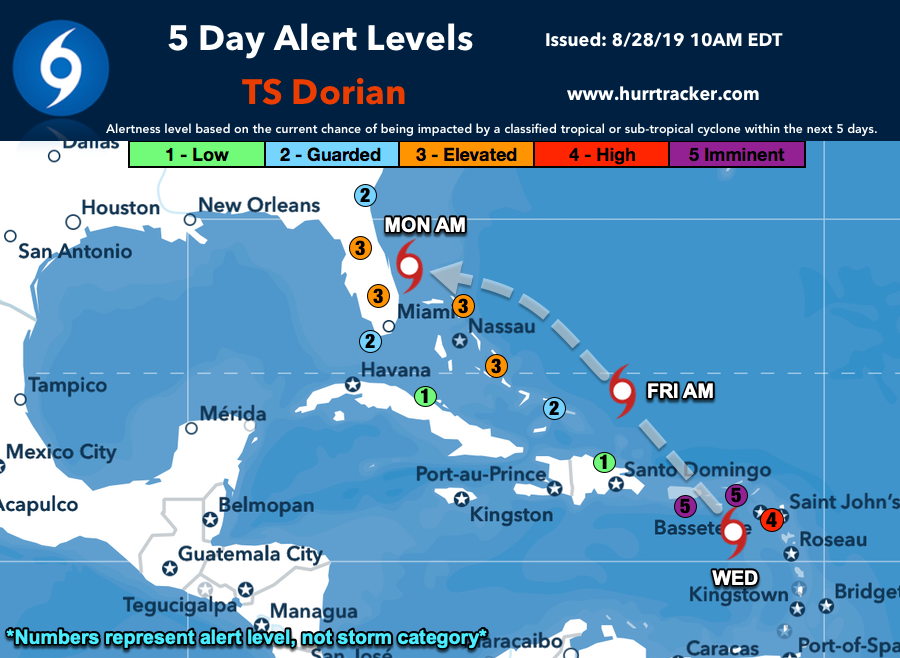
Alert Levels: The latest 5 Day Alert Level Map from the Hurricane Tracker App now has "elevated" 5 day alert levels for a good portion of the FL Peninsula. Have a hurricane plan in place & know how to execute those plans if watches/warnings are issued. Risks are increasing for FL & NW Bahamas.
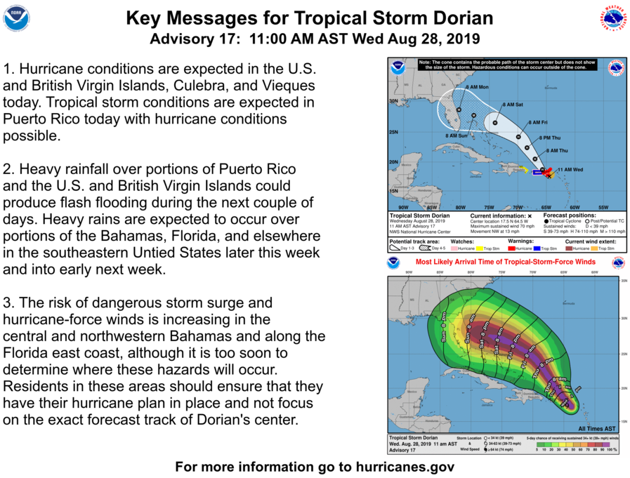
NHC Key Messages: