8/27/16 - Invest 99L Getting Better Organized. Slowly...
8/27/16 - We will have a new post and email update later this evening on #99L. Some interesting developments today. No imminent threat to land or south Florida though.
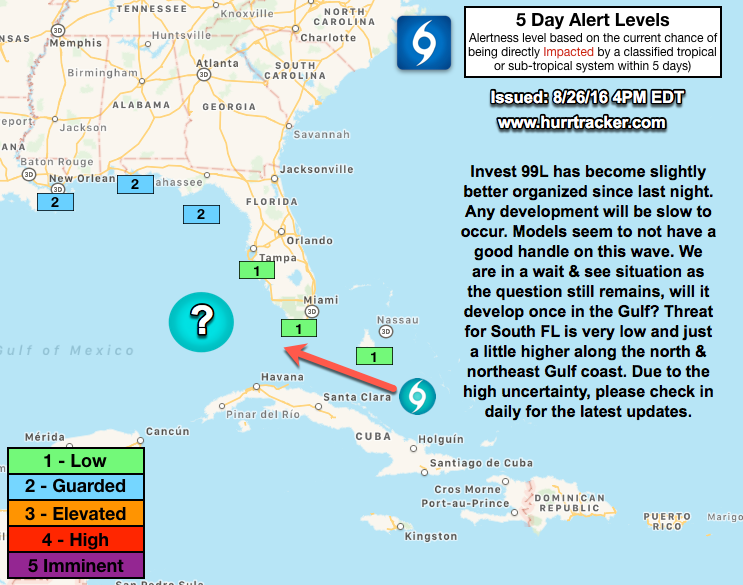
What a roller coaster ride it has been with Invest 99L. This has been the most challenging system to forecast as the models are performing very poorly. There is some evidence that 99L has become better organized today and is producing sustained periods of convection near its broad center. Wind shear is low above the system, but it has come down significantly since yesterday and 99L will continue to move into a more favorable environment and warmer ocean temperatures. The NHC states there is a 60% chance of development.
While it appears the threat for a tropical cyclone across S FL is low (cannot completely be ruled out), the threat for heavy rains this weekend and early next week exists. Localized flooding may become a concern across parts of S FL as this system passes through the Florida Straits.
If you are a resident or have an interest along the north or northeastern Gulf Coast, continue to check in daily on this system as there is a medium chance it could develop in the Gulf and affect someone. There is high uncertainty with this outlook and we will let you know when the forecast becomes more clear, for now just remain vigilant.
~Hurricane Tracker App Team
If you would like to receive these updates the moment they are published, please click here to sign up for email updates.