WED 9/10 2PM EDT: Development Near FL possible
(See Bottom of The Post For New System In The E Pacific)
This is a quick update on newly tagged Invest 92L in the Bahamas. This system is quickly becoming better organized this afternoon and chances appear to be increasing that we may see a tropical cyclone form just east of Florida over the next couple of days as slowly moves towards the west. We will add the invest to the app along with a full discussion by 5PM EDT. Interests in the Bahamas & South Florida should pay close attention to this developing weather story. We will have a full discussion later today.
9AM: Today marks the climatological peak of the 2014 Atlantic hurricane season. Dry air has has kept a tight lid on activity so far this season compared to normal. There are a couple of systems in the Atlantic to watch (see below), but nothing of real concern. Closest to land, is an area of disturbed weather over the Bahamas. The convection has been weakening and development chances are in the low category.
Invest 91L in the eastern Atlantic has a high chance of developing into the next named system over the next five days. The good news is this system will stay out in the open waters of the Atlantic.
We would like to remind everyone that the 2014 Atlantic hurricane season goes through the end of November. While it has been quiet so far, all it takes is one storm to cause issues over one area. We will likely only see two or three more named storms based on the current pattern before the season ends. There's always a possibility later in the season that a system could develop in the Caribbean or the Gulf and move towards the north. We will be here through the end of the season with constant updates to keep you informed.

9/10/14 marks the peak of hurricane season and satellites show an unusually quiet period.

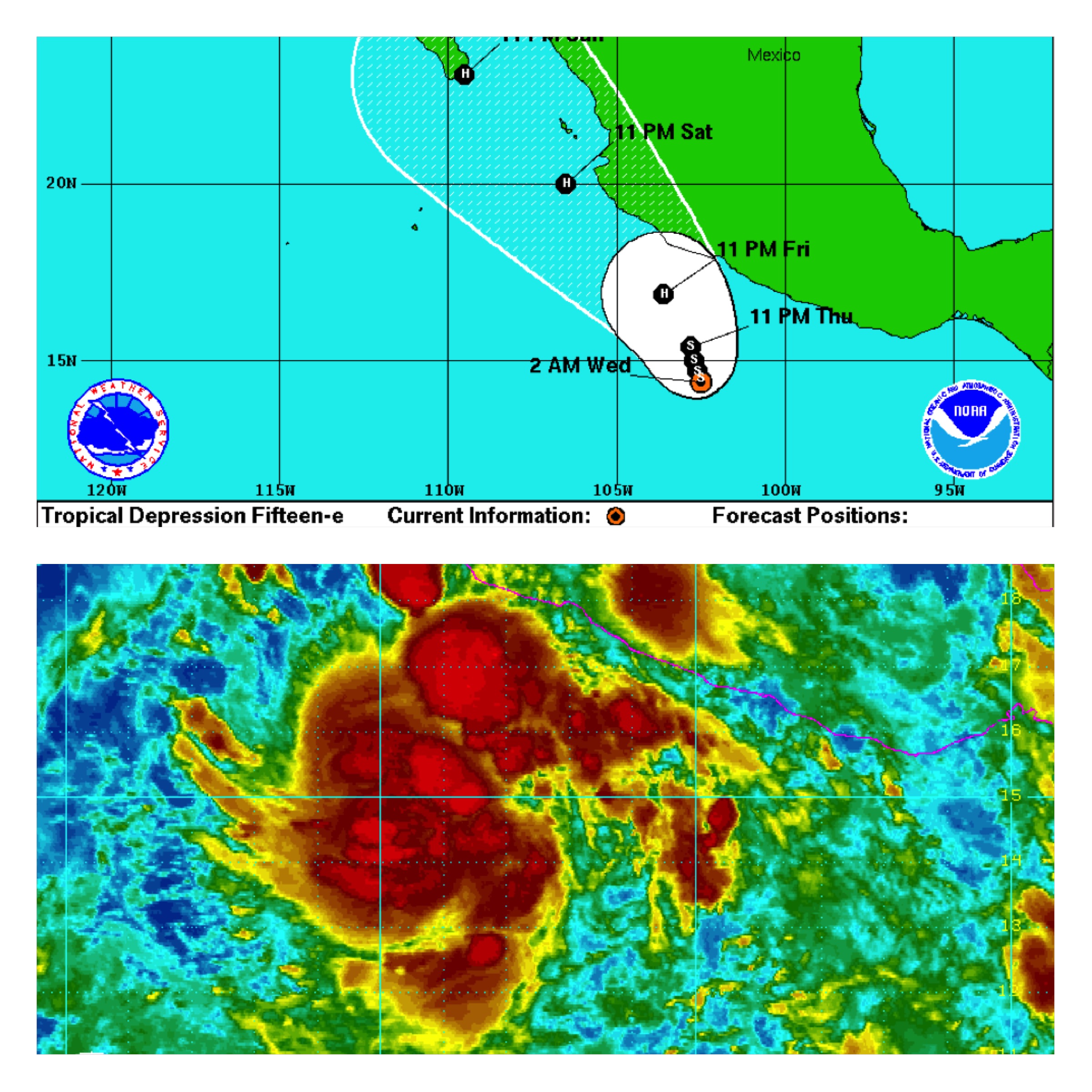
Over in the eastern Pacific off of the coast of Mexico it continues to be very active. The 15th tropical cyclone of the year has formed (TS Odile) and the forecast is for it to strengthen into a category one hurricane and move towards Cabo San Lucas on the Baja Peninsula of Mexico by Sunday. A stronger category two hurricane is not out of the question. If you are a resident or have interests in the Baja Peninsula or southwestern Mexico, please pay very close attention to this system over the next couple of days. Early next week, this system is likely to bring more moisture into the southwestern United States.