
9/8/18 - Florence Poised To Impact The Southeastern United States
We are in the climatological peak of hurricane season and unfortunately a major hurricane will have the potential to make landfall next week somewhere from northeast FL to North Carolina. The threat to Bermuda has diminished as Florence will track south of the island.
Today Florence is a tropical storm, but recon data shows pressures are beginning to drop and Florence should regain hurricane strength within 24 hours and become a major hurricane by Tuesday.
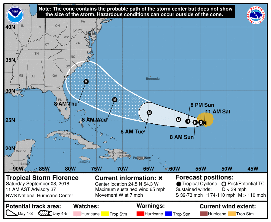
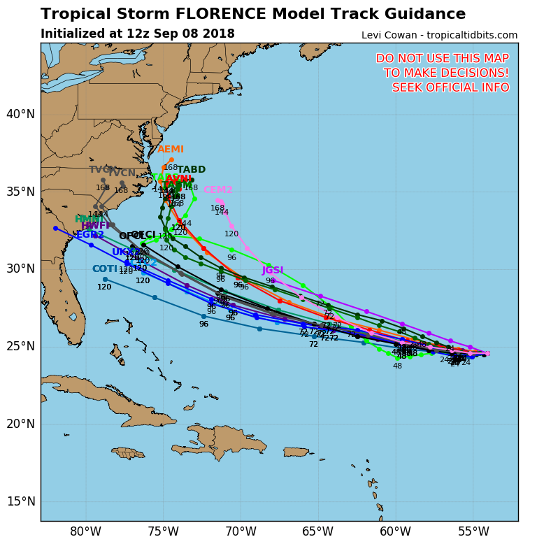
Models remain adamant that a strong high pressure ridge over the western North Atlantic will push the storm towards the coast. The latest GFS model keeps Florence just off the coast of North Carolina, but it’s notorious for breaking down high pressure ridges too quickly. We are leaning with the EURO/UKMET model suite.
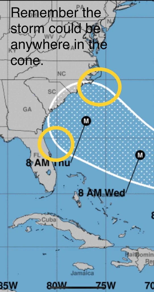
Note, the hurricane can track anywhere within the five day NHC cone. Brand Panovich posted this image on Twitter and it does a good job at conveying this. Florence is forecasted to be a major hurricane with winds of 130-145 mph as it approaches the coast in 4-5 days. Environmental conditions will support a major hurricane. There’s no wind shear or dry air forecasted at this time to help limit strength.
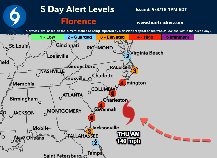
Our 5 Day Alert Levels
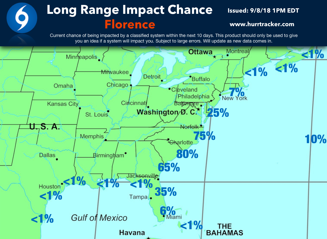
Our latest impact chance graphic.
If you are a resident or have interests from eastern FL into NC, please review your hurricane plan and listen to local officials over the coming days. We will amend this discussion with more information this afternoon once more data comes in.
Thanks for using Hurricane Tracker.