
TS Fiona Is Likely This Week, Followed By 2 More Storms
Note: We will issue a new post on TD6/Fiona and our next possible system on Wednesday 8/17. Receive our detailed discussions via email as soon as they are published, please tap here.
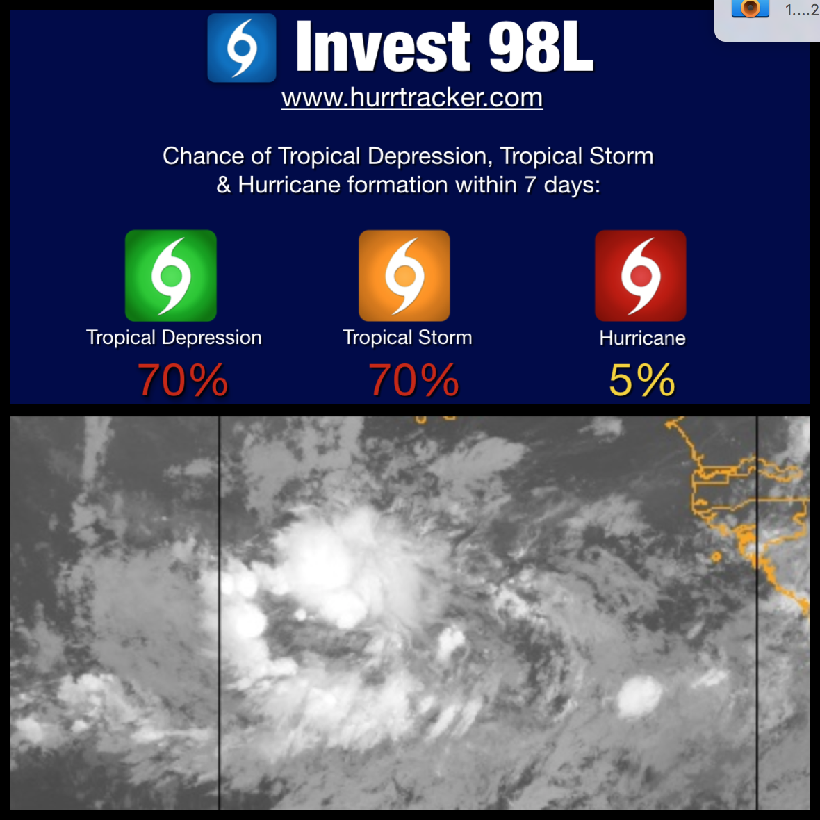
We are now tracking Invest 98L which we are giving a high chance of development (70%). During the last couple of days, models (particularly the EURO/GFS models) have been been showing development. The environment across the Main Development Region (MDR) has become markedly better than the past several weeks. It appears this could lead to a burst of systems across the Atlantic as models are in good agreement that we could see Fiona, Gaston and Hermine develop from African waves all within the next 7-10 days. Of course it's too early to pin point tracks, but early indications are that 98L/Fiona will stay out to sea, while the wave behind it (currently still over Africa) will have to be watched very closely as it could possibly track more west and pose a threat to the eastern Caribbean sometime next week. Stay tuned to the Hurricane Tracker App for the latest on 98L and the potential uptick in activity.

7 days from now, the GFS & EURO models show multiple systems spread across the Atlantic.