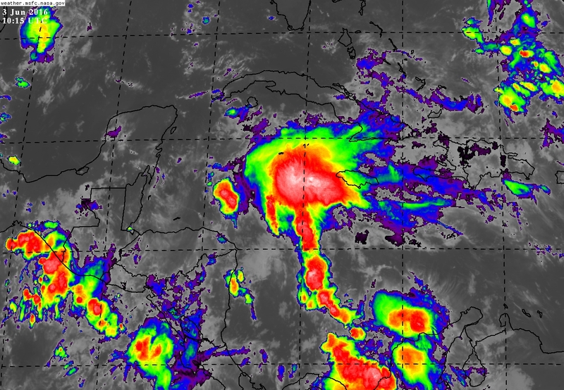
6/3/16 - TS Colin May Form Next Week & Impact FL
Receive our detailed discussions via email as soon as they are published, please tap here. Our posts are updated as conditions warrant, but all storm data including advisories, maps, models and NHC data within the storm pages are updated in real time
Whew, we are only 2 days into the season and we are already watching for the potential of our third named system. Also, Bonnie has re-gained tropical characteristics and is a depression again. Bonnie is moving away from the NC coastline and will continue to do so.
As Bonnie departs, we turn our attention to the SW Caribbean where an area of disturbed weather is beginning to take shape. This area will work its way northward into the southern Gulf of Mexico late this weekend and forecast models are depicting an area of low pressure to form. Currently, the NHC states there is a 60% chance of development through 5 days. All of the major models are forecasting at least a tropical storm to develop, while a couple models are close to hurricane strength. At this time, it appears the system wouldn't be anything more than a moderate tropical storm (50-55 mph winds) as wind shear is forecasted to be strong across the Gulf of Mexico and should keep the system in check despite warm waters. We only see a 20% chance at this time of this system becoming a hurricane if it develops. If a tropical storm forms, this would be the earliest "C" named storm in recorded history. Fast start to 2016 for sure.
Here is our thinking on track/intensity/timing based on the latest data. Food threat will be highest in SW FL.
Track: The future track of this system seems fairly straightforward. Steering winds out of the west across the Gulf of Mexico would turn the system towards the west-central FL coast (even as far N as the Big Bend region) on Monday-Tuesday. As the system approaches FL, the models show it picking up forward speed and quickly crossing the peninsula. This will limit the amount of rain falls across central FL.
Impacts/Intensity: The biggest impacts at this time will be heavy rain where 3-6 inches with locally higher amounts will be common to the east and southeast of the center. Thinking SW FL is in position to see the highest rainfall totals at this point. We do want to note, there wont be as much rain on the western side of the storm due to the forecasted wind shear. The forecast could change, but at this time winds up to 50-55 mph will be possible on the east side of the center. We will monitor future model runs and let you know if they trend stronger.
Forecasted wind shear from today's GFS run. Wind shear of 40-50 knots could affect the western side of the system.
Conclusion: All interests in FL should check in often for updates on this developing system. We will be here through the weekend with continued updates. Thank you for using and trusting the Hurricane App for your tropical weather information. For more frequent information, follow us on Twitter @hurrtrackerapp.
If you have an 2 extra minutes, take a listen to our latest audio update here: http://bit.ly/1cHTE10


