
MON 8/11 11AM EDT - Tracking Invest 94L/Hurricane Julio
A broad area of low pressure in the east Atlantic has been designated as Invest 94L. The NHC has placed 20% odds of development over the next 5 days. This broad area of low pressure will generally head towards the west and may develop some. However, there is still a strong layer of African dust over the central/eastern Atlantic that may inhibit significant development as we recently saw with TS Bertha & TD 2. Wind shear across the Atlantic seems favorable to support development. Please visit the Current Storms page for Invest 94L for more information. As always, we will keep you updated.

Hurricane Julio will pass north of Hawaii causing little issues. There may be some increased surf on the northern shores of Hawaii, but that's about it.
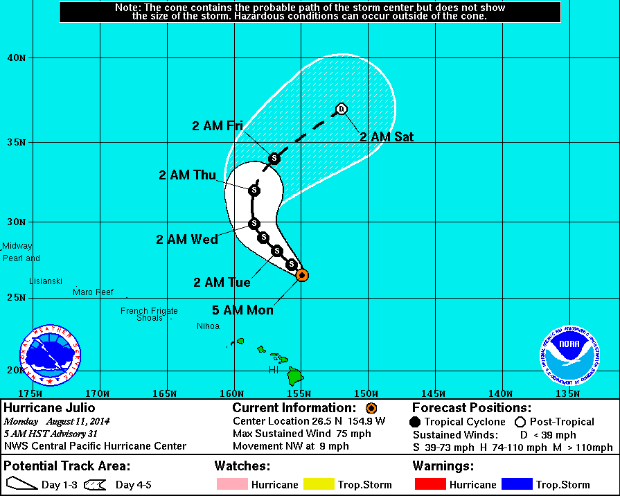
Julio will pass north of Hawaii.