FRI 8/8 5AM HST - TS Iselle Has Made Landfall
TS Iselle has made landfall, but will continue to drench portions of the island with rainfall for the next few hours. TS Warnings are still posted for all of Hawaii. Hurricane Julio should pass safely north of Hawaii, but we will keep an eye on it for you. The Atlantic Basin appears it will start to get busy sometime late next week. Stay tuned for tropical updates from the Hurricane Tracker App.


hurrtrackerapp
Strengthening…2PM HST #Iselle Update: 80 mph winds (CAT 1) /WNW @ 17 mph/150 miles ESE of Hilo.
8/7/14, 8:02 PM
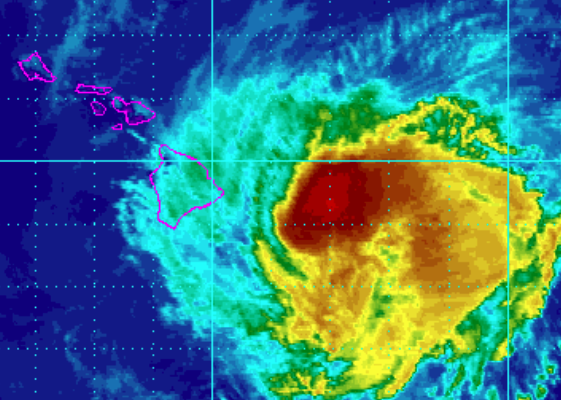
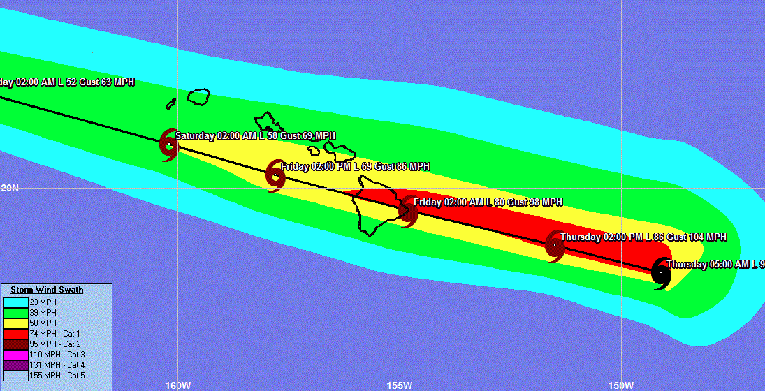
Hurricane warnings have been issued for the big island of Hawaii as Hurricane Iselle heads west northwest. Iselle is forecasted to make landfall on the big island of Hawaii tonight. Hawaii county can expect 60-80 mph winds with higher gusts along with 5-8 inches of rainfall. Winds will be stronger at higher elevations, possibly up to 85-90 mph at 1-2K feet. The northern half of the island has the greatest chance of seeing the strongest winds, especially Hilo, HI. A little more weakening is forecast before landfall, but not much.
Storm surge will be 1-3 feet (Big Island Windward & Kau). TS warnings are also in effect for Maui County (See graphic below for complete watches/warnings) . The weather will begin to deteriorate later this evening with the worst of the weather passing overnight and early FRI morning. If you need constant updates, follow our real time Twitter feed @hurrtrackerapp. Tap on the Eastern Pacific tab for complete storm information. (We have also added animated radar and some updated maps to the "Maps & Models" section on Iselle's page.)