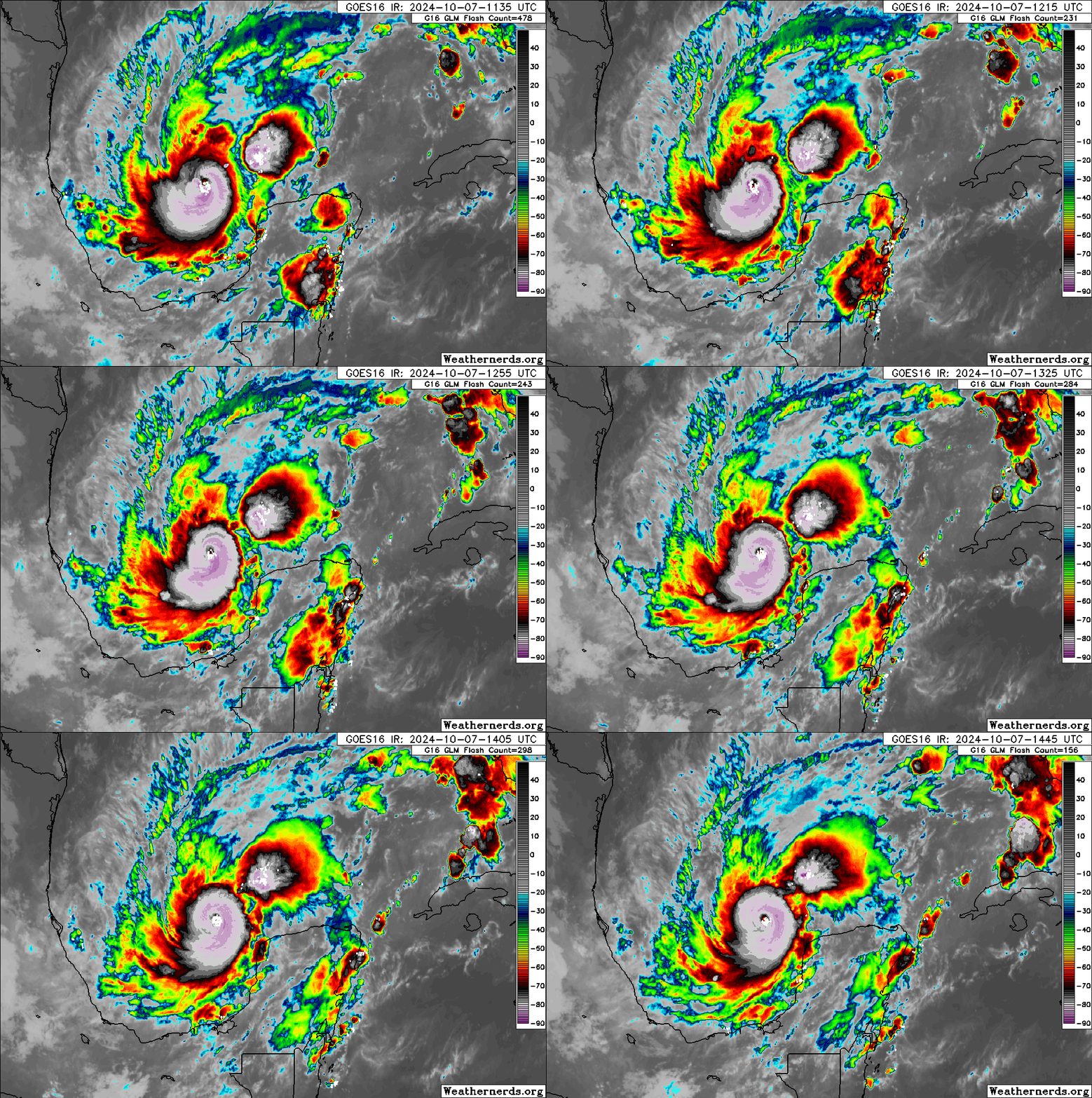
10/8/24 - Major Hurricane Milton Headed To Florida

After weakening some last night due to an eye-wall replacement cycle, Milton has intensified once again and regained high-end Category 5 status with 165 mph winds. Upon approach to Florida on Wednesday, Milton is expected to interact with some upper-level wind shear and that should cause some slight weakening but not enough to knock it below major hurricane status. Milton’s wind field is also expected to double in size and damaging winds, life-threatening storm surge, and heavy rainfall will extend well outside the forecast cone. This is a very serious situation and residents in Florida should closely follow orders from their local emergency management officials. Evacuations and other preparations should be completed today. Milton has the potential to be one of the most destructive hurricanes on record for west-central Florida. please check the current storms tab > milton for all the latest graphics and advisories

We will have a new push alert update after the Wednesday 5 PM EDT NHC Advisory.

If you are not already a premium graphics subscriber, sign up today and get higher-resolution storm graphics that contain more information so you can make informed decisions. It also helps support our app since we now offer it free. We want to be around for a long time!

Premium users will also have access to wind graphics that the NHC does not publish. Details & sign up here > Premium Graphics Info.

Thank you for being a Hurricane Tracker App user and supporting our passion for tracking tropical cyclones!

10/7/24 - Milton Is a Powerful Category 5 Hurricane

Hurricane Milton has rapidly intensified during the last 24 hours and is now a category 5 storm with winds near 180 mph. Milton should begin weakening a little bit as the environment near the coast won't be as favorable to maintain its current intensity. However, even if Milton weakens a little bit, it’s still going to be a very large and powerful hurricane with catastrophic effects across portions of Florida, especially near the coast where it makes landfall. If you are in the path of Milton, please take this storm very seriously and take any and all precautions to protect life and property and as always, listen to local officials when it comes to evacuations. Tropical storm, hurricane and storm surge watches are in effect for portions of Florida. Please click on the discussion tab below to read out full analysis on Milton.

NOTE: Due to the overwhelming interest in Major Hurricane Milton, NOAA servers are experiencing high user loads at times and it may impact some data in the app loading slowly or not loading at all during peak times. Some, but not all data within our app relies on the NOAA servers functioning properly. If you are a premium graphics subscriber, our premium section does not rely on NOAA servers and should function properly as our servers are functioning properly at this time. Premium graphics are updated every 6 hours with each full NHC advisory package.

If you are not already a premium graphics subscriber, sign up today and get higher-resolution storm graphics that contain more information so you can make informed decisions. It also helps support our app since we now offer it free. We want to be around for a long time!

Premium users will also have access to wind graphics that the NHC does not publish. Details & sign up here > Premium Graphics Info.

Thank you for being a Hurricane Tracker App user and supporting our passion for tracking tropical cyclones!

10/6/24 - Milton Has Become a Hurricane

Milton has become the 9th hurricane of the season with winds of 80 mph and is forecasted to become a dangerous major category 4 hurricane with winds near or in excess of 145 mph when it makes landfall in FL on Wednesday. Landfall will be some near or just of Tampa Wednesday afternoon. Do no focus on the exact track as impacts will reach far from the center. Storm surge and hurricane watches will likely be issued for parts of Florida later today. Please use the next couple of days to make plans and preparations to protect life and property if you are in the cone.

If you are not already a premium graphics subscriber, sign up today and get higher-resolution storm graphics that contain more information so you can make informed decisions. It also helps support our app since we now offer it free. We want to be around for a long time!

Premium users will also have access to wind graphics that the NHC does not publish. Details & sign up here > Premium Graphics Info.

Thank you for being a Hurricane Tracker App user and supporting our passion for tracking tropical cyclones!