2/9/26 - 2026 Atlantic Pre-Season Outlook #1
We are just a little under 4 months away from the beginning of another hurricane season and as of the latest data we have, it’s looking like it could be a near average season. A La Niña pattern has dominated across the tropical pacific which has led to a dreadful winter weather pattern that has been dominate across the midwest U.S. and the eastern U.S. However, the cooler waters across the tropical Pacific are warming and all indications point to a moderate El Niño setting in just in time for hurricane season. We will likely see neutral ENSO conditions late February through April (No El Niño or La Niña) followed by a strengthening El Niño near the end of Spring 2026.
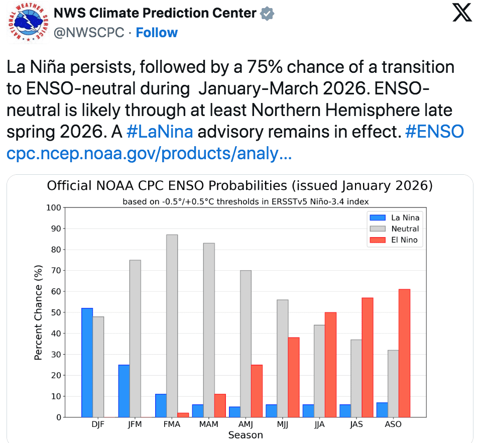
A post from the National Weather Service’s Climate Prediction Center shows NOAA’s ENSO outlook issued in January, including a 75% chance of a transition to ENSO-neutral by late winter/early spring and rising El Niño odds later in the year. (Photo courtesy NWS Climate Prediction Center)
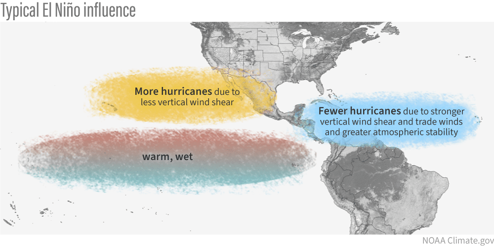
El Niño conditions tend to increase wind shear across the Caribbean and the Main Development Region of the Atlantic limiting the intensity and number of tropical systems.
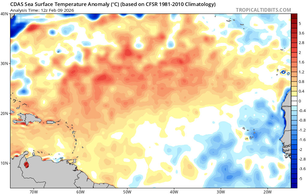
A large portion of the tropical Atlantic Sea Surface temps are running above average.
Last month, Tropical Storm Risk (TSR) issued the first outlook for the 2026 Atlantic Hurricane Season, with 3 major and 7 total hurricanes expected. The seasonal prediction, which also indicates the possibility of 14 tropical storms, could closely mirror activity seen during the 1991-2020 climatology period spanning the period from June 1st to November 30th, 2026, the forecast employs data through to the end of November 2025. Sea surface temperatures are expected to remain warmer than average, which is likely to keep the basin at least near average numbers. TSR warns that the forecast is still somewhat uncertain, given the possibility of El Niño conditions developing and persisting through summer and autumn 2026. Stay tuned for more updates as we get closer to June 1st.
If you are not already a premium graphics subscriber, sign up today and take advantage of our limited 25% off season sale. It won’t last long! Details here > Premium Graphics Info. This offer applies to new members only and will run for a limited time so sign up today and help support our service. Thanks!
The season will officially get kicked off on June 1st for the Atlantic and May 15th for the Eastern Pacific. Thank you for being a Hurricane Tracker App user and supporting our passion for tracking tropical cyclones!