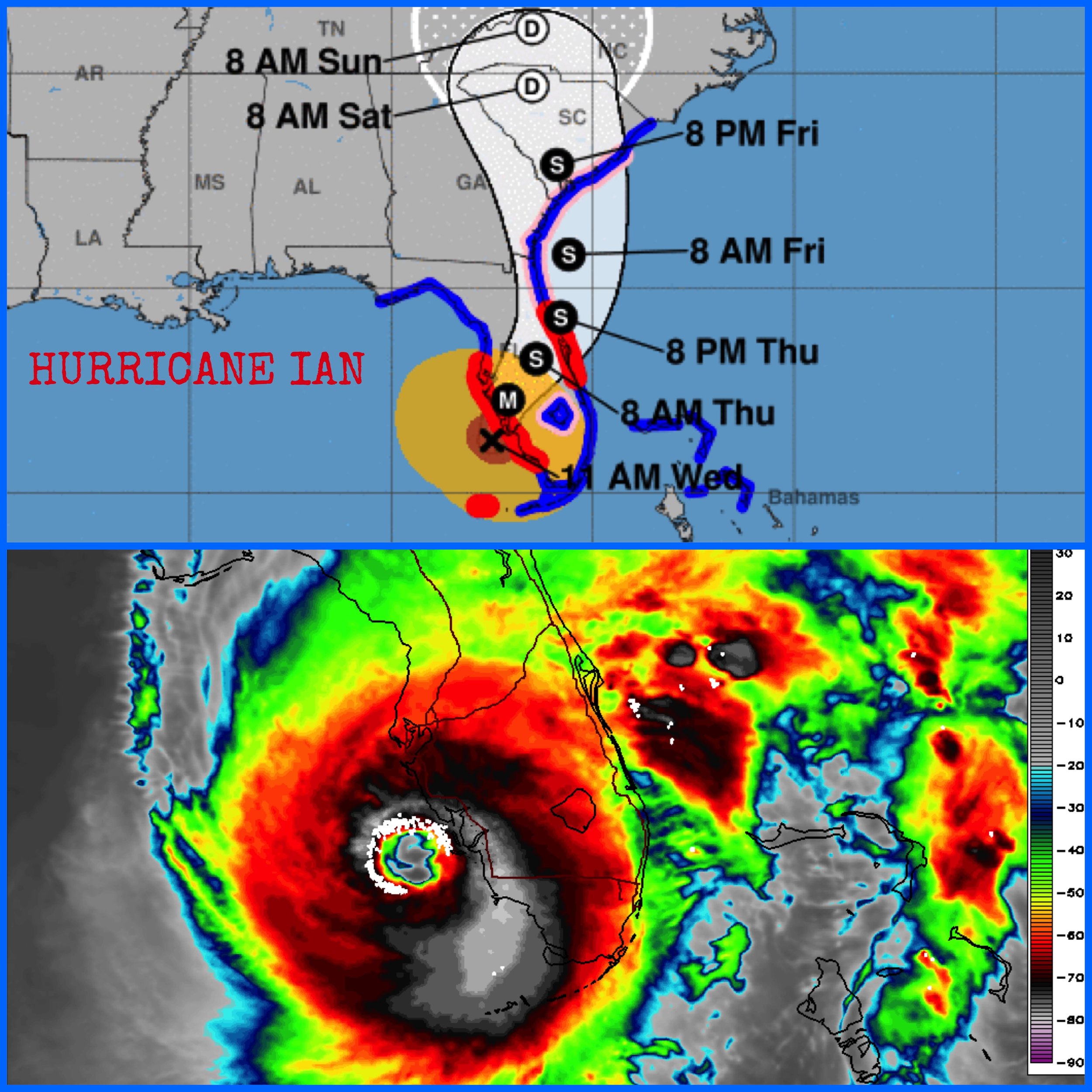
9/28/22 - 11AM EDT
Ian is a high end category 4 and could intensity a little further prior to landfall in SW FL this afternoon. #Ian is closing in on Port Charlotte as one of the strongest hurricanes on record to make landfall in the U.S. Catastrophic storm surge inundation of 12 to 18 feet above ground level along with destructive waves are expected somewhere along the southwest Florida coastline from Englewood to Bonita Beach, including Charlotte Harbor. Residents in these areas should urgently follow any evacuation orders in effect. Catastrophic wind damage is beginning along the southwestern coast of Florida today near the landfall location. Hurricane-force winds are expected to extend well inland along near the core of lan. Preparations to protect life and property should be urgently rushed to completion. Also, heavy rainfall will spread across the Florida peninsula through Thursday and reach portions of the Southeast U.S. later this week and this weekend. Widespread, life-threatening catastrophic flooding is expected across portions of central Florida with considerable flooding in southern Florida, northern Florida, southeastern Georgia and coastal South Carolina. Widespread, prolonged major and record river flooding is expected across central Florida. Our thoughts and prayers are with everyone who will be affected by Ian. Stay safe!