
8/25/17 - Hurricane Harvey Has Made Landfall, But Impacts Will Be Felt For Days
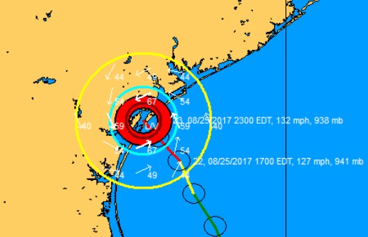
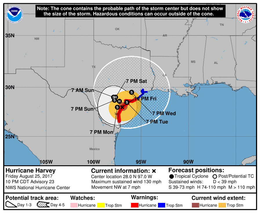
Overview - Harvey has made landfall in Texas between Port Aransas & Port O'Connor. The 12 year streak (4324 days) of no major (CAT 3 or above at landfall) hurricanes making landfall in the US has ended. However, Harvey will continue to cause major impacts across parts of Texas through next week. Catastrophic flooding is expected as Harvey will be a VERY slow mover.
*Always visit the "Current Storms" section for the very latest real time info on Harvey.
Our Twitter Feed: https://twitter.com/hurrtrackerapp
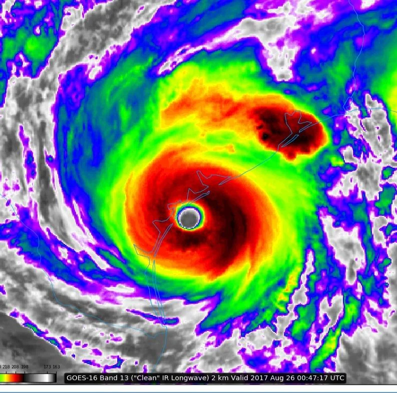
Latest wind field plot as Harvey made landfall.
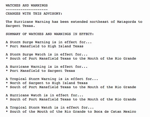
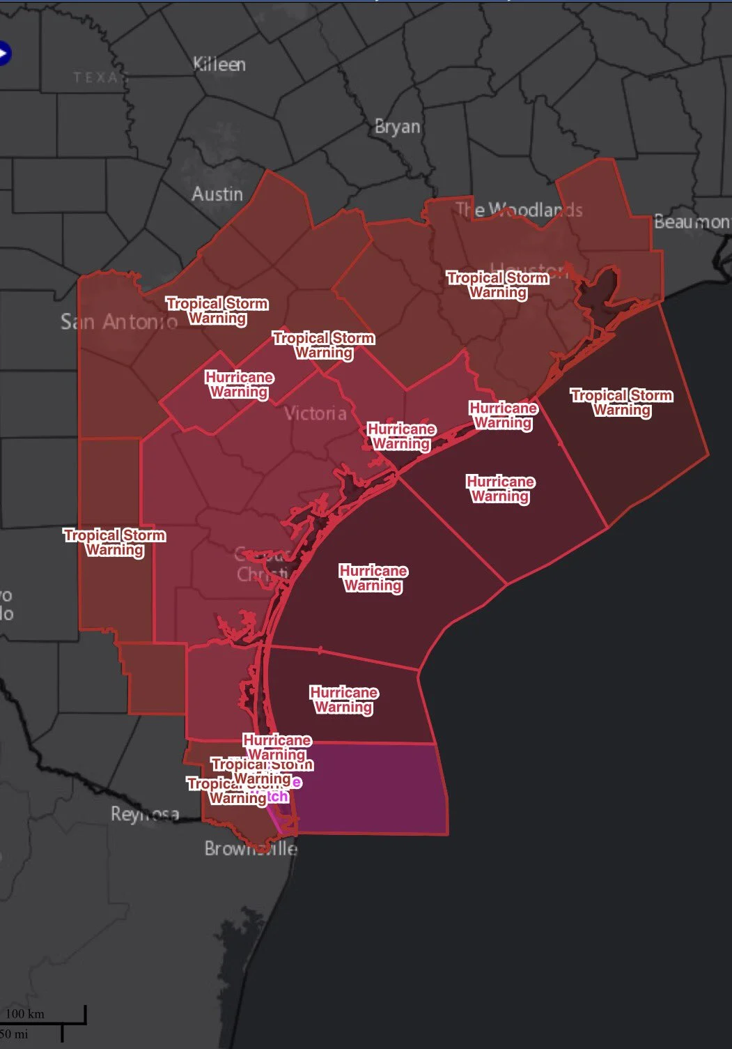
Watches/Warnings - Hurricane, tropical storm, and storm surge remain in effect:
Track - What’s most concerning is that some reliable model guidance slows or stalls Harvey just inland this weekend and has Harvey moving east back out over the gulf and possibly making a second land fall in southwest Louisiana. This potential is something we are watching very closely.
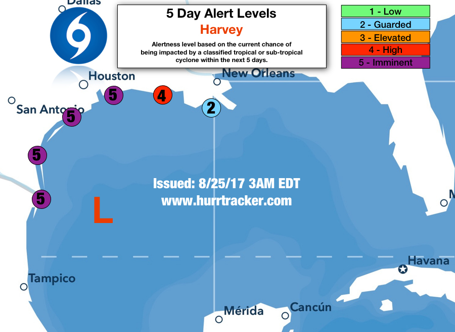
Alert Levels - Impacts are imminent for portions of the western Gulf coast. Residents and interests in western LA need to also pay close attention to Harvey as it could impact your area as it departs TX next week. Please review our key below for recommended actions to take based on the alert level issued for your area.
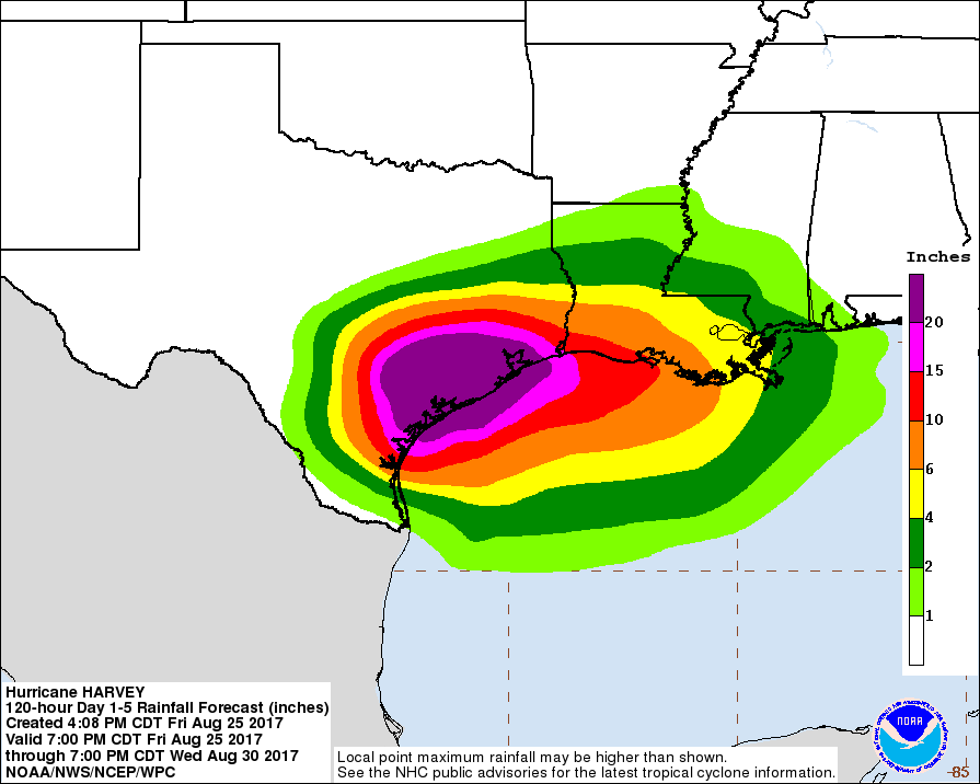
Impacts - As with all tropical systems, effects will be felt away from the center and we do expect that heavy rain and the training of rain bands will likely lead to a major flood event for portions of southern and eastern Texas. We may even see a heavy rain event in portions of western Louisiana this weekend. Some of the latest guidance is forecasting 1-2' feet or more of rain, these numbers are believable if the system stalls or slows to a crawl as some guidance shows.
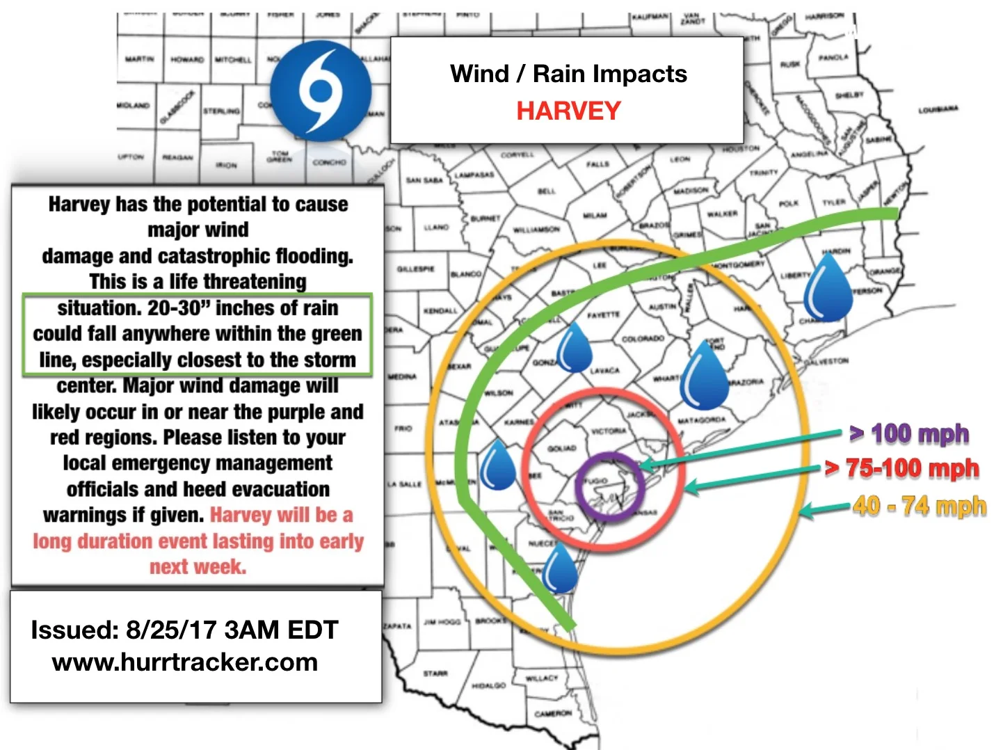
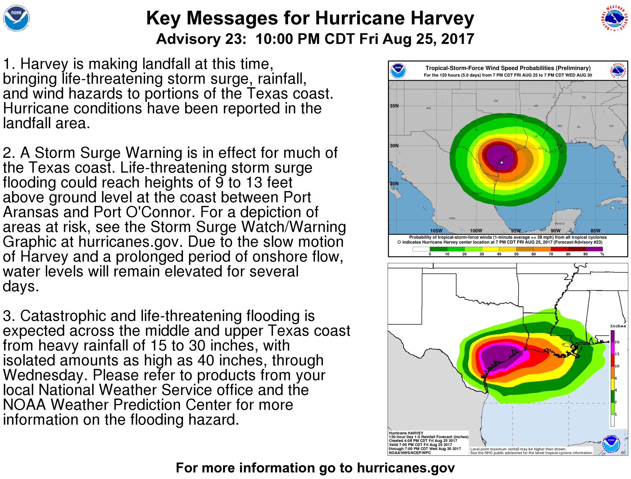
There is a growing threat of major wind damage near where Harvey makes landfall as the NHC is forecasting Harvey to remain a Cat 3 storm with 125 mph winds. Storm surge up to 12 feet is also possible along the TX coast to the east of where the center makes landfall.
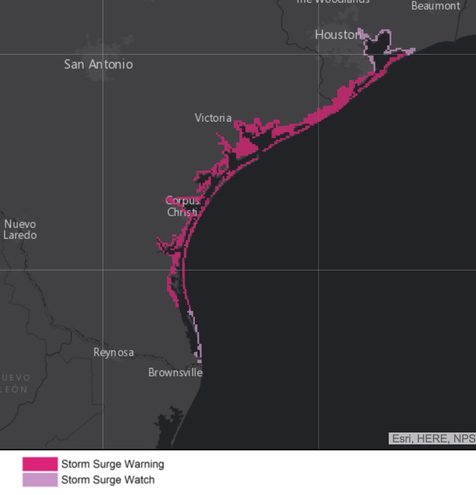
Storm surge watches and warnings are in effect for the TX coast
Conclusion - If you are a resident or have interests along the Gulf of Mexico from northeastern Mexico through Texas into western Louisiana, please continue to check in throughout this week for updates on this system as we will be here with the latest information. Thank you for using Hurricane Tracker.