
7/4/17 - Monitoring Invest 94L For Development
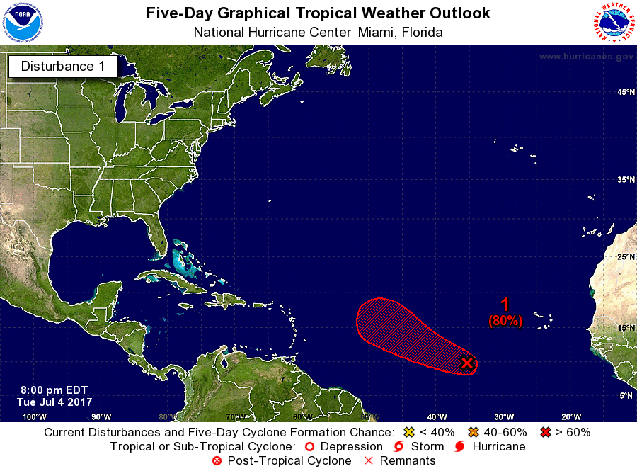
We hope everyone had a great 4th of July holiday! Invest 94L in the eastern Atlantic currently has a high chance of development (80%) according to the National Hurricane Center. There will be a window of favorable conditions from now until late Friday for Invest 94L to develop into a depression or TS Don. As the system gets closer to the NE Caribbean, wind shear will increase and the environment will become increasingly unfavorable and weakening is expected this weekend.

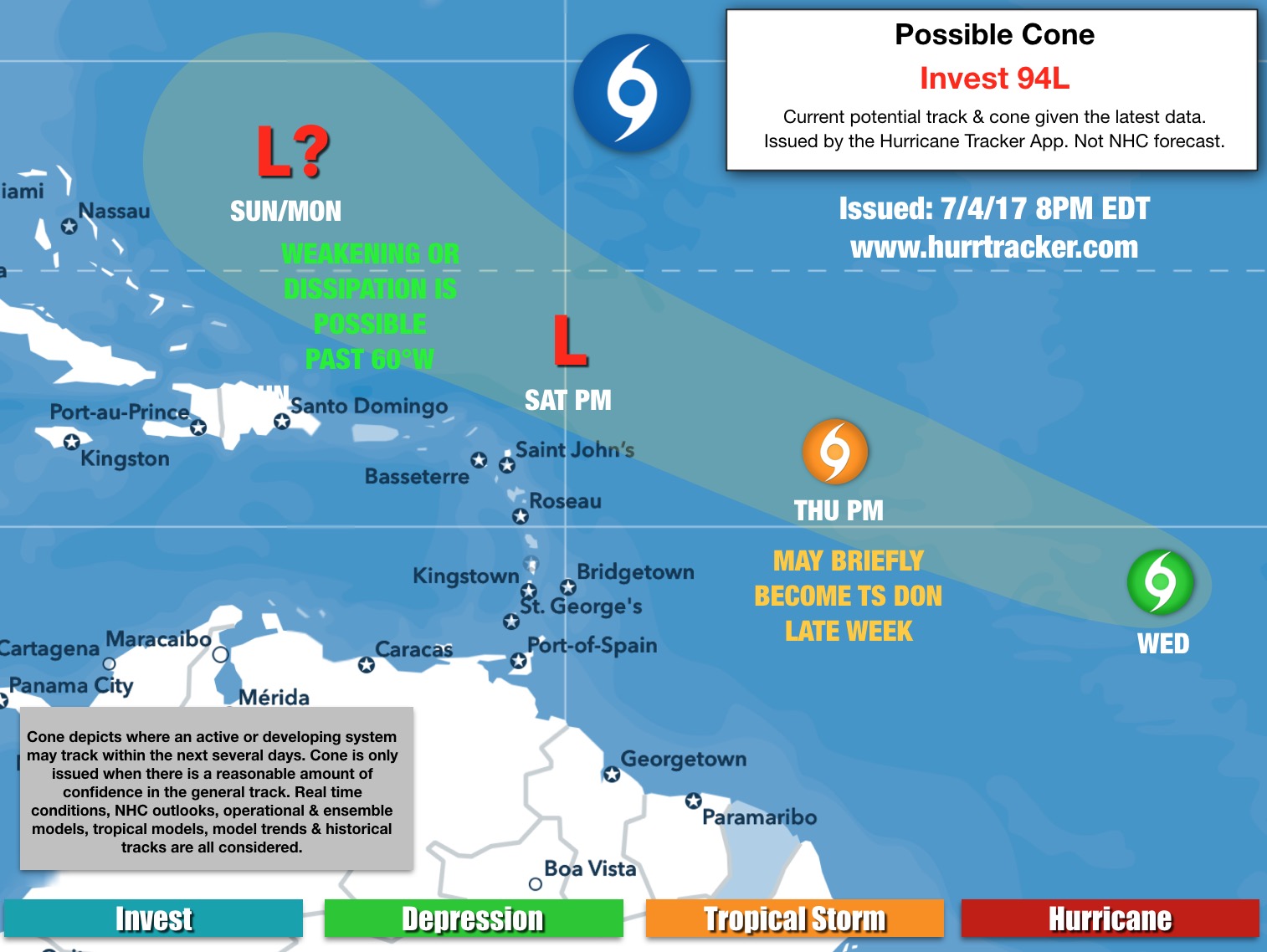
Track: 94L will gradually track to the WNW over the next several days and should pass north of the Lesser Antilles, but we have issued Low Alert Levels (see below) as minor impacts to the NE Caribbean can't yet be fully ruled out. Beyond this weekend (if there's anything left to track) there are more questions than answers as it's too early to tell if this system will impact Bermuda, The Bahamas or any portion of the United States Coastline. The 7-10 day model forecasts have been all over the place as far as track and intensity is concerned. For now, we will monitor the progress of this system and keep you updated as new data comes in. If/once the system develops, the models will have a much better handle on the forecast.

Intensity: Confidence levels right now with the intensity forecast are much lower than normal. 94L has been batting frequent dry air instructions which have prevented this system from firing any meaningful, sustained convection that could aid in the development process. Also, the system is embedded in a monsoonal trough and will need to move away and detach from the trough to have a better shot of developing in the short term.

Very dry air can be seem NW of 94L in the water vapor imagery.
94L will have a brief window where it could strengthen into a tropical depression or TS Don. We are not expecting anything more than a 40-50 mph tropical storm, and that may even be generous.
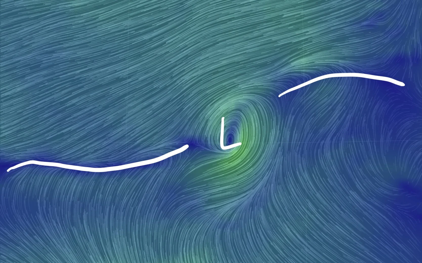
94L is embedded within a monsoonal trough. Development usually takes longer to occur in these setups.
In summary, there's a high chance of development over the next few days and we do expect the system to struggle this weekend and beyond as the environment north of the Caribbean is forecast to be unfavorable. At this time, there is no threat to land but residents and interests in the NE Caribbean should monitor the progress of this system. Thanks for using Hurricane Tracker.