
6/20/17 - TS Cindy Forms In the Gulf & 2017 Is Already In The History Books
TS CINDY
Tropical Storm Cindy formed in the north-central Gulf of Mexico earlier today and that marked 2017 the 4th season in history where we had two named storms active (Cindy & Bret) at the same time in the month of June. The other three years that happened was in 1909, 1959 & 1968. Pretty remarkable as this is a fairly rare event. The NHC has written the last advisory on TS Bret as of 5PM est. Listen to our latest audio update here: http://bit.ly/2sHRQDm
If you would like to receive these updates the moment they are published, please click here to sign up for email updates.
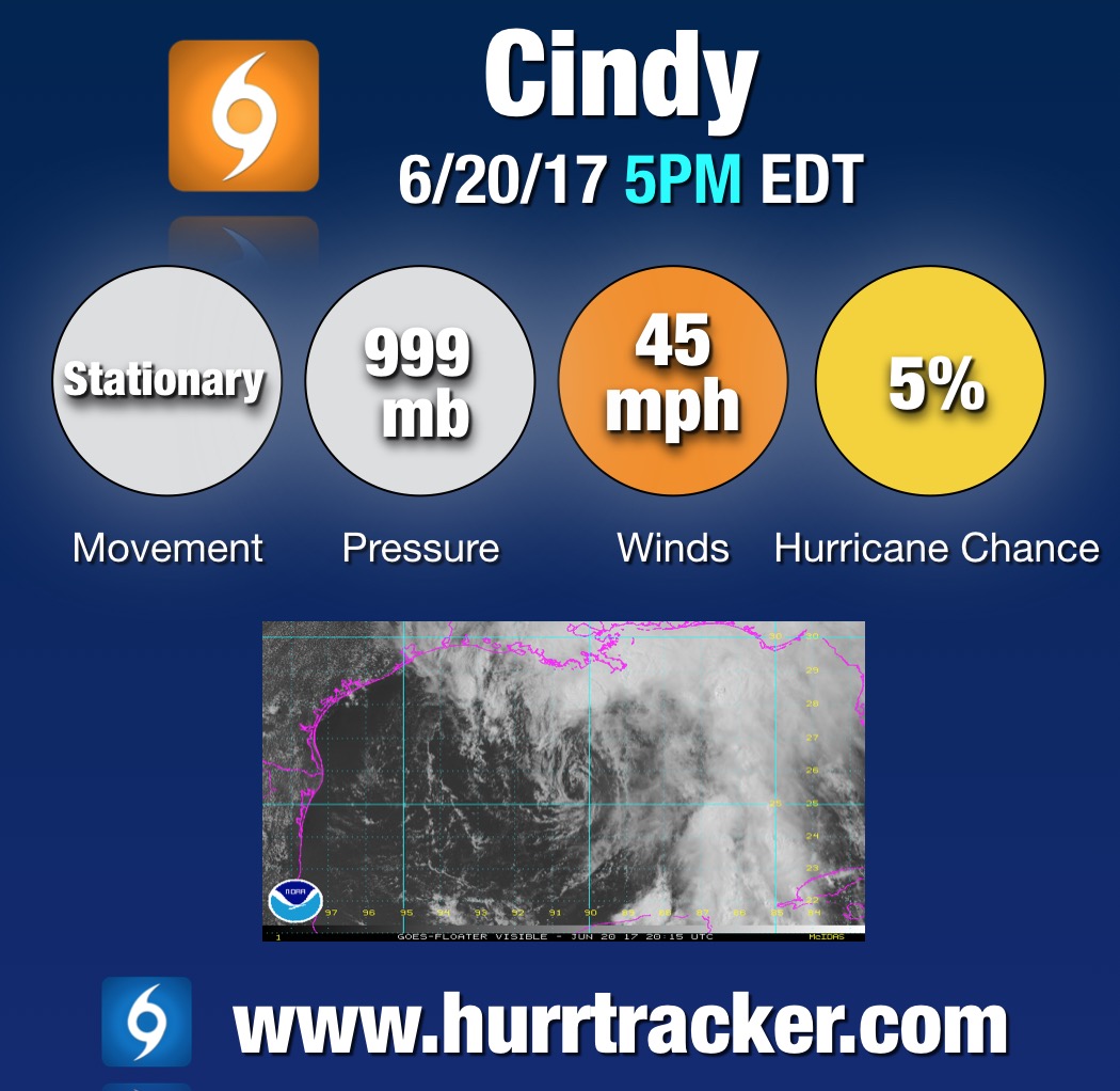

Cindy will slowly track towards the TX/LA border where tropical storm warnings are in effect from San Luis Pass, TX to the MS/LA border. Tropical storm conditions will begin to reach the southern coast of LA overnight tonight. The biggest impact from Cindy will be heavy rain and flash flooding (see the latest rain forecast from WPC below). Over 12" inches will be possible in some isolated areas. Turn around, don't drown. We have even been getting some pouring rain here at our Atlanta, GA headquarters from the outer bands of Cindy.


Here's a summary of the hazards associated with Cindy from the NHC:
HAZARDS AFFECTING LAND
----------------------
RAINFALL: Cindy is expected to produce total rain accumulations of
6 to 9 inches with isolated maximum amounts of 12 inches over
southeastern Louisiana, southern Mississippi, southern Alabama, and
the Florida Panhandle through Thursday. This rainfall could cause
life-threatening flash flooding in these areas.
Rainfall amounts of 3 to 5 inches with isolated maximum amounts of 6
inches can be expected farther west across southwest Louisiana into
southeast Texas through Thursday.
WIND: Tropical storm conditions are expected to first reach the
coast within the warning area later today and spread westward within
the warning area through early Thursday.
STORM SURGE: Inundation of 1 to 3 feet above ground level is
possible along the coast in portions of the Tropical Storm Warning
area.
TORNADOES: Isolated tornadoes are possible this evening and tonight
from south-central Louisiana to the western Florida Panhandle.
Thank you for using Hurricane Tracker to track TS Cindy. Check out our Model Watch section to see what we may be tracking next. Enjoy your evening!