9/21/19 - Jose To Linger & Maria Should Miss The United States East Coast
Note: At times, our team will write in-depth discussions on the tropics or systems below. Always visit the "Current Storms" section for the latest advisories and tracking maps on active systems.
We’re still tracking Tropical Storm Jose and Hurricane Maria. Jose has now been a named storm for 16 days. That makes it the eighth longest named storm on record!
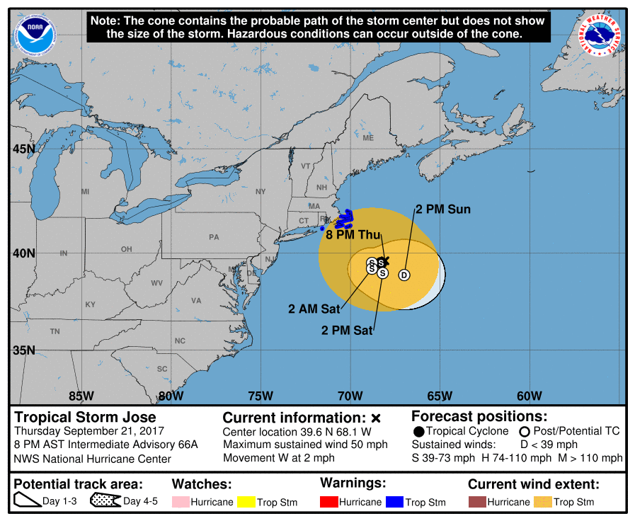
Tropical Storm Jose: Jose has stalledl off the New England coast. It is currently about 150 miles southeast of Nantucket, MA. Winds are expected to gust there and along the Massachusetts coast up to 40-50 mph through the weekend as the storm just sits offshore. There will be some showers at times, but the general theme are the clouds and breezy conditions in southeastern New England. The main impacts through early next week as Jose gradually weakens will be the beach erosion due to the significant waves of up to ten feet pounding the coast. Tropical Storm Warnings remain in place for: Woods Hole to Sagamore Beach, including Cape Cod, Block Island, Martha's Vineyard, and Nantucket. The models have been trending towards the idea of Jose dissipating off the Northeast coast around Monday of next week. By then, we can finally say so long to Jose!
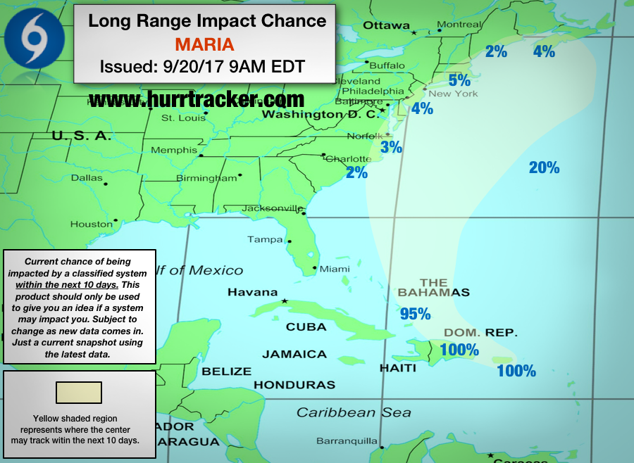
Hurricane Maria: We know everyone wants to know about Maria because it is a major hurricane and there is a slight chance it impacts the U.S. East Coast.
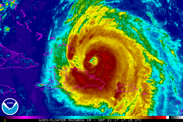
Short-Term Forecast: Maria re-strengthened over the water northwest of the Dominican Republic. Also, the eye of Hurricane Maria has significantly expanded in size compared to the pinhole eye it used to have before making landfall on Puerto Rico.
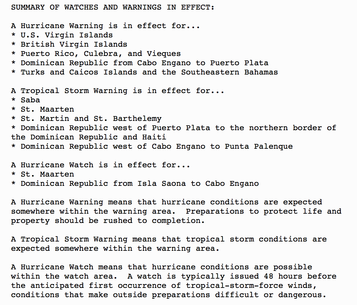
Maria will continue to bring rain and wind gusts up to hurricane-force to the northern coast of the Dominican Republic through tonight. Then, it will begin to steer northward, moving just east of Turks and Caicos on tomorrow. The eastern islands of Turks and Caicos will likely deal with hurricane-force winds in excess of 74 mph. There is even the possibility these islands take a hit from the western eyewall of Maria. Both the Turks and Caicos islands and the southeastern Bahamian islands can expect up to twelve feet of storm surge with waves up to fifteen feet tall. Significant damage is unfortunately possible for Turks and Caicos again after they got destroyed by Hurricane Irma less than two weeks ago.

Long-Term Forecast: In the long-term after Maria moves north of Turks and Caicos, it’s time for the U.S. East Coast to monitor this storm. At this time, we are able to rule out direct impacts for Florida and South Carolina, but from North Carolina through Maine and even the Canadian Maritimes, there is the chance for impacts. Maria will track somewhere between the Outer Banks of North Carolina and Bermuda on Tuesday. Around this time is when there is a small amount of uncertainty. None of the operational models, such as the European or American, take Maria into the coast, although a few of its ensembles do. We’re leaning towards the idea of Maria staying far enough offshore for minimal impacts as it tracks out to sea due to a trough, which is what the large majority of models show. Again, monitor the storm but we are currently forecasting Maria to not make landfall on the United States.
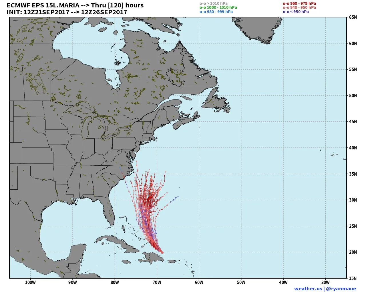
Latest European ensemble model runs only shows a few tracks towards the Mid-Atlantic
Tropical Outlook: The National Hurricane Center currently states there will no new tropical cyclone development in the next 5 days.
We will have another update as conditions warrant on Hurricanes Jose and Maria. Thank you for using our service and application.
-- Jackson Dill, Hurricane Tracker Team