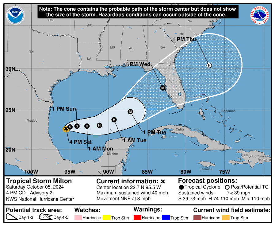
10/5/24 - Milton Forms In The Gulf, Expected To Become a Major Hurricane
The NHC has initiated advisories on TS MILTON in the Gulf of Mexico. It’s forecasted to become major Hurricane Milton before making landfall along the west coast of FL mid-week near Tampa. The initial forecast calls for a 115 mph category 3 storm. This storm will have the potential of causing life threatening impacts to a large portion of the Florida peninsula. Storm surge, flooding rains and hurricane force winds will all be impactful for a large part of Florida. All interests in FL and the NW Bahamas should track this storm closely. ALL GRAPHICS FOR MILTON WILL UPDATE with the new name ON THE NEXT NHC ADVISORY.
The latest forecast track takes the center of what is expected to be major Hurricane Milton right across the Tampa and Orlando metro ares on Wednesday. Expect winds over 100 mph along this track and extended power outages along with flash flooding. Storm surge along the central west coast of FL could be over 10 feet. Prepare now!
If you are not already a premium graphics subscriber, sign up today and get higher-resolution storm graphics that contain more information so you can make informed decisions. It also helps support our app since we now offer it free. We want to be around for a long time!
Premium users will also have access to wind graphics that the NHC does not publish. Details & sign up here > Premium Graphics Info.
Thank you for being a Hurricane Tracker App user and supporting our passion for tracking tropical cyclones!


