
Alberto Is Headed To The Northern Gulf Coast
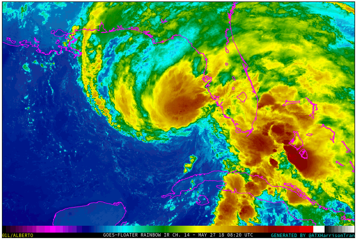
Overview: Alberto is a Subtropical Storm today with winds of 50 mph. Alberto is expected to strengthen some over the next 24 hours as it moves north in the Gulf of Mexico.
If you would like to receive these updates the moment they are published, please click here to sign up for email updates.
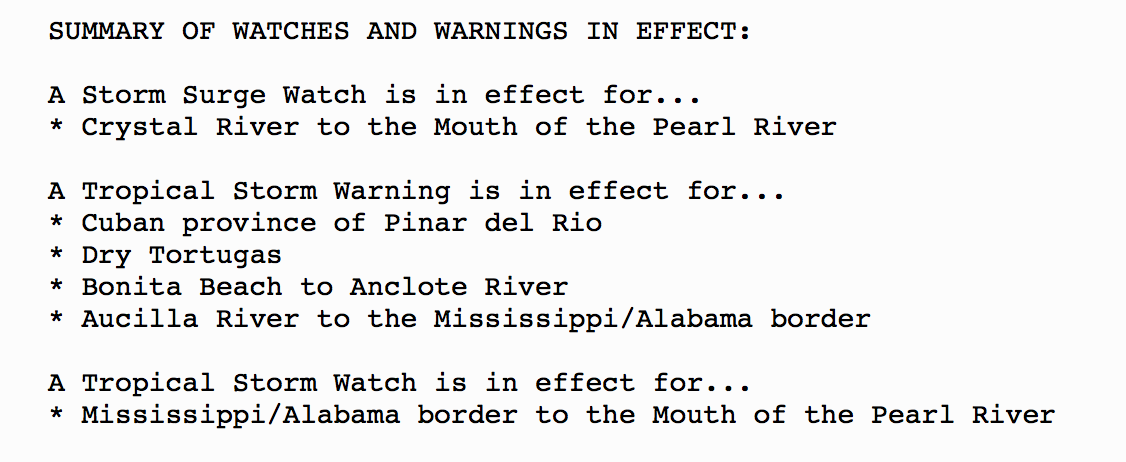
Watches/Warnings:
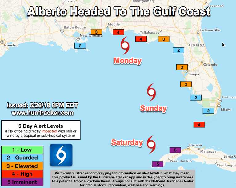
Track: Alberto should move northward to north-northeastward tonight, and then turn north-northwestward and decelerate on Sunday and Sunday night as it moves around the eastern side of a trough/cutoff low.
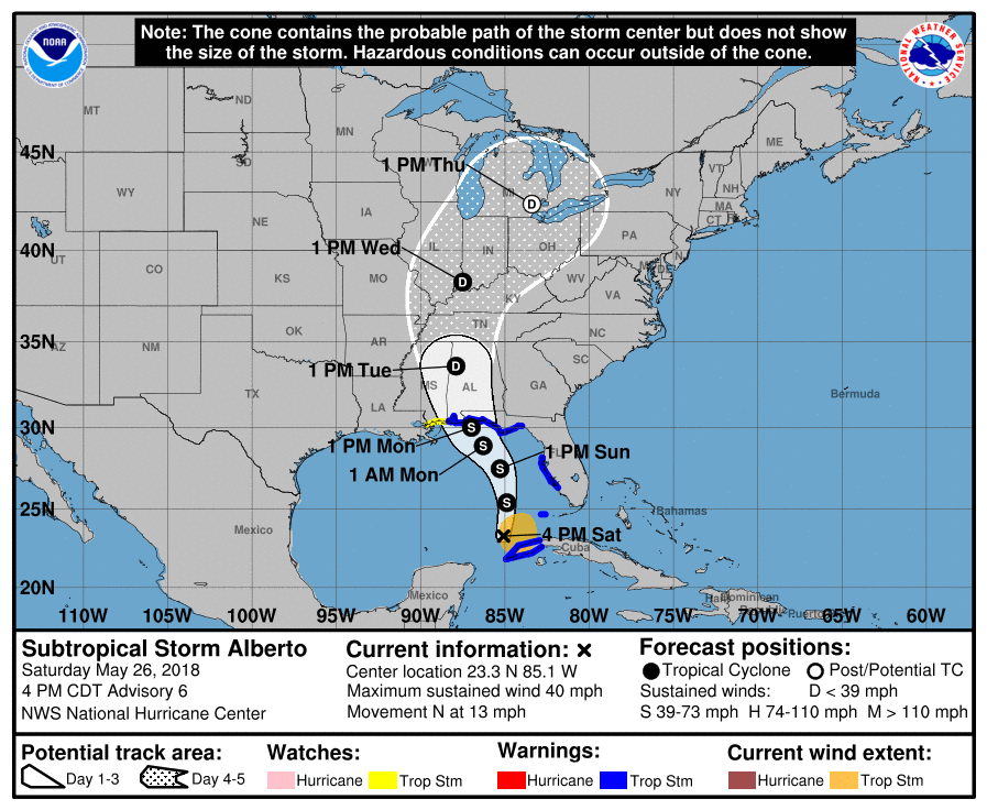
Intensity: The NHC currently forecasts winds to peak around 65 mph as Alberto makes landfall along the northern Gulf coast sometime Monday afternoon. There is about a 30% that Alberto will achieve hurricane intensity. Dry air will likely be ingested into the center once it’s in the norther gulf, limiting any further intensification.
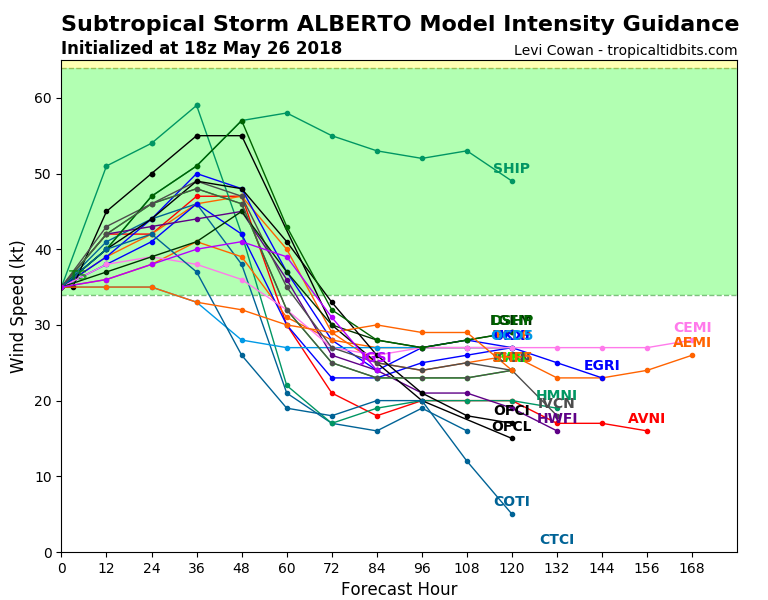
All the intensity guidance models keep Alberto below hurricane intensity.
Alert Levels:
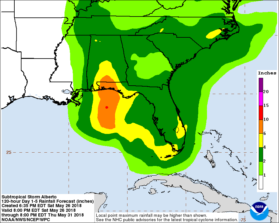
Impacts: Regardless of its exact track and intensity, Alberto is expected to produce heavy rainfall and flash flooding over western Cuba, southern Florida and the Florida Keys. Rainfall and flooding potential will increase across the central U.S. Gulf Coast region and over much of the southeastern United States beginning Sunday and will continue into next week. Rainfall accumulations of 3 to 7 inches with maximum amounts of 10 inches are possible across the Florida Keys and southern and southwest Florida. Heavy rains will begin to affect the central Gulf Coast region into the southeastern United States on Sunday and continue into the middle of next week as Alberto moves northward after landfall. Rainfall totals of 5 to 10 inches with maximum amounts of 15 inches are possible along the track of Alberto from eastern Louisiana, across much of Mississippi, Alabama, western Tennessee and the western Florida panhandle. Rainfall totals of 3 to 5 inches with maximum totals of 8 inches are possible from the southern Appalachians into the coastal southeast United States.
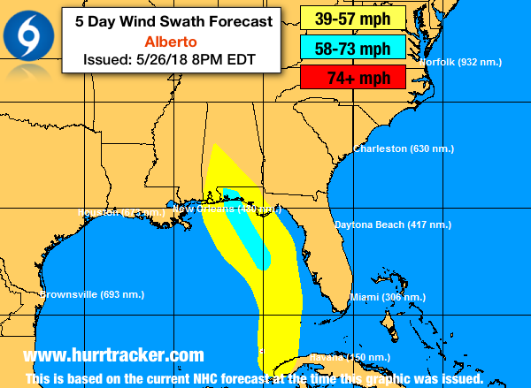
Tropical-storm-force winds and hazardous storm surge are possible along portions of the central and eastern U.S. Gulf Coast beginning on Sunday, including areas well east of the track of Alberto's center.
Dangerous surf and rip current conditions will likely spread northward along the eastern and northern Gulf Coast through Monday.
Storm Surge: The combination of storm surge and the tide will cause normally dry areas near the coast to be flooded by rising waters moving inland from the shoreline. A 2-4 foot water rise is expected from Crystal River to the Mouth of the Pearl River.
Tornadoes: Isolated tornadoes are possible this evening and tonight across parts of west-central Florida, including the Keys.
Stay tuned for the latest updates on Alberto from The Hurricane Tracker App. Thanks for using our service. ~Steve Parker