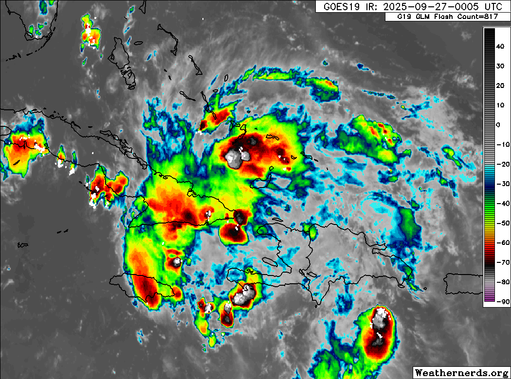
9/27/25 - TD 9 Analysis

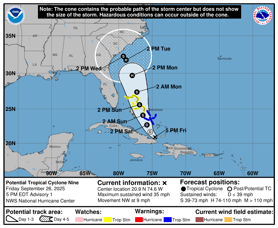
A Tropical Storm Watch has been issued for the east coast of Florida from the Palm Beach/Martin County Line northward to the Flagler/Volusia County Line. TS Warnings remains in effect for The Bahamas.

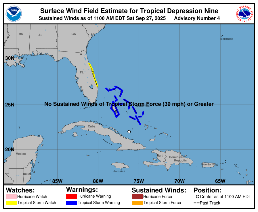
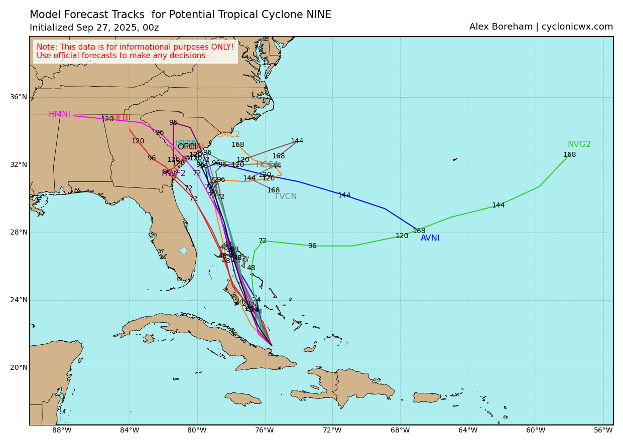
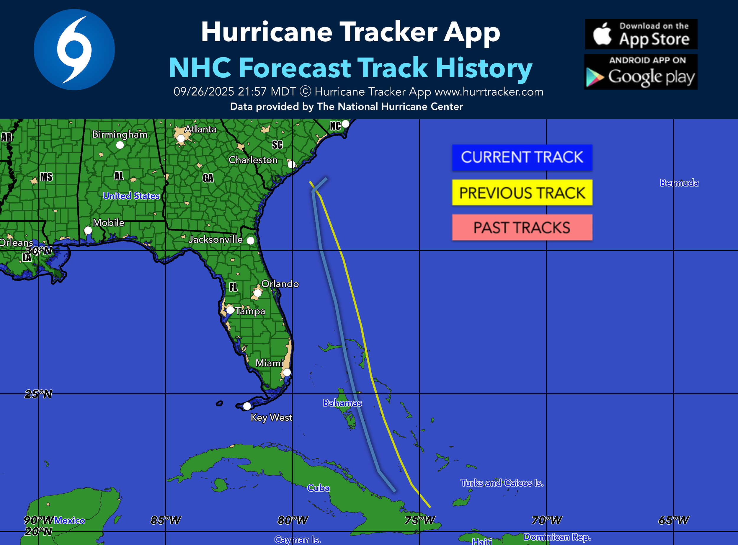
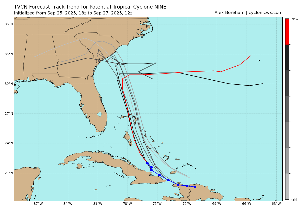
Some good news with the last couple cycles of model runs. TD 9 has slowed down which will allow Humberto to pass to its east on Monday potentially allowing TD 9 to start turning east next week before it reaches the U.S. coast. The center may stay roughly 150 miles offshore of South Carolina if this trend plays out. If the system speeds up, we could still see a U.S. landfall. Nothing is finalized, but recent trends in the data are encouraging.

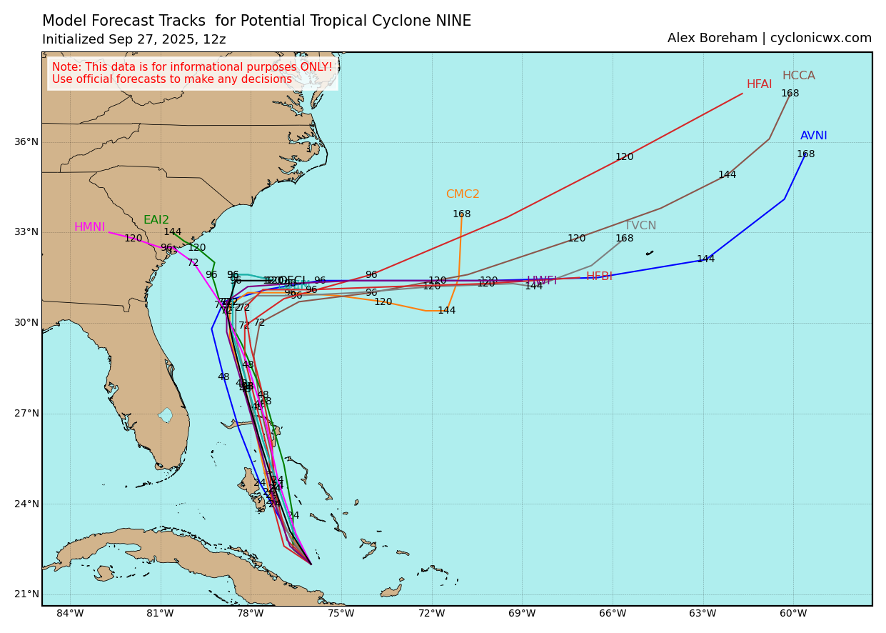
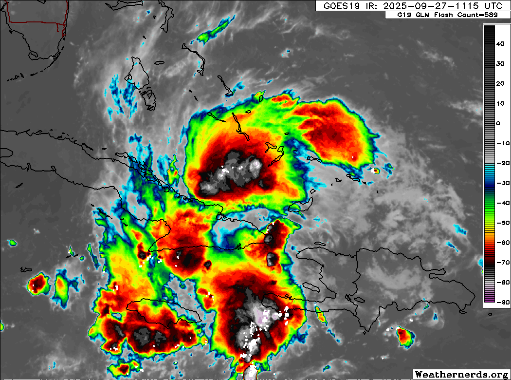
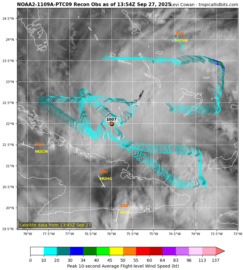
Potential Tropical Cyclone 9 has organized enough per the latest recon data to become our next tropical depression. Tropical Depression 9 is forecasted to take the next name which is Imelda.

Sept 2025 - PTC 9 Analysis

The 0Z Spaghetti plots really show the divergence in the model data days 3-5. Some west into the SE, some east over open water. We will have more updates here on Saturday. Always tap the “current storms” icon below and then “PTC 9” for the latest data and advisories.

New NHC track at 11PM was nudged a bit west (blue line) in the short-medium range, but now showing a potential slow NE turn in 5 days as the center is near or on the coast. Going to be a rough week along the SE U.S. coast next week thats for sure.

PTC 9 is becoming better organized this evening as you can see more twisting and turning north of Haiti compared to how it looked this am. Should easily see a tropical storm within 24-36 hours. NHC states a 90% chance of development.

Here's the initial forecast track for PTC 9. TS watches & warnings issued for a portion of the Bahamas. Expected to become TS Imelda and eventually a category 1 hurricane early next week as it heads towards South Carolina. Stay tuned for updates if you are included in or near the forecast track/cone.