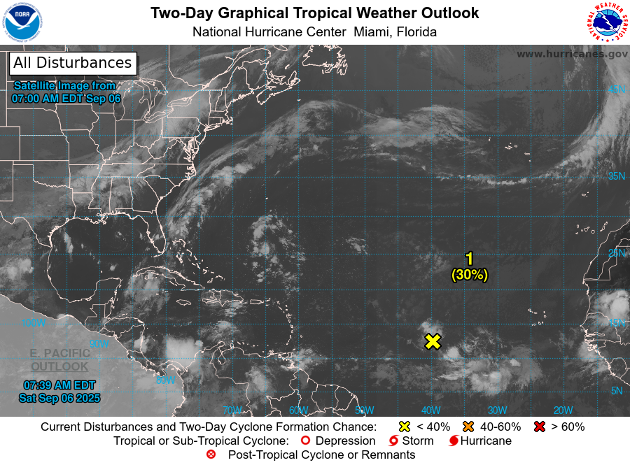
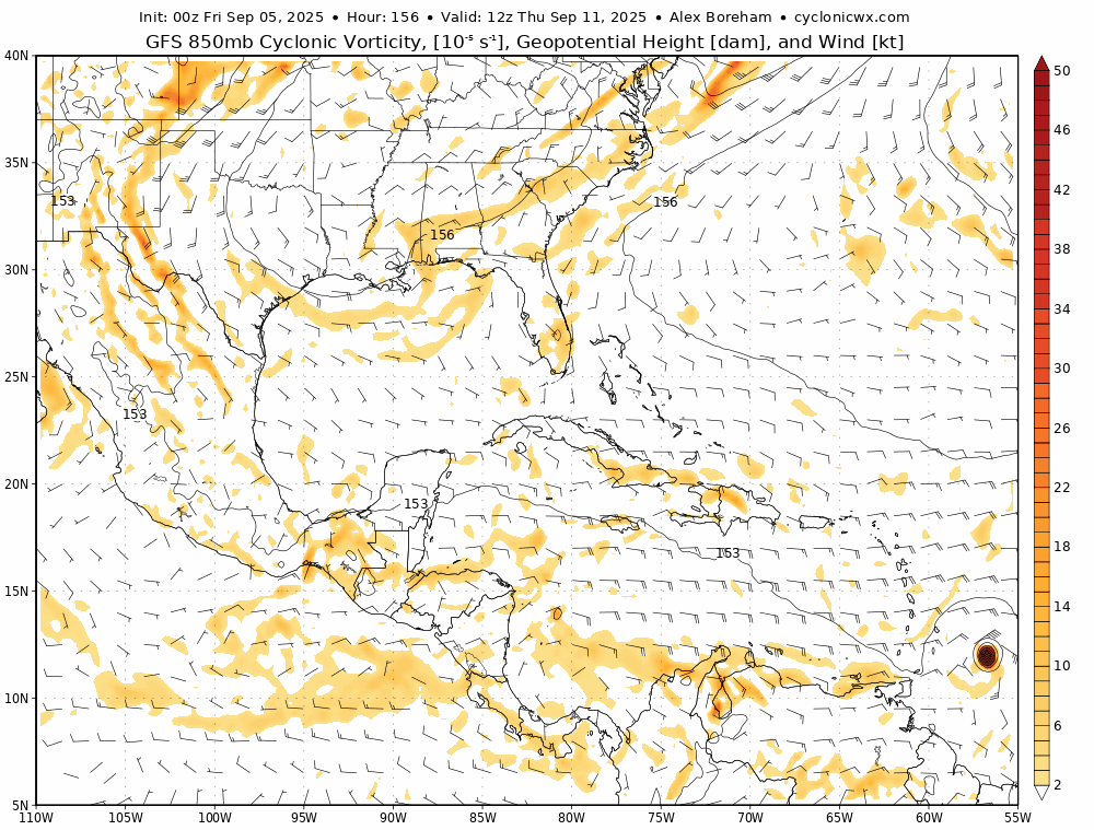
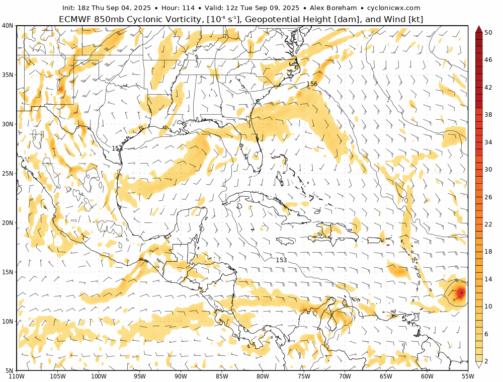
9/6/25 - Invest 91L Discussion

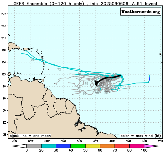
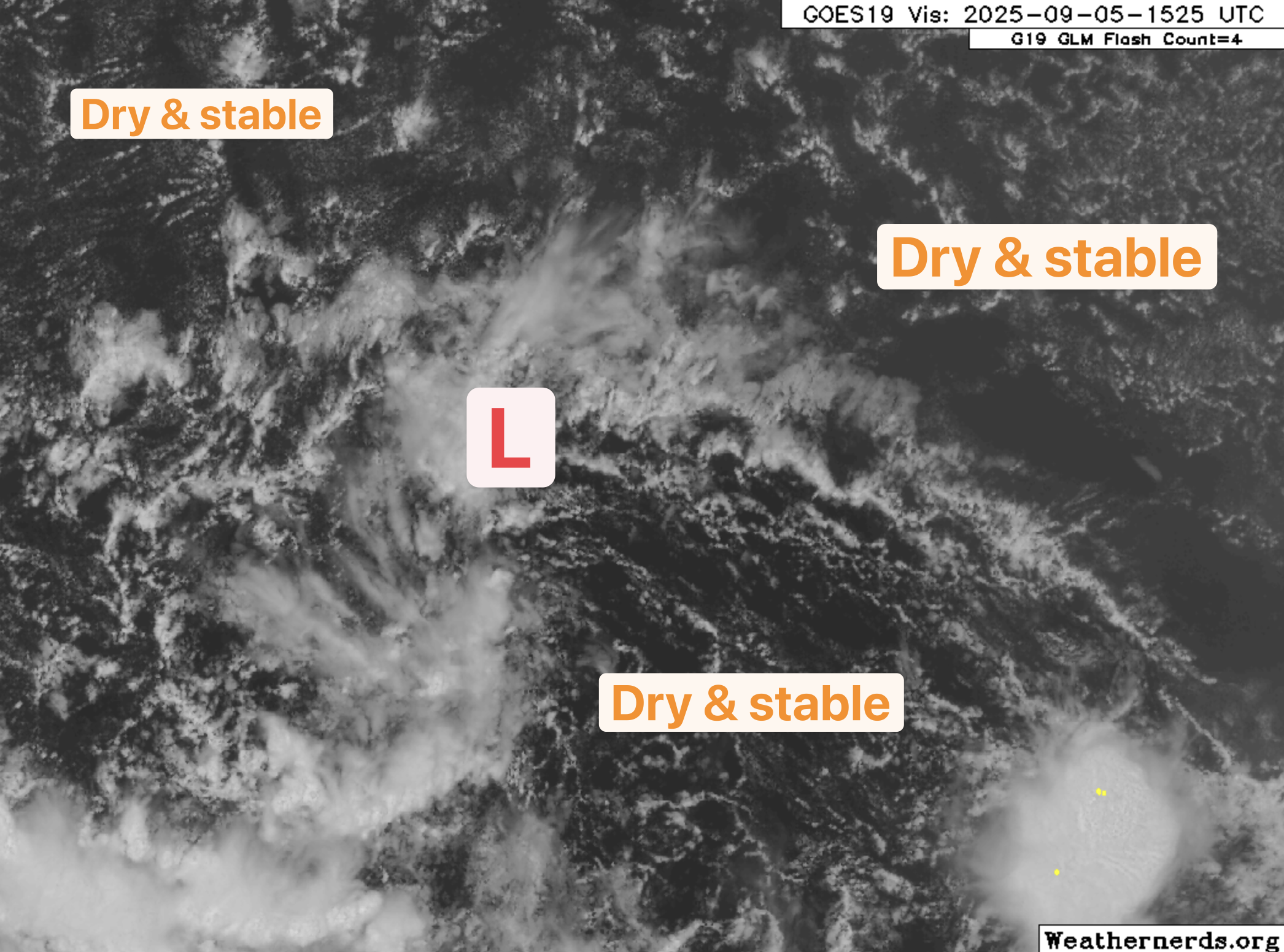
The only chance 91L may have is it would need to track WSW as the 12Z spaghetti plots show to move away from the super dry air to its north and for some of the moisture to its SE to get ingested. Not impossible, but low odds. Still some left over vorticity. We will watch just in case it makes a come back. This will be the last discussion update on 91L unless the forecast changes. Have a great weekend everyone and thanks for using Hurricane Tracker App.

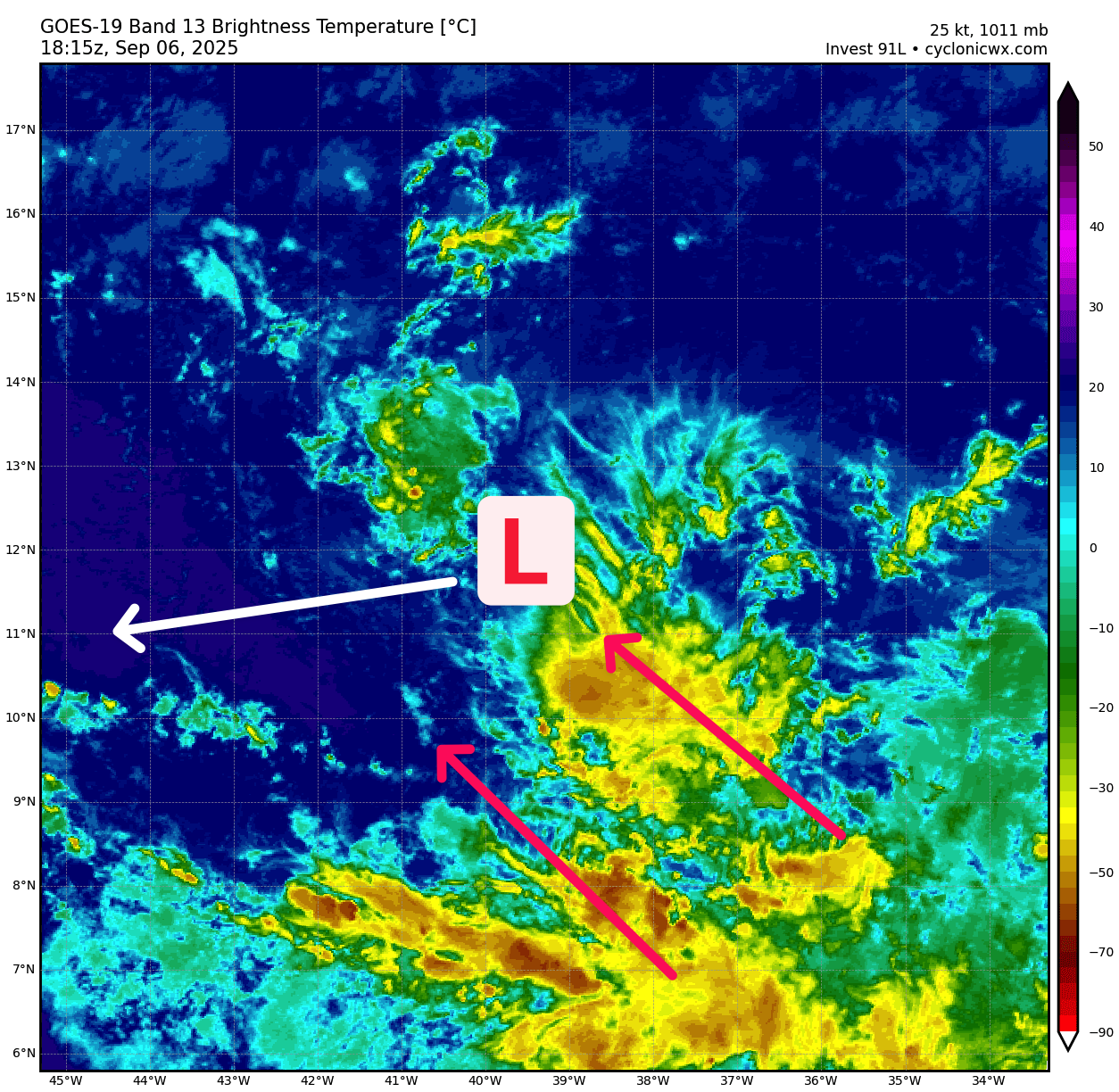
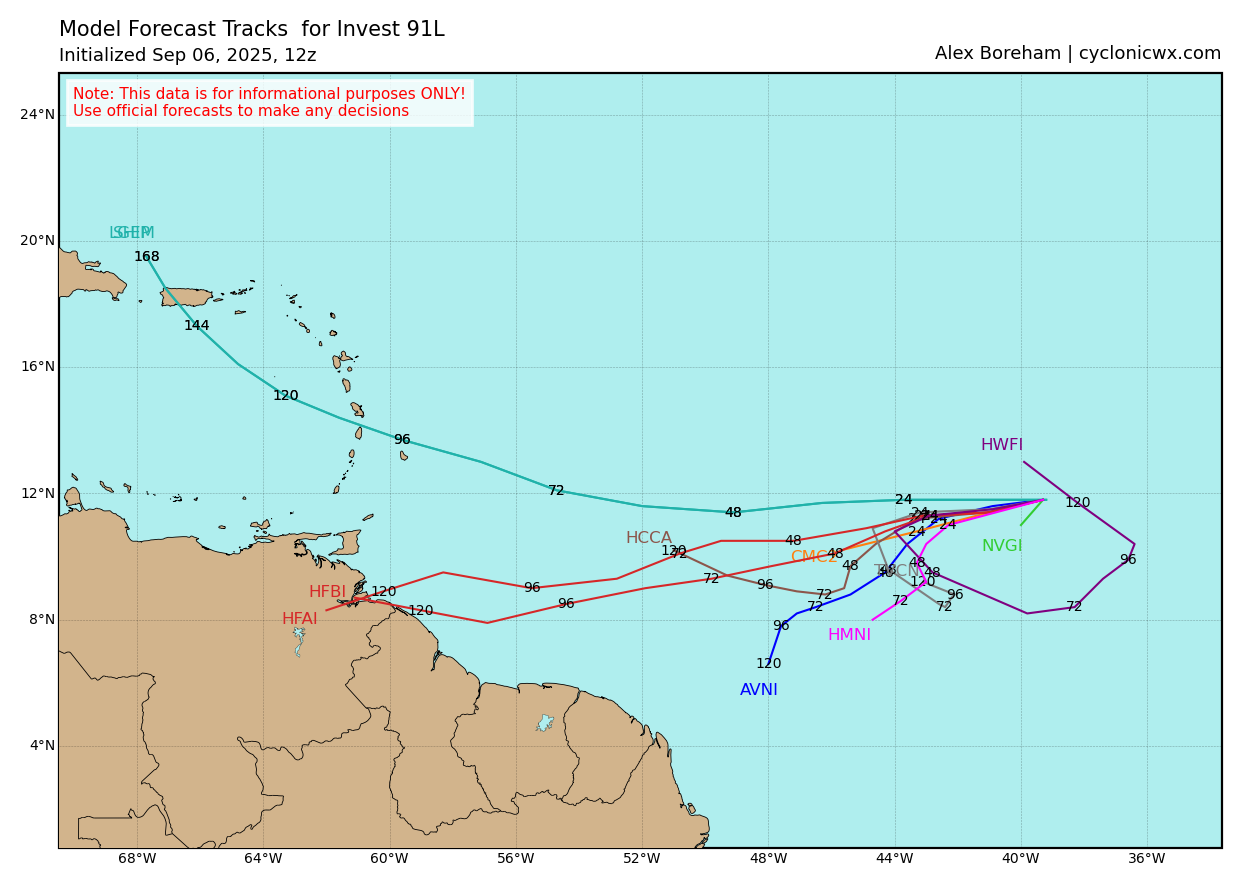
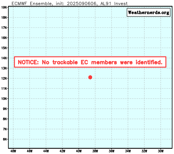
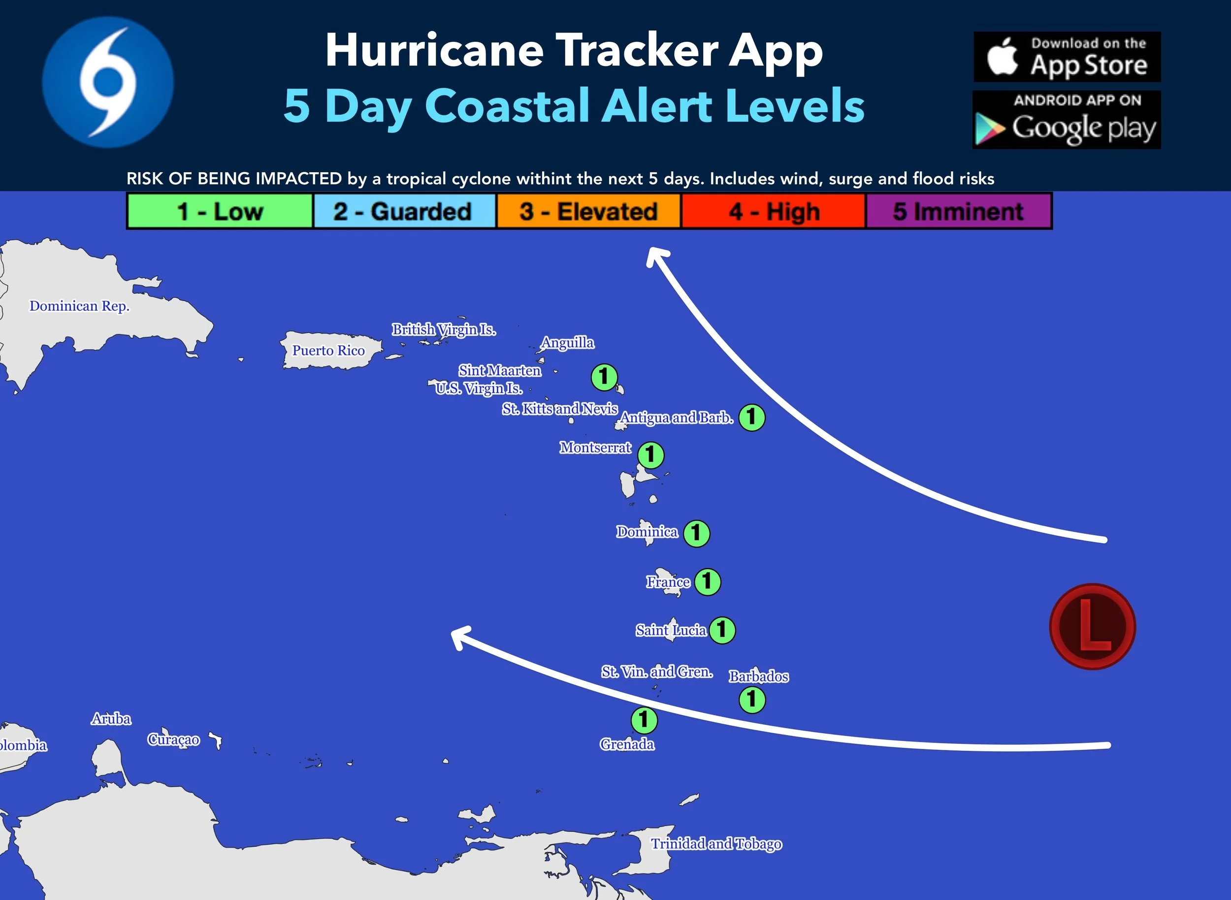
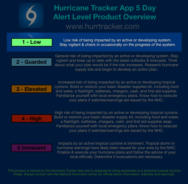
There’s not much left of Invest 91L and the NHC now states there’s a low chance of development. We have removed our low Alert Levels for the Caribbean. All in all, this is great news for the Lesser Antilles. However, this was a huge failure with all the global and ensemble members. A few of the new AI models actually did a good job not showing development of this system. Shows we have a long way to go in this department.

9/5/25 - Invest 91L Discussion

An abundance of stable, dry air all around 91L for now. As long as this persists, do not expect much development.

The morning runs of the GFS and CMC models have joined the EURO and have dropped development of Invest 91L. Thats great news today for the Caribbean. The NHC has dropped development chances from 90% to 70% . We can’t totally write it off just yet and we will certainly keep you updated on any further changes or trends with this system. True development chances as of right now are probably closer to 40% for the upcoming 7 day period.

06Z GEFS showing a much weaker system compared to previous runs.

The last 2 European operational runs show 91L NOT developing. The 0Z Euro Ensembles (shown below) are now less excited compared to 12 hours ago. Will have to wait and see if this is a trend or a short term model fluke. This would be good for the Caribbean if this becomes a trend across the board with other data. Still lots of time to monitor. No immediate threat to anyone.

Latest 9/5/25 0Z Euro Ensemble run is less excited.

9/4/25 12Z Euro Ensemble run was more excited.

We have issued our 5 Day Alert Level Graphic for the Lesser Antilles. At this time there is a “Low” risk of being impacted within 5 days by 91L. The risk is low for now due to the intensity and track uncertainties that exist in the model data. The latest 0Z run of the EURO model completely fizzles out the storm before reaching the islands. That is not the forecast, but a trend we will watch for in future model data. Still lots of time to see how this system shakes out. We will have more analysis here later today (Friday, Sept 5th).

Lesser Antilles: Stay vigilant and check in occasionally on the progress of the system.

The 0Z GFS and the 0Z Canadian had big shifts south compared to previous runs. Here’s a snippet of the 9/5/25 0Z GFS run. Tracks 91L/Gabrielle into the southern Lesser Antilles next Friday. Forecasted pressure in the 980’s-990’s this run. Not a forecast, just a model run.

The latest run of the EURO model 9/4/25 18Z run shows some weakening as the system enters the Caribbean Wednesday of next week. Clearly, models are not agreeing on the intensity of this system which means we have a lot to watch. Lots of time to see which way this trends for the Caribbean.