Hurricane Matthew Brings Heavy Rain, Wind & Surge To GA/SC/NC
Check the storm page under "Current Storms" for all the latest information, maps & advisories. Information there is updated in real time. This section is not meant to provide real time information. Our latest full discussion is below:
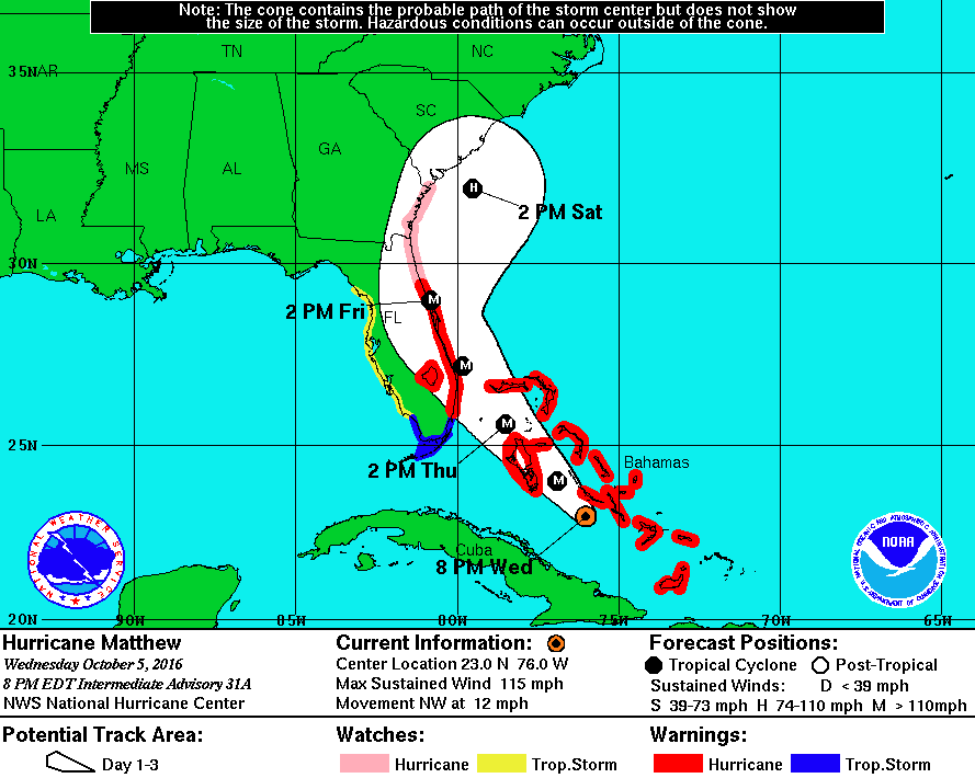
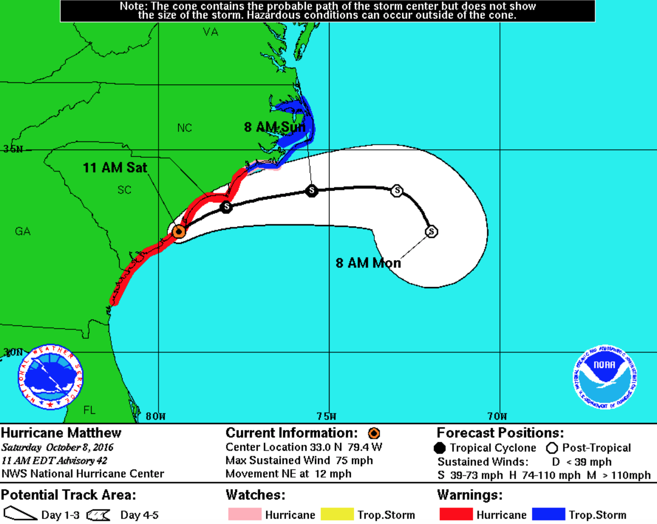
Latest advisory & key messages from the NHC:
Hurricane Matthew is still a hurricane with winds of 75 mph. That makes Matthew a Category 1 storm on the Saffir-Simpson scale. Matthew will move northeast during the next 12 hours along the coastlines of SC/NC. Matthew is producing strong winds up to 85 mph and storm surge up to 9 feet in some areas in coastal SC/NC. Some inland areas may also recieve up to 12 inches of rain. As of Saturday morning, the northern eye-wall was lashing the great Charleston, SC area. A serious inland flooding event is unfortunately unfolding in the Carolinas.
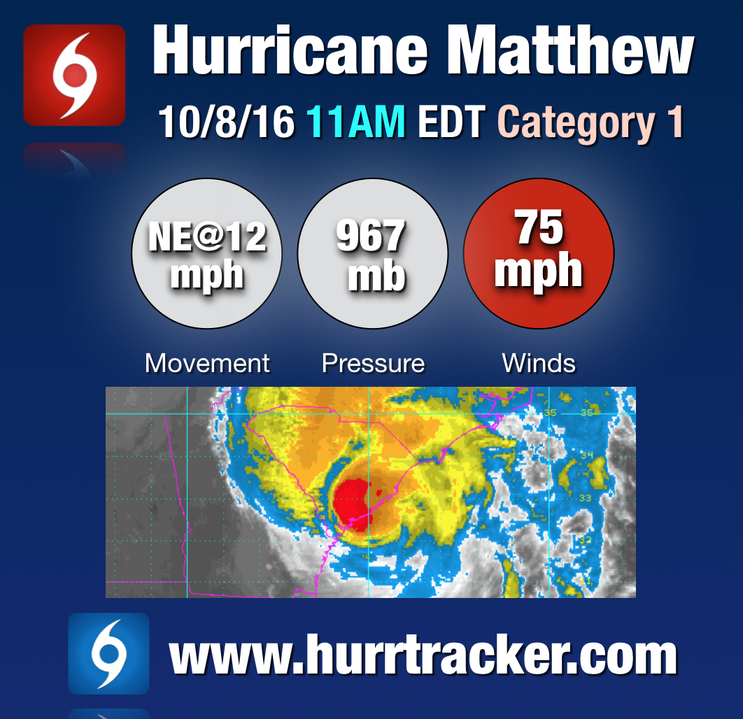
Key data from the latest NHC advisory
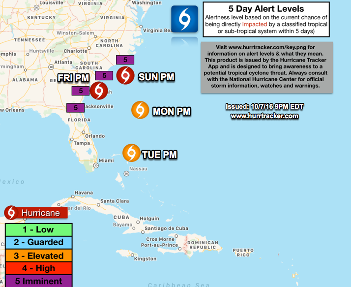
The National Hurricane Center has issued numerous warnings and watches for portions of the southeastern United States coast. See the graphic below for the most recent watch and warning information.
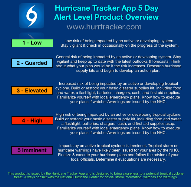
We have issued imminent Alert Levels for portions of the southeast coast. Always follow the advice of your local emergency management officials and consider evacuating if asked to leave. Matthew is one of the most dangerous storms we've seen in years and unfortunately is poised to cause damage across portions GA/SC/NC during the next 24 hours or so. Along with property damage from storm surge and wind, power outages may occur and last days, weeks, or even months in rare cases in the hardest hit areas.
If you are in the path of Matthew, we urge you to please take this storm very seriously and take all measures to protect life, property and pets.
Thank you for using the Hurricane Tracker App and we will be here with updates throughout the next several days until Matthew is safely away from land.