
Hurricane Matthew Could Become Powerful Hurricane
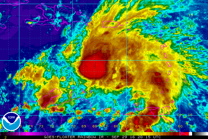
Matthew was upgraded to the 5th hurricane of the Atlantic season earlier today. As of this evening, winds are at 75 mph and the storm is moving to the west.
If you would like to receive these updates the moment they are published, please click here to sign up for email updates.
Over the next few days, Matthew is expected to strengthen into a category 2 or 3 hurricane. It will be traveling over some of the warmest waters in the basin. Wind shear is forecasted to decrease after 48 hours and Matthew could be approaching Jamaica and SE Cuba as a powerful hurricane.
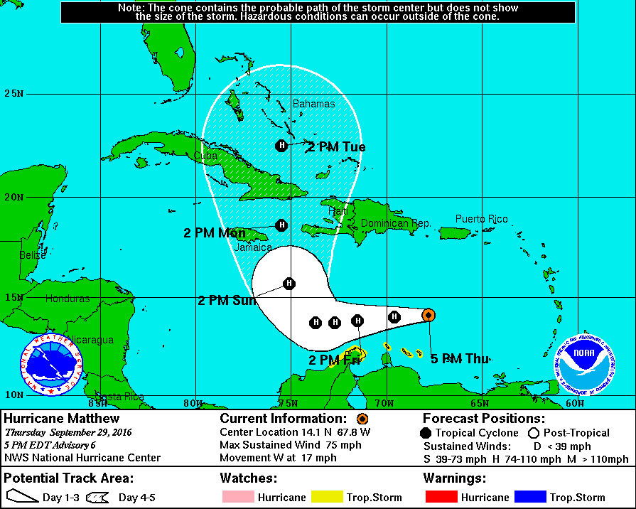
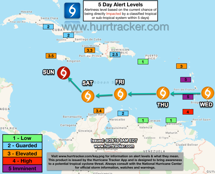
Over the next 5 to 7 days, Matthew will be moving towards the west and then turn towards the northwest sometime late this weekend and will likely impact Jamaica and eastern Cuba as a powerful hurricane. If you are in those regions, we urge you to follow the latest forecast from the National Hurricane Center and to begin preparing for a strong or major hurricane.
Beyond the 5 to 7 day timeframe, models are literally all over the place. We can see a track into the eastern Gulf of Mexico, a track into Florida or the Southeast US, or a track closer to the mid Atlantic/New England coast. Of course the option out into the open Atlantic is a possibility as well. One of the most complicated steering patterns we have seen in years is setting up and models are not good enough to figure it out this far in advance. It will likely be another five days or so before we know if there is a true threat to some portion of the United States coastline. For now, the best advice is to check in daily for updates and the latest forecast track. This will be a slow-moving storm and we will be tracking it for 10 days, or maybe even longer.
Please check out our video update below for more detailed information. https://youtu.be/VSd4gIEsK1M
We will have another discussion as conditions warrant. Thank you for using the Hurricane Tracker service and have a great evening.


