6/19/16 - TD 4 Has Formed & Shoud Become TS Danielle Overnight
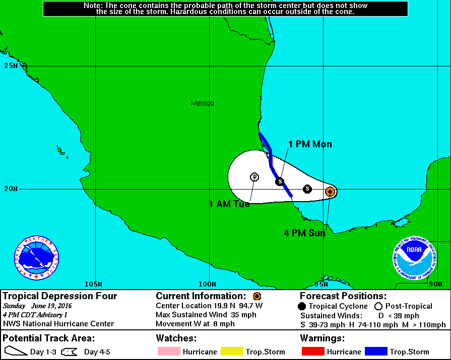
Invest 94L has been upgraded to TD 4 as the Hurricane Hunters found the system had sufficiently organized enough to become a tropical cyclone. TS Warnings have been issued for a portion of the east Mexico coastline. Heavy rains and flooding will be the main threat with this system. No U.S. impacts are expected.
Some models are hinting that we may see another system form in the Western Caribbean or Bay of Campeche before the month is over. We will keep an eye on it and update Model Watch as necessary. Thanks for using Hurricane Tracker.