
6/6/16 - Heavy Rain, Gusty Winds & Possible Tornados For FL, GA, SC & NC as TS Colin Approaches
Overview: Overall, Tropical Storm Colin remains disorganized this evening as the main areas of convection are located well to the east and north of the broad center. However, it is packing a punch in some locations across West Florida. Tropical Storm Warnings are still in effect for portions of FL's Gulf & Atlantic coastlines. TS Warnings are also in effect for the GA coastline up to NC. Colin's winds are holding at 50 mph and it may strengthen to 60 mph overnight or Tuesday am as it skirts the SE US coastline. Gusts to 60 mph are possible in the strongest bands. It will cross FL tonight and be located just off the GA/SC coastlines tomorrow morning.
Receive our detailed discussions via email as soon as they are published, please tap here. Our posts are updated as conditions warrant, but all storm data including advisories, maps, models and NHC data within the storm pages are updated in real time

TS Warnings are in effect all the way to NC.
Rainfall: Heavy rain has been the big issue as we have been saying for days now. Some areas in the FL Panhandle have received 4-6 inches, while some portions of FL's west coast have received 2-3 inches with more on the way overnight. Even south GA is getting in on some action. Rainfall rates in S GA have exceeded 2 inches+ per hour! An additional 2-4" inches+ could fall across north and central FL before the center moves out tomorrow am.

TS Colin is spreading rain across 5 states.

Radar estimates 4 inches plus has fallen offshore. These totals will be move onshore throughout the evening.
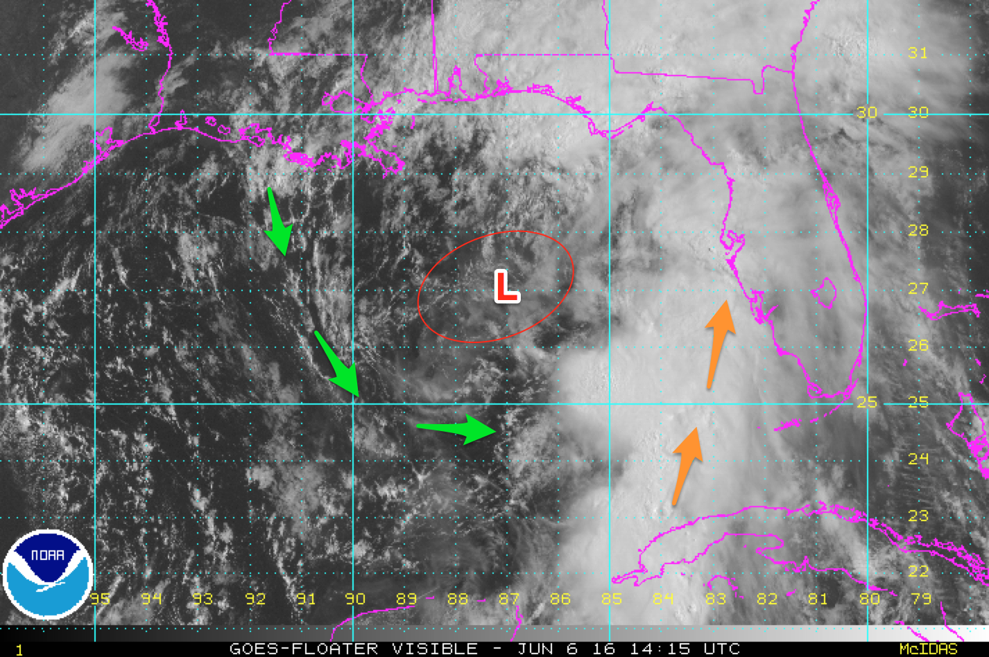
You can see just how disorganized Colin is. Not a classic looking tropical storm.

Radar picked up a 61.5 mph wind gust offshore of Sarasota, FL as the first strong band rolled through.
Tornado Risk: There is a chance of tornadoes this afternoon across a good portion of the FL Peninsula. Tornadoes associated with tropical systems tend to be short-live and less than EF1 rating.
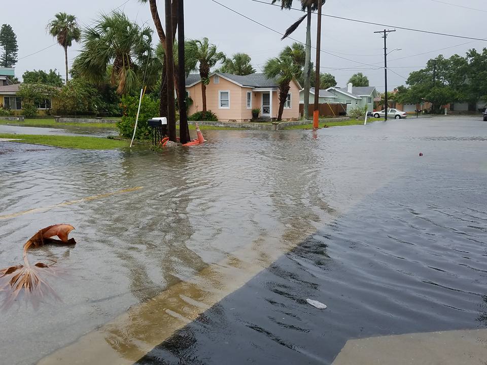
Flooding: Some coastal flooding has occurred along the FL coast today. High tide is this afternoon and water levels may rise to 3 feet. Here are some pictures.

Conclusion: TS Colin has followed the forecasts and no major changes are expected overnight. TS conditions and heavy rain will effect more of FL as we progress through the overnight hours. Tropical Storm force winds and heavy rain will affect the coastlines of GA, SC & NC through early afternoon tomorrow. Flooding, isolated tornadoes and local power outages will be the main impacts. Please stay safe if you are in Colin's path.
After a busy start to the season, it appears the tropics will slow down for a couple of weeks at least. Thanks for using the Hurricane Tracker App and we will be back with another post tomorrow. Please visit Colin's page in our app for all the latest information and updates. Thank you for using the Hurricane Tracker App. www.hurrtracker.com
Receive our detailed discussions via email as soon as they are published, please tap here. Our posts are updated as conditions warrant, but all storm data including advisories, maps, models and NHC data within the storm pages are updated in real time


