6/4/16 - Tropical Storm Colin Is Expected To Form In The Gulf Of Mexico By Sun Night Or Mon & Impact The Florida Peninsula
Update: We will have a new post on newly formed TD 3 early this afternoon. See yesterday's post below:
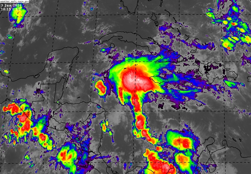
Since yesterday, we have been watching an area of disturbed weather in the Western Caribbean Sea. The National Hurricane Center has designated it as invest 93L and it has a 70 % chance of developing within the next 48 hours, and 80% within five days. Invest 93L is expected to gradually organize today through Sunday as it tracks north across the northwestern Caribbean. It should reach the southern Gulf of Mexico by late Sunday. All of the current computer models are still consistently showing that this area of low pressure will form into Tropical Storm Colin as tracks northeast across the southern and eastern Gulf of Mexico. We do want to stress, that winds will not be a big concern with this system due to the fact that wind shear will keep it from being anything more than a moderate tropical storm. Rainfall and the potential for flooding across portions of the Florida peninsula Will be the biggest concern. This storm will be lopsided, meaning that all of the active weather will be located on the east side of the center. There will not be much rain to the north and west of the center.
Receive our detailed discussions via email as soon as they are published, please tap here. Our posts are updated as conditions warrant, but all storm data including advisories, maps, models and NHC data within the storm pages are updated in real time


Track: Confidence is very high that the storm will track north and east through the Gulf of Mexico and make landfall near or just north of Tampa sometime on Monday night or Tuesday morning. The center of the storm is expected to be broad so the exact location won't matter much. We do not expect any drastic shifts with the track in future model runs. However, some of the most recent runs have been trending a bit further north towards the big bend area of the coast. See our current thinking below on winds and track.
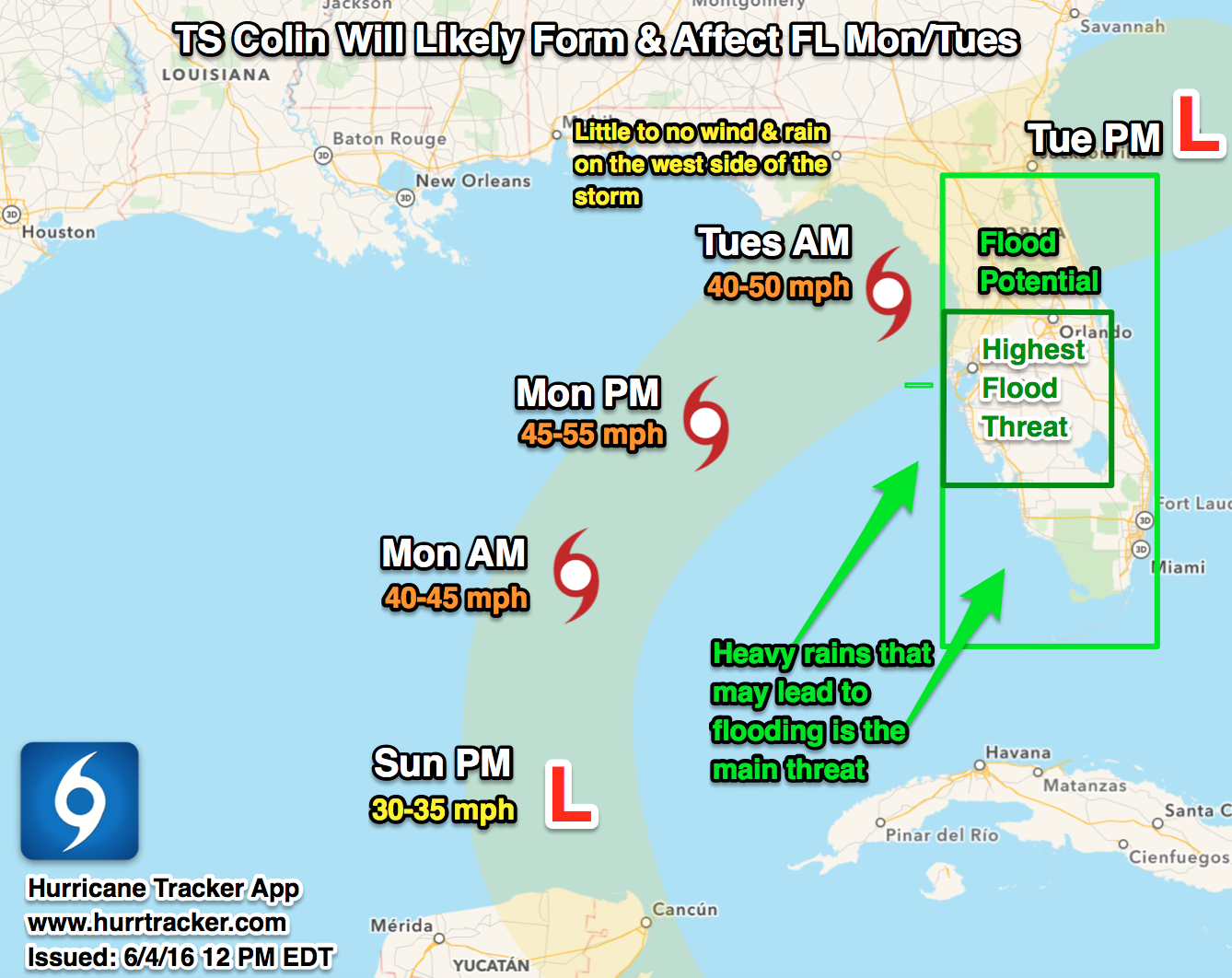

Winds: Due to the forecasted wind shear above the storm, we do not expect winds to get any stronger than 50 or 55 mph. The strongest winds will be confined in the strongest thunderstorms and likely displaced east of the center. As of this post, we only see a low chance (10%) at this becoming a hurricane before it reaches Florida. Once it crosses Florida, there is a bit higher chance that it could become the second hurricane of the season over open waters as it is moving away from the United States.
Rain/Flooding Potential: The heaviest rainfall with a flooding threat looks to be centered along the west coast of Florida. Total rainfall amounts of 5 to 10 inches are forecasted to fall from Monday night through Tuesday afternoon. 1 to 3 inches are currently expected across south and southeast Florida. If you are in an area prone to flooding, please check in often for updates as flooding maybe a big concern in some areas, especially in west-central FL.

Tornado Threat: Increased wind shear across Florida Monday afternoon through Monday night means that there will be an increased tornado threat. Especially to the east of the center in the strongest thunderstorms. This is something we will be monitoring very closely.
Closing: While this will be a large, sheared messy system, the threat for flooding and possible tornadoes is high. If you have interests in FL, please check in often for updates. We will be here through the weekend and early next week with the most detailed information on this developing tropical system. Thanks for using our service and the Hurricane Tracker App. We will leave you with our current 5 day Alert Levels.
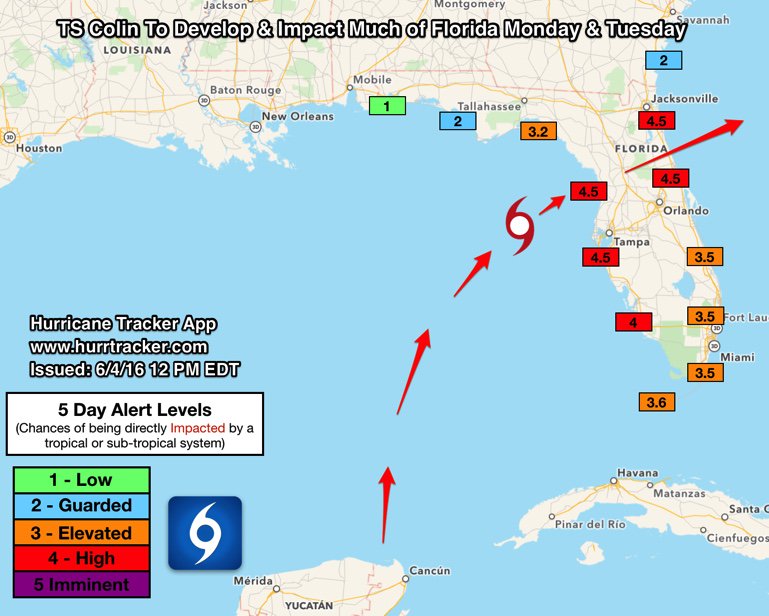
Much of FL will be impacted Mon & Tue by upcoming TS Colin. High Alert Levels. Flooding is the biggest threat.