10/7/18 - 10AM EDT

Sent to Gulf & FL/Bahamas push regions:

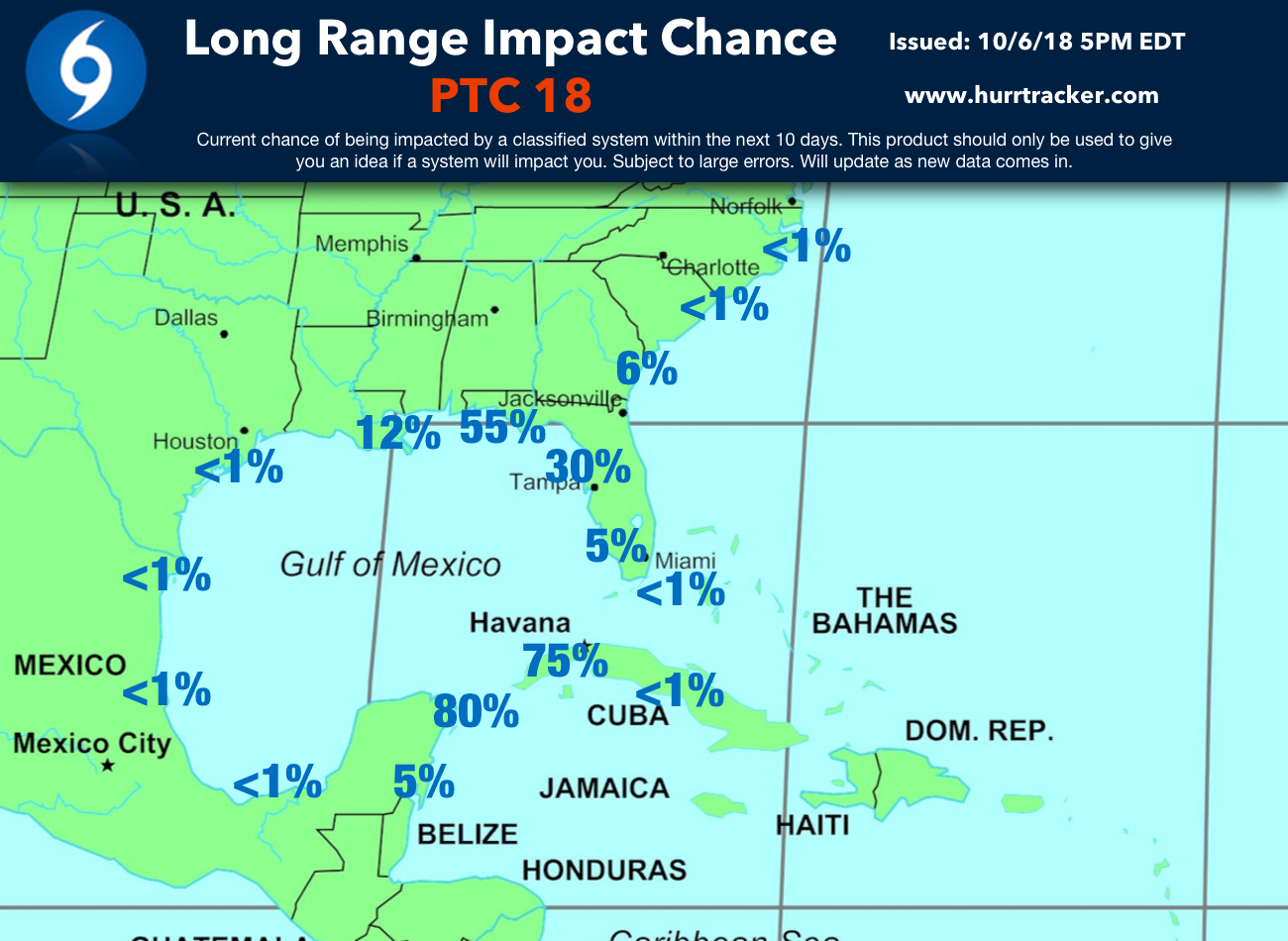
Tropical Depression 14 formed early this morning in the northwest Caribbean Sea. This system is expected to become a hurricane in the Gulf of Mexico in two to three days. The next name on the list would be Michael. The NHC currently forecasts peak winds of 75 mph, but several reliable models are showing a much stronger hurricane once it arrives along the FL Panhandle Wednesday. All interests in or near the cone should monitor this system very closely this week.

115050_5day_cone_no_line_and_wind.png

10/6/18 - 5PM EDT

Sent to Gulf coast & FL/Bahamas push region:

The NHC has initiated advisories on Potential Tropical Cyclone 14. The NHC does forecast this system to become Tropical Storm Michael & track towards the Northern Gulf coast with a landfall on Wednesday. Winds are currently forecasted to reach 70 mph before landfall, but this system could reach hurricane status as some model data supports a stronger system than currently forecast. All interests from eastern Louisiana to FL should monitor the progress of this system closely.

Our 5 day Alert Level graphic.

Our 5 day Alert Level graphic.

Our Long Range Impact Chance graphic.

Our Long Range Impact Chance graphic.