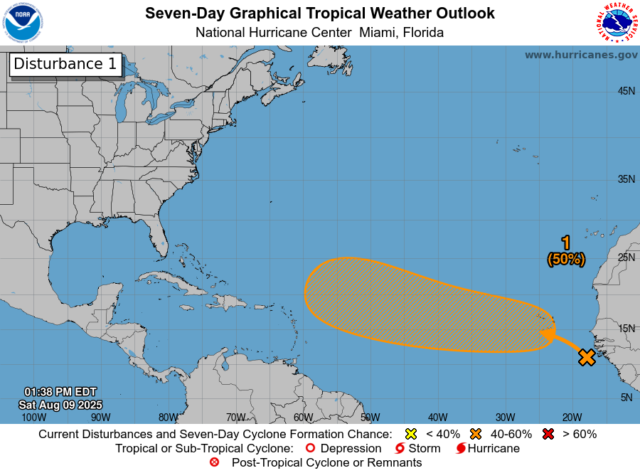
8/9/25 - Tracking Invest 97L In The Atlantic
Newly designated Invest 97L is being watched for development as it tracks across the Atlantic during the next week. The NHC states there is currently a 50% chance of development. The atmospheric conditions appear conducive for gradual development and it could become a hurricane in about a week. It’s too soon to know if this system will impact land, but it needs to be watched closely. We will keep you informed of any updates. The next name is Erin. Click on “Invest 97L” under current storms for all the latest information and model data. Thanks for using Hurricane Tracker App.
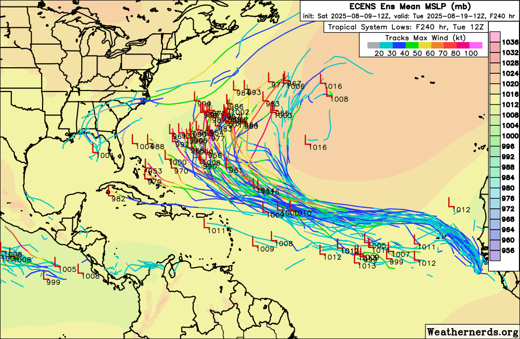
The 12Z 8/9/25 European Ensembles
O HI-RES! If you are not already a premium graphics subscriber, sign up today and take full advantage of what Hurricane Tracker has to offer. Details here > Premium Graphics Info. Thank you for being a Hurricane Tracker App user and supporting our passion for tracking tropical cyclones! We couldn’t do this without your support! 2025 will be our 15th year of tracking tropical systems!
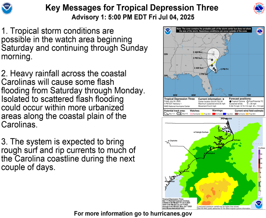
Example image below of just one of our premium graphics offerings during an active storm.
Details here > Premium Graphics Info.
Thanks for your ongoing support and helping to keep this app active!