5/28/25 - TD 1E - 1st System In The Western Hemisphere Forms

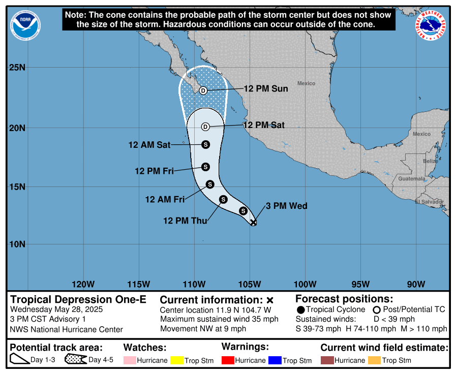
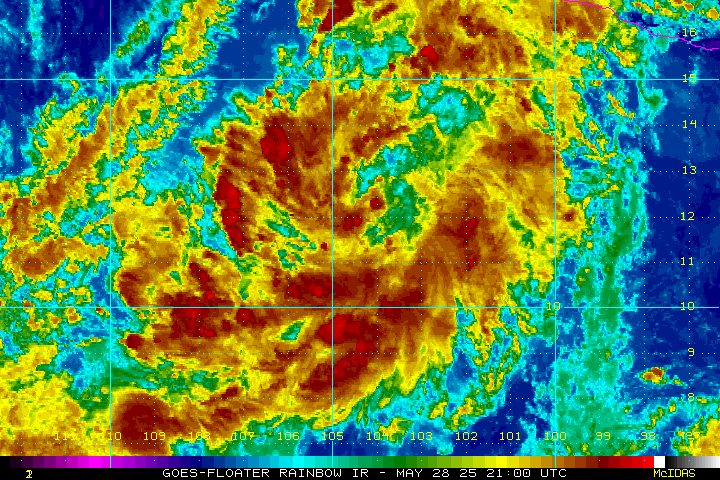
Tropical Depression 1E in the Eastern Pacific became the first system of the season in the Western Hemisphere earlier today. TD1E is forecasted to become Tropical Storm Alvin later tonight. Later this week, it will turn north towards Baja Mexico, but is expected to weaken dramatically due to cold waters near the coast. Little to no impact is expected for Mexico at this time. Read below for an Atlantic update.

To view Eastern Pacific storms, click on “E Pacific” at the top of the home page in the app.

For the Atlantic Basin, there’s some indication there might be a chance for development in the area of the Western Caribbean in about 10 days or so. A pulse of the MJO we be moving across the western Atlantic and that may be able to spark development. We will keep you updated on this potential. Nothing to worry about at this time.

The CPC indicates the western Caribbean may be the area to watch between June 11-17.

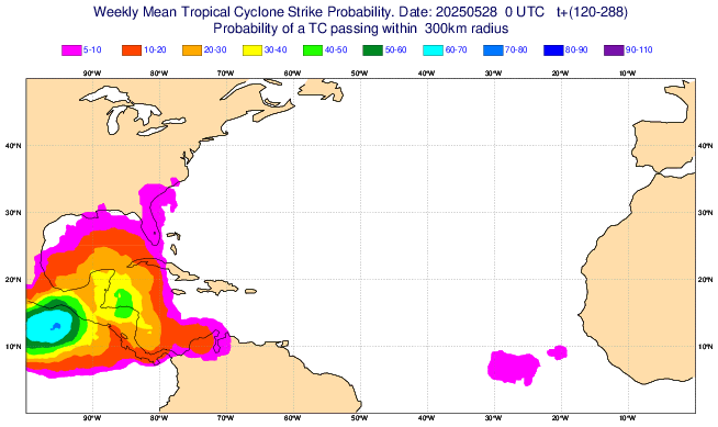
Ensembles showing a 40/50% chance of development in the western Caribbean within 2 weeks. Will monitor.

If you are not already a premium graphics subscriber, sign up today and take full advantage of what Hurricane Tracker has to offer. Details here > Premium Graphics Info. Thank you for being a Hurricane Tracker App user and supporting our passion for tracking tropical cyclones! We couldn’t do this without your support! 2025 will be our 15th year of tracking tropical systems!

Example image below of just one of our premium graphics offerings during an active storm.

Details here > Premium Graphics Info.

Premium graphics example for subscribers.

Alvin Is Expected In The Eastern Pacific Mid Week. No Mexico Threat

The first tropical depression of the Eastern Pacific season is expected mid-week south of Mexico. The system should stay south of the coast and weaken as water temps fall below 80°F the further WNW it tracks. Baja Mexico should be safe from this one. Will watch for any changes. The first name on the list this season for the Eastern Pacific Basin will be Alvin.

If you are not already a premium graphics subscriber, sign up today and take full advantage of what Hurricane Tracker has to offer. Details here > Premium Graphics Info. Thank you for being a Hurricane Tracker App user and supporting our passion for tracking tropical cyclones! We couldn’t do this without your support! 2025 will be our 15th year of tracking tropical systems!

Example image below of just one of our premium graphics offerings during an active storm.

Details here > Premium Graphics Info.

Premium graphics example tracking image for subscribers.

5/22/25 - NOAA Predicts An Above Average 2025 Season

NOAA’s outlook for the 2025 Atlantic hurricane season, which goes from June 1 to November 30, predicts a 30% chance of a near-normal season, a 60% chance of an above-normal season, and a 10% chance of a below-normal season.

The agency is forecasting a range of 13 to 19 total named storms (winds of 39 mph or higher). Of those, 6-10 are forecast to become hurricanes (winds of 74 mph or higher), including 3-5 major hurricanes (category 3, 4 or 5; with winds of 111 mph or higher). NOAA has a 70% confidence in these ranges. 

The season is expected to be above normal – due to a confluence of factors, including continued neutral ENSO conditions (No El Niño) warmer than average ocean temperatures, forecasts for weak wind shear, and the potential for higher activity from the West African Monsoon, a primary starting point for Atlantic hurricanes. All of these elements tend to favor tropical storm formation. 

List of names that will be used for the 2025 Atlantic season.

The high activity era continues in the Atlantic Basin, featuring high-heat content in the ocean and reduced trade winds. The higher-heat content provides more energy to fuel storm development, while weaker winds allow the storms to develop without disruption. 

This hurricane season also features the potential for a northward shift of the West African monsoon, producing tropical waves that seed some of the strongest and most long-lived Atlantic storms.

Stay with Hurricane Tracker as we will be here to keep you updated on storm development this upcoming season, all it takes is one to make major impacts to to life and property.

If you are not already a premium graphics subscriber, sign up today and take full advantage of what Hurricane Tracker has to offer. Details here > Premium Graphics Info. Thank you for being a Hurricane Tracker App user and supporting our passion for tracking tropical cyclones! We couldn’t do this without your support! 2025 will be our 15th year of tracking tropical systems!

Example image below of just one of our premium graphics offerings during an active storm.

Details here > Premium Graphics Info.

Sample image from our premium graphics offering. Note the level of detail we provide for our premium users.