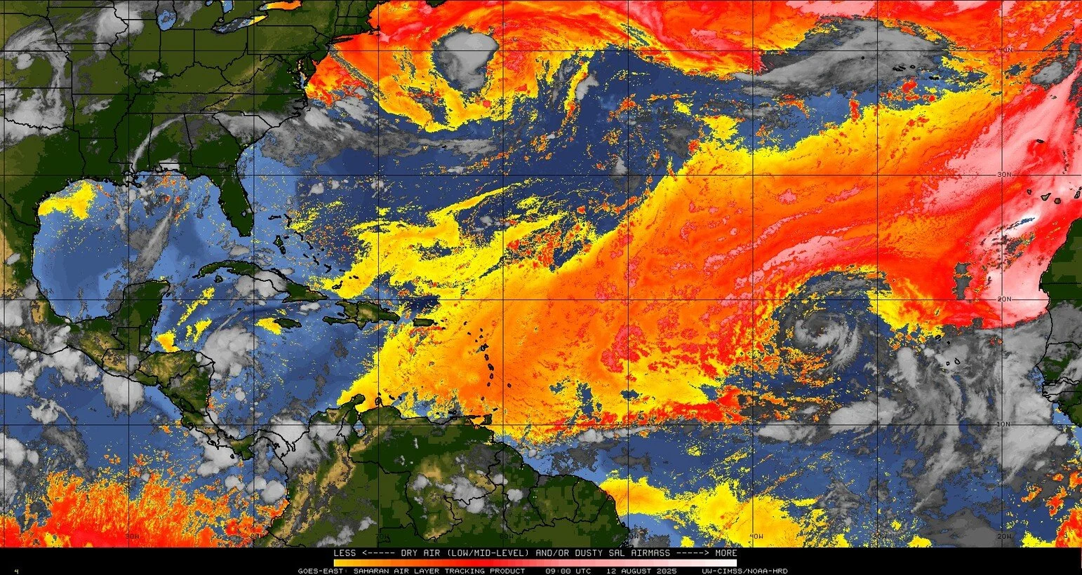
8/13/25 - TS Erin Discussion and Analysis
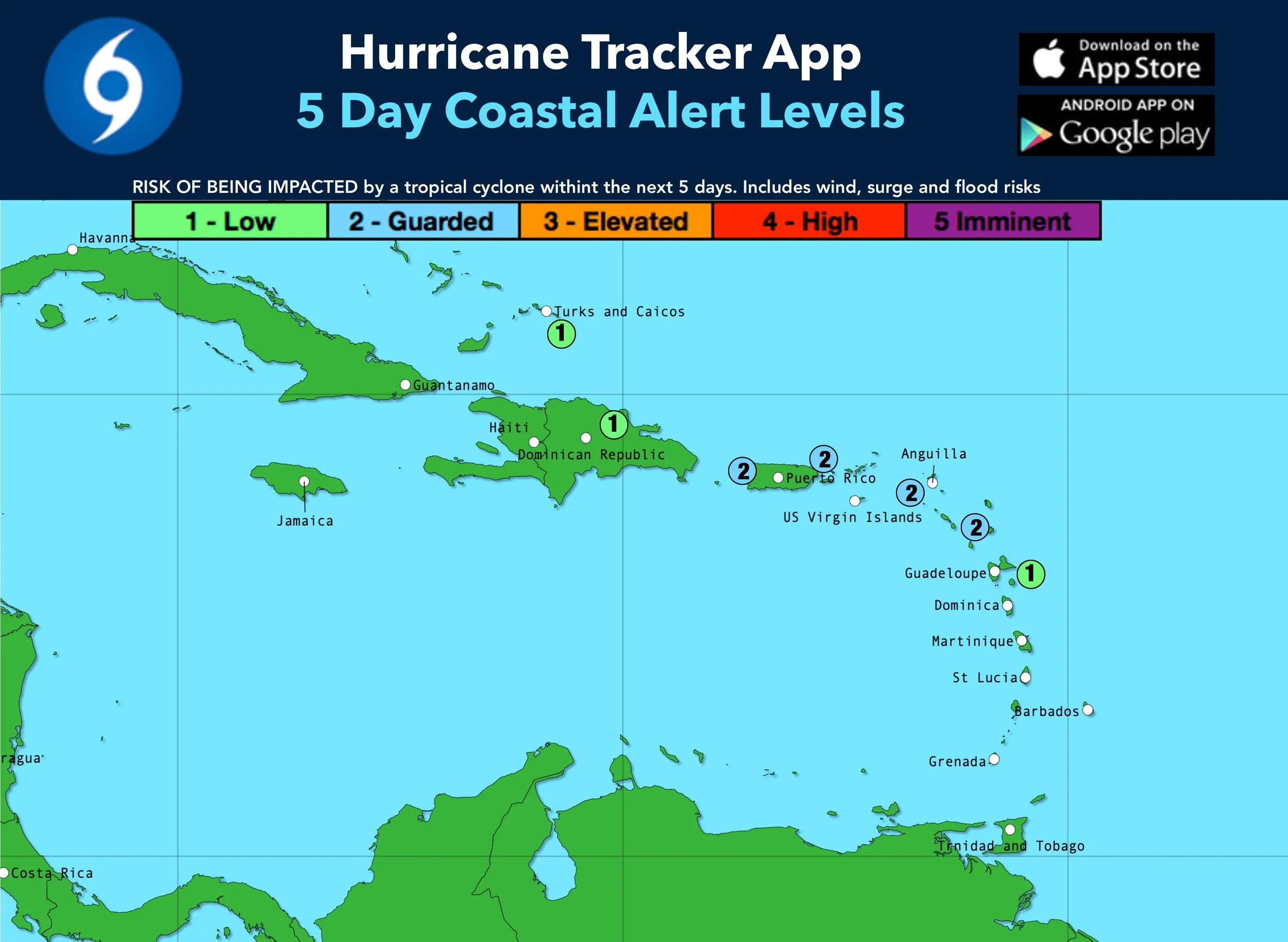
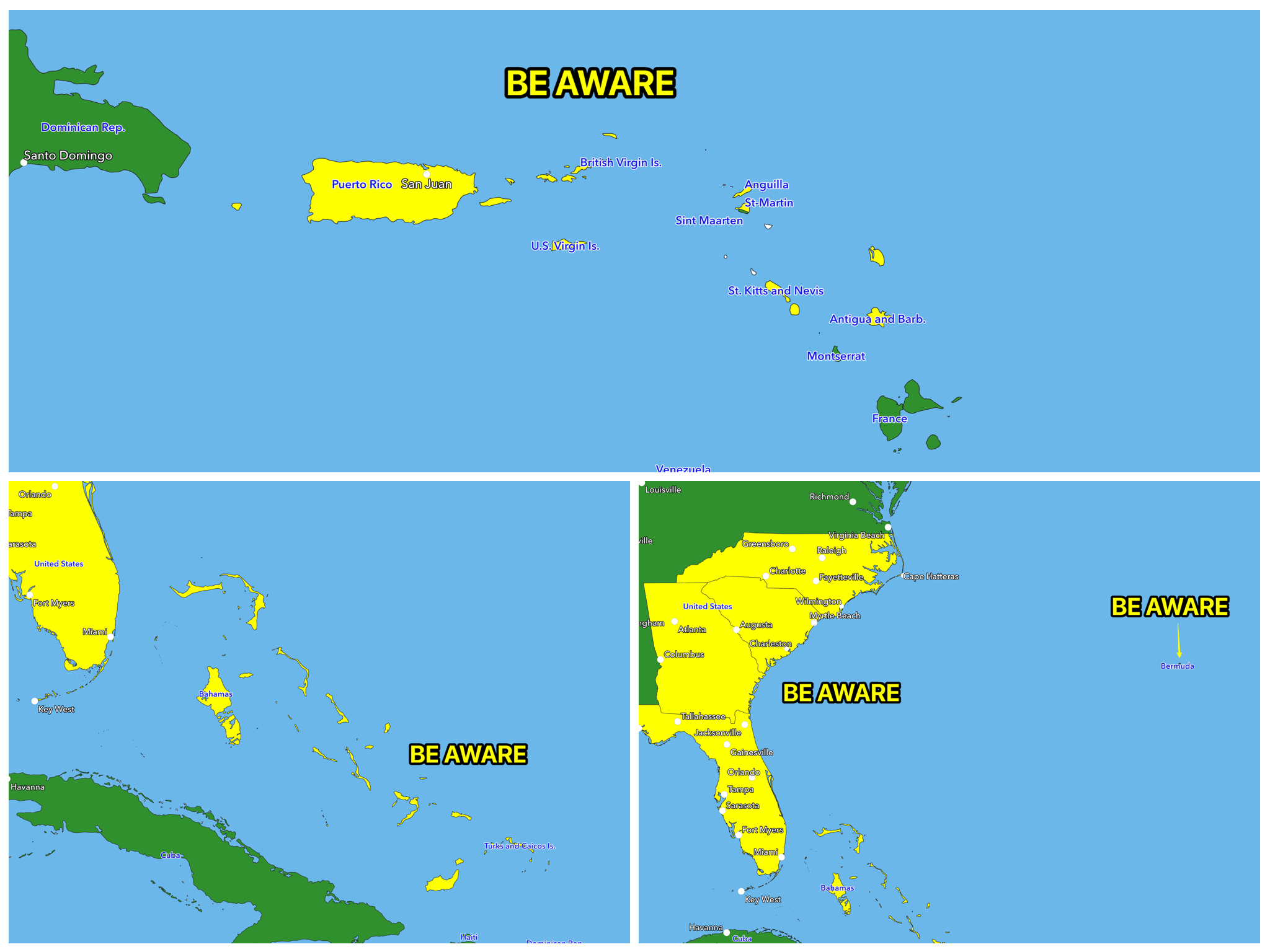
We have highlighted areas in yellow throughout portions of the Caribbean, Bermuda, Bahamas and SE U.S. that just need to “Be Aware” and keep an eye on “Erin” as the storm draws closer. If any of these areas need to “prepare” we will update the graphics. Final track not yet known.
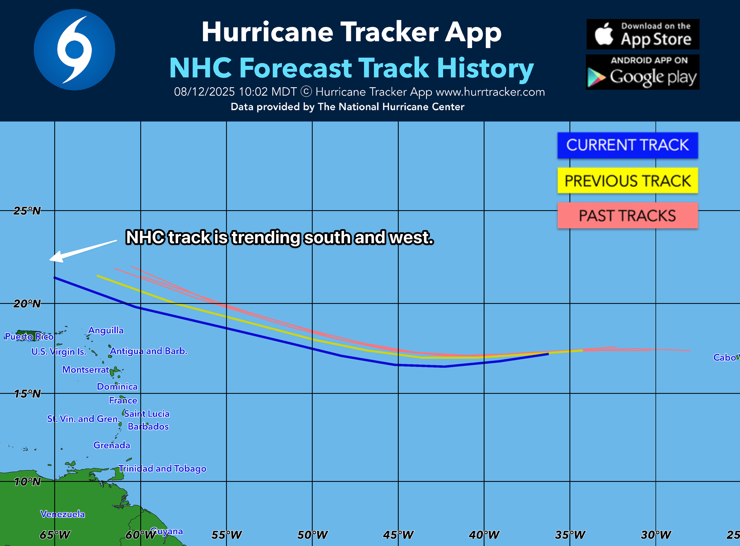
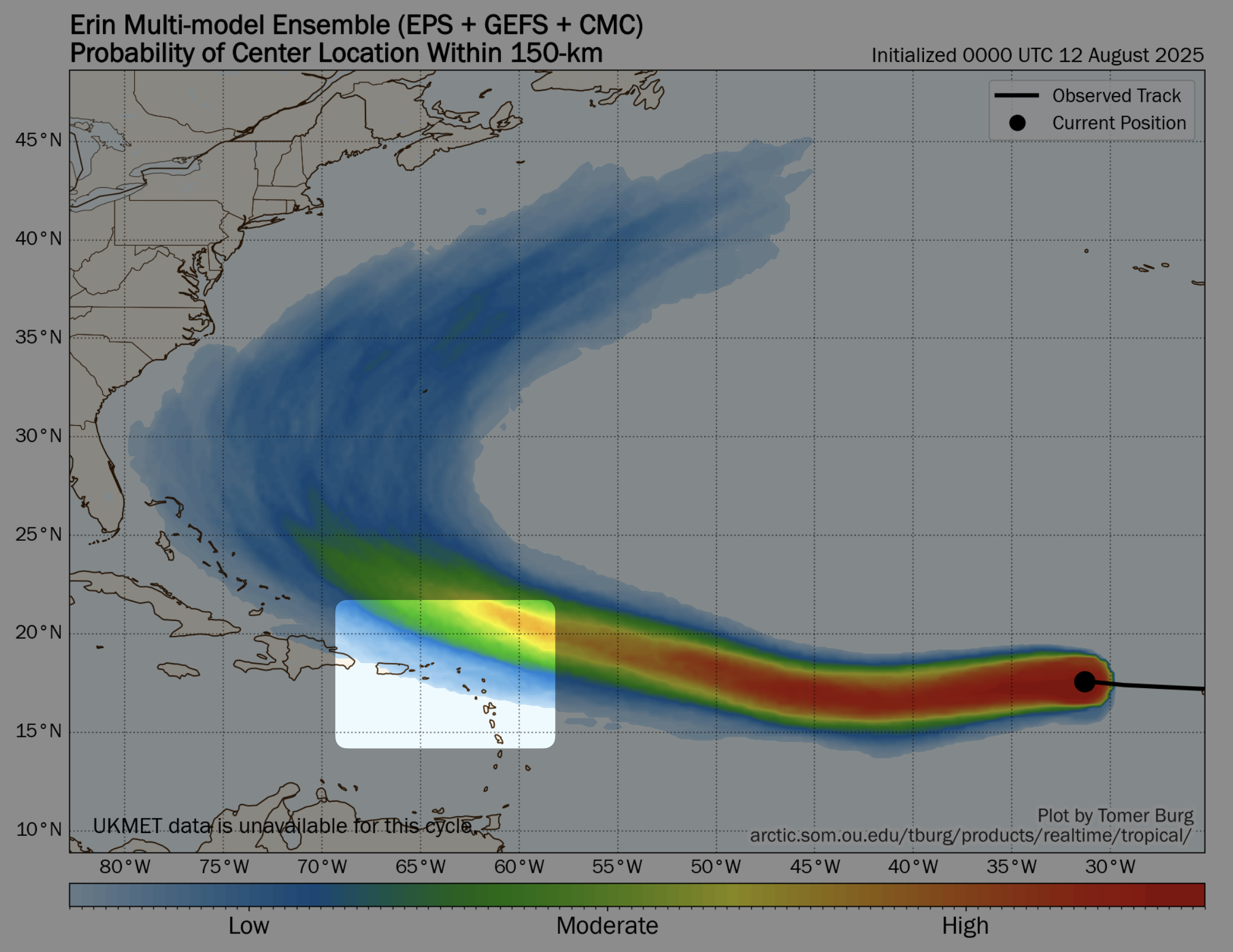
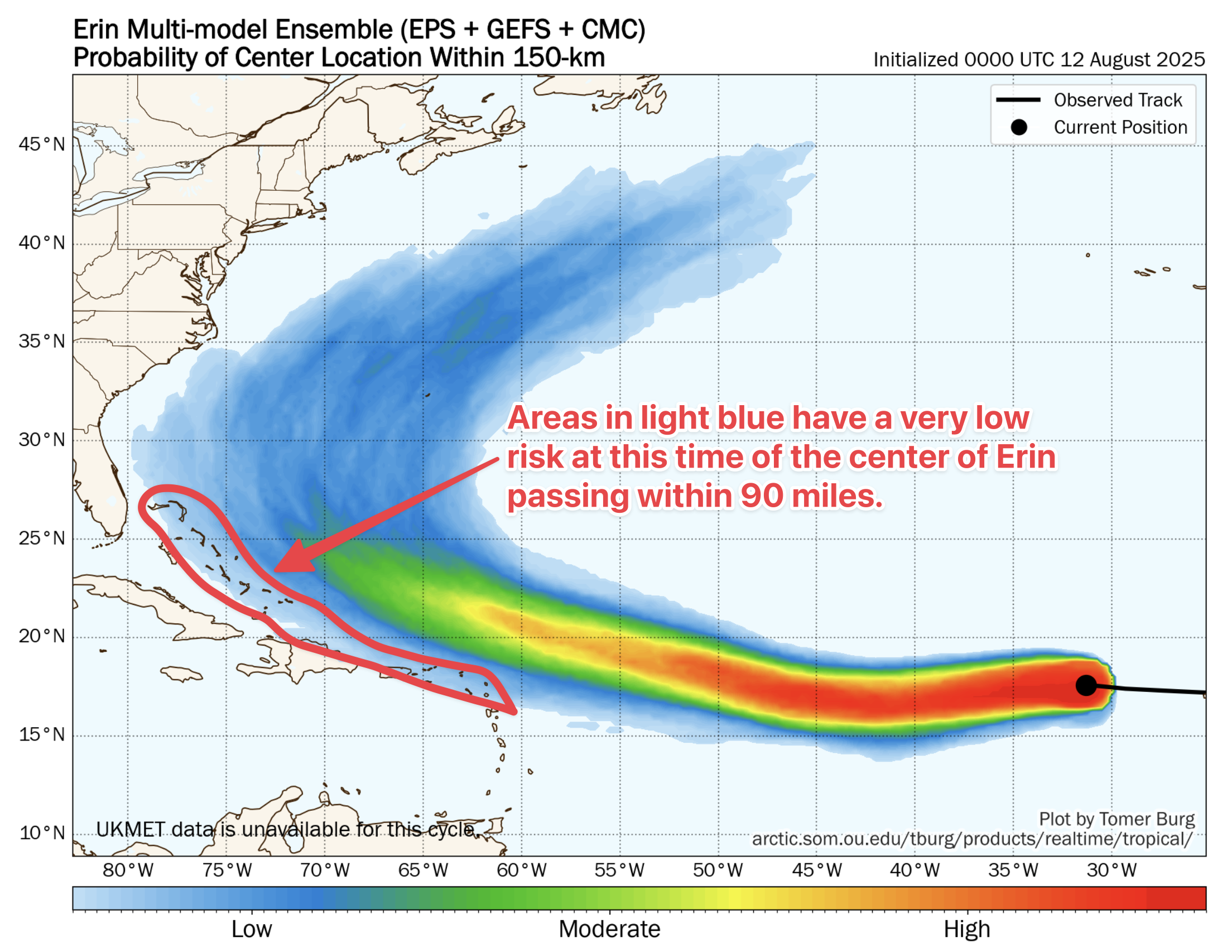
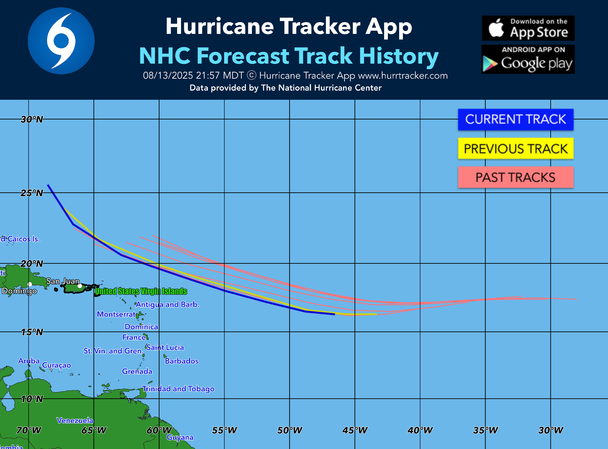
11PM NHC track showing the NNW turn (blue line) in 5 days for Erin. Some model data trying to bring Erin a little more west. Will see what data tomorrow brings. We will have a major hurricane in the western Atlantic this weekend. Best scenario is for Erin to shoot the gap between U.S. and Bermuda and not directly affect anyone. Final track not set yet. Stay tuned.
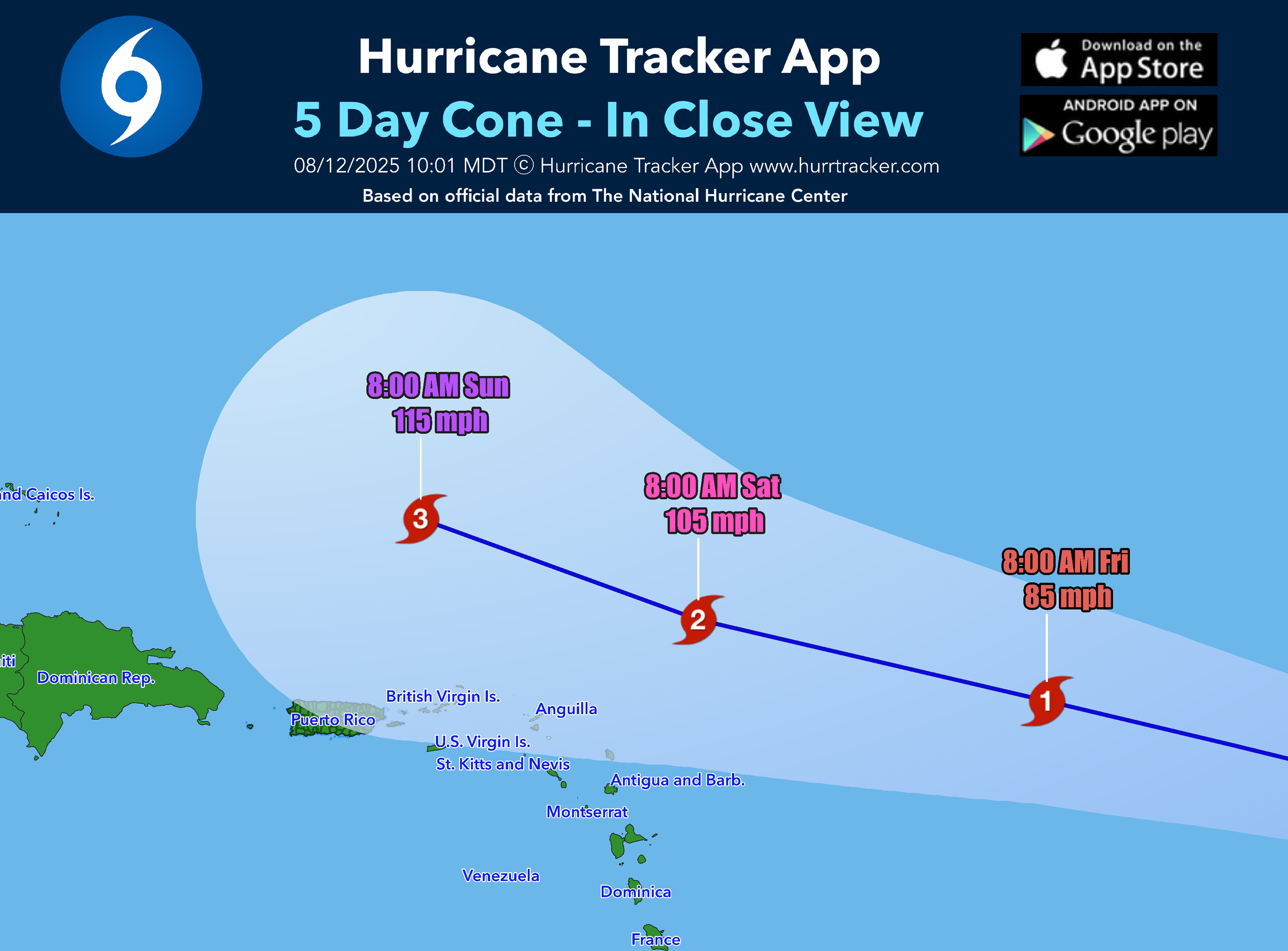
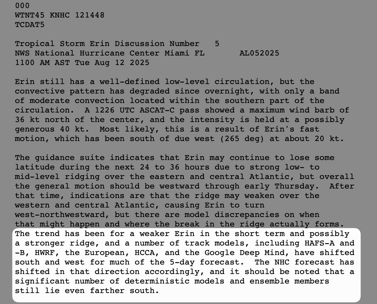
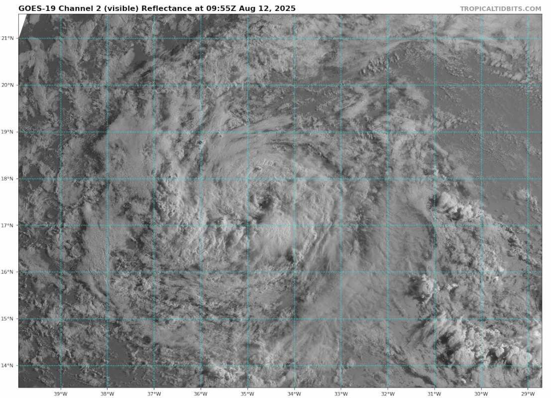
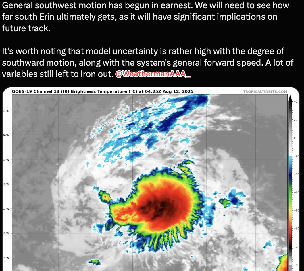
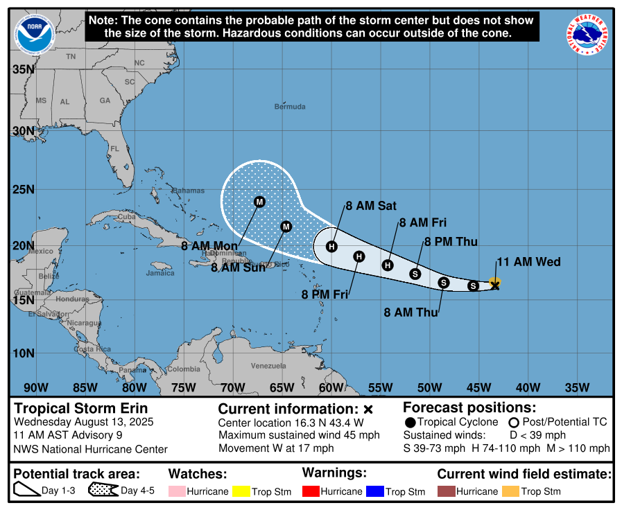
Tropical Storm Erin has been maintaining its intensity near 45 mph, but is forecasted to become a hurricane on Friday and a major hurricane this weekend. The latest track guidance takes it a bit farther away from the northern Caribbean, but there still may be some impacts and possible feeder bands affecting the region around Puerto Rico. Interests in the northern Leeward Islands, Virgin Islands, and Puerto Rico should still monitor the progress of Erin in case of any unexpected forecast changes.
Computer models the last 12 hours are showing a little more agreement that Erin will slide just north of the Caribbean and east of the Bahamas. Bermuda will have to watch Erin very closely as the chance of impacts on the island are somewhat increasing. The center may pass just west of Bermuda next week. Erin will be a strong category 3 or 4 hurricane at that time as indicated by the guidance.

At this time there is very little chance of impacts on the U.S. mainland, but we will still monitor for any forecast changes. Stay tuned to the Hurricane Tracker App. Always click on current storms > Erin for all the latest graphics and forecasts on Erin.
GO HI-RES! If you are not already a premium graphics subscriber, sign up today and take full advantage of what Hurricane Tracker has to offer. Details here > Premium Graphics Info. Thank you for being a Hurricane Tracker App user and supporting our passion for tracking tropical cyclones! We couldn’t do this without your support! 2025 will be our 15th year of tracking tropical systems!
Example image below of just one of our premium graphics offerings during an active storm.
Details here > Premium Graphics Info.
Thanks for your ongoing support and helping to keep this app active!