Gordon Headed Towards The Gulf Coast & Florence Strengthens
9/3/18 - We are in the heart of the climatological peak of the hurricane season. We're currently tracking two active tropical systems and unfortunately, it appears we may be tracking two more by the time next week rolls around. Tropical Storm Gordon is tracking towards the northern Gulf Coast and will make landfall tomorrow night. Tropical Storm Florence continues to churn in the open Atlantic and we are watching the long term forecast of that system very carefully. Behind Florence, two more tropical systems may develop over the next 10 days.
Click here to listen to our latest audio update.
To get these discussions sent to your email, check out our email update service here.
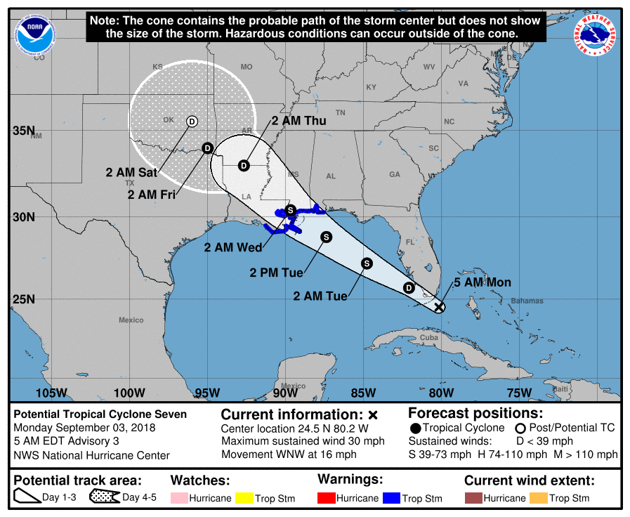
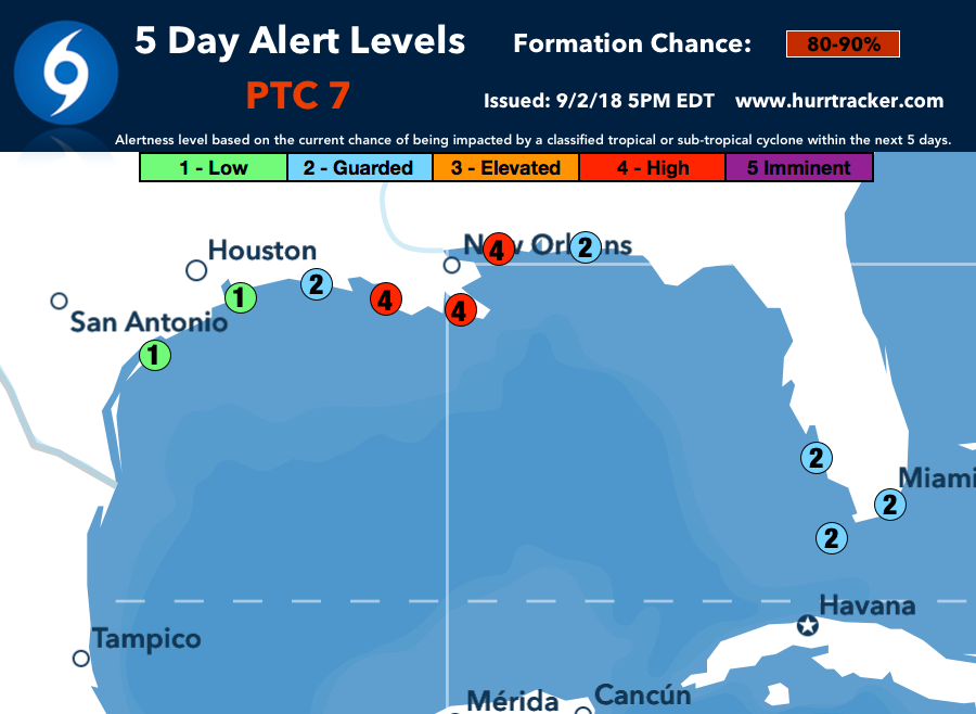
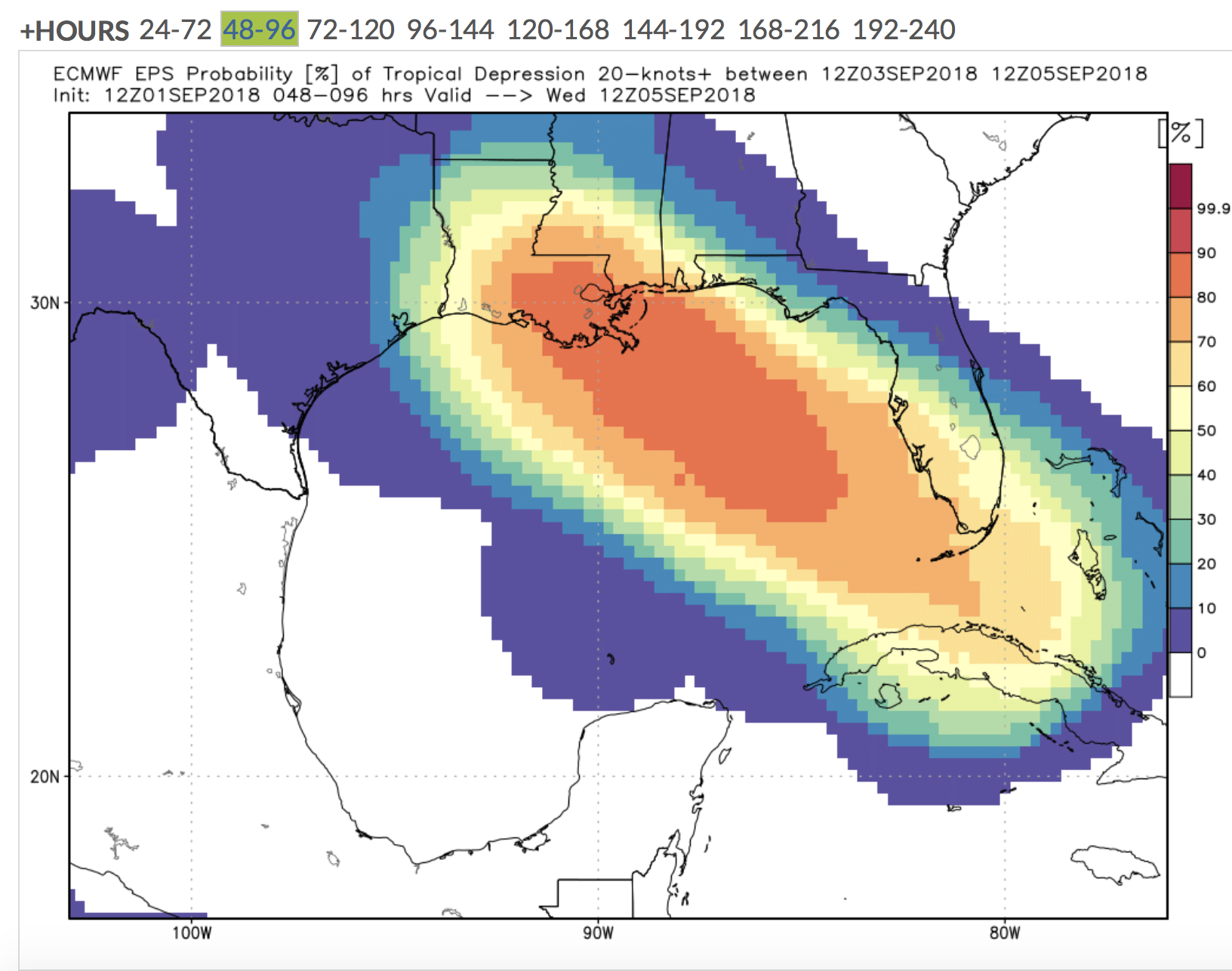
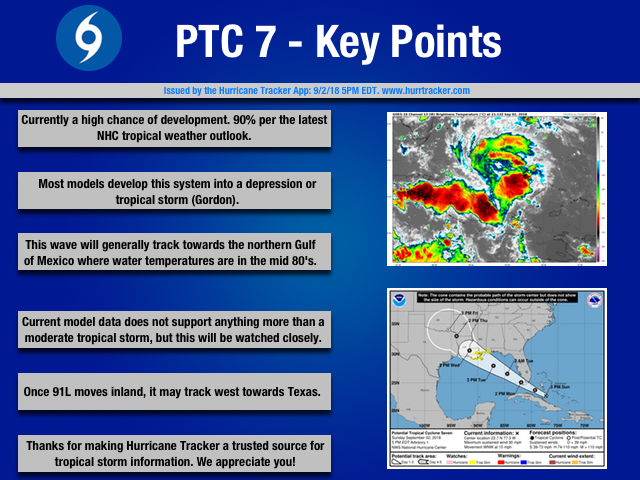
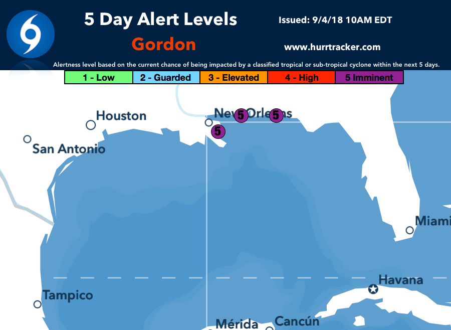
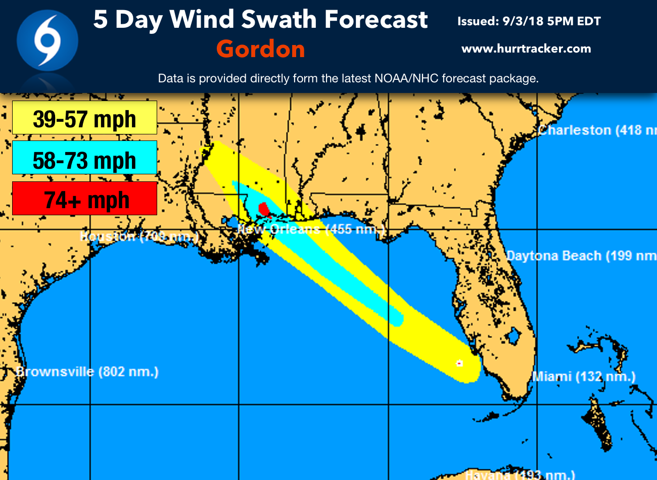
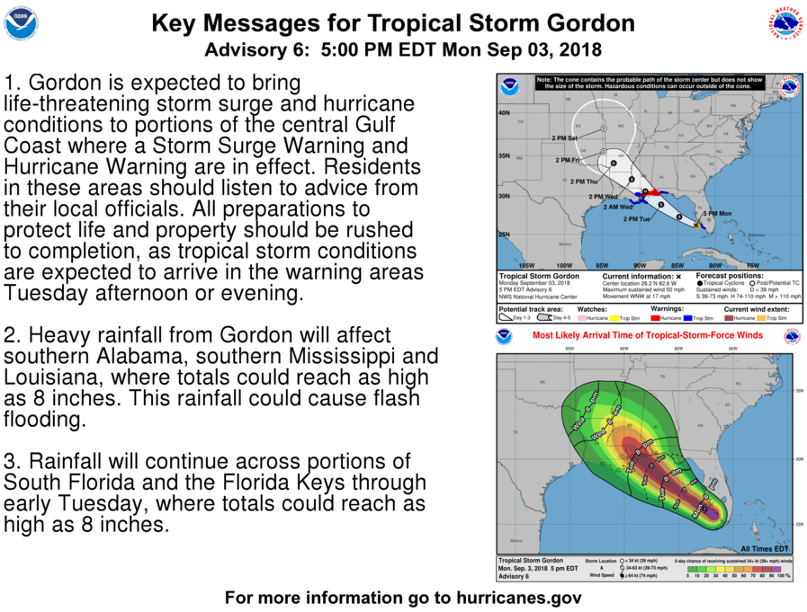
Tropical Storm Gordon: Gordon quickly formed early this morning and has been steadily intensifying through the day while bringing tropical storm conditions to the Florida Keys and parts of southern Florida. Confidence is high that Gordon will track towards the northern Gulf Coast and make landfall along the Mississippi Coast late tomorrow night. As of this writing, the NHC forecasts Gordon to make landfall as a strong tropical storm, but it could very well be a category one hurricane with winds over 74 mph. Tropical storm & Hurricane warnings have been issued for portions of the northern gulf coast. If you are a resident or have interests along the northern gulf coast, please continue to monitor Tropical Storm Gordon closely over the 36 hours.
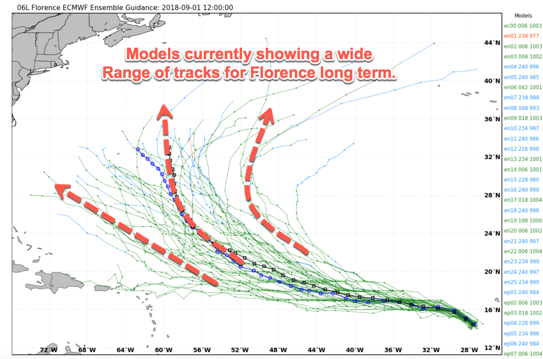
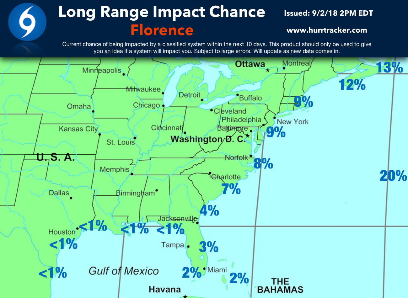
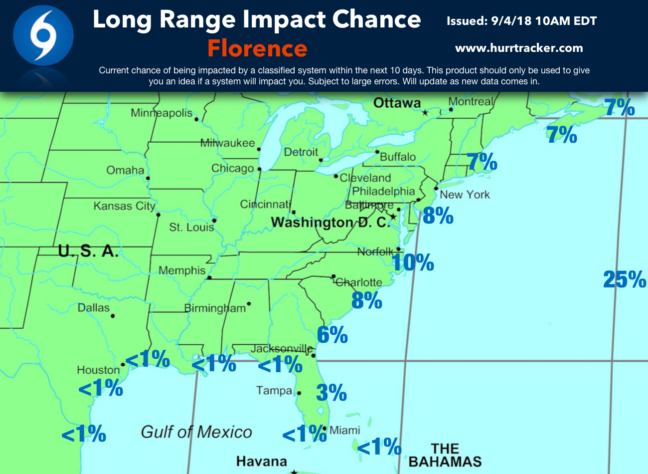
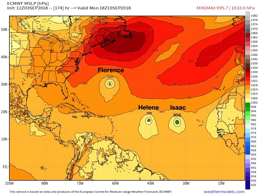
Hurricane Florence: Florence has strengthened somewhat during the last 24 hours and may become a hurricane by tomorrow, but some computer model guidance forecasts Florence to weaken some over the next few days as it begins to encounter wind shear and some dry air. Florence will stay out over the open Atlantic during the next several days. Confidence in the forecast track beyond the next five days is very low. Some model data is forecasting that Florence will turn north into the open Atlantic and not harm any land, while other guidance suggests a ridge of high pressure will build over the western Atlantic and potentially force Florence close to Bermuda or even the eastern United States seaboard. It is important to note that only a handful of storms have impacted the US Coast after crossing 60° West and 25° North, which Florence is forecasted to do. Given the fact that we've had an unusually strong high pressure over the Atlantic so far this year, it's not impossible for Florence to make it all the way to the eastern seaboard. Please review our Long-Term Impact Chance graphic below based on the latest data. We will keep you updated on the long-term forecast track of Florence as we get closer in time and more data comes in, but any potential impacts to Bermuda or the eastern United States would not be in till later next week.
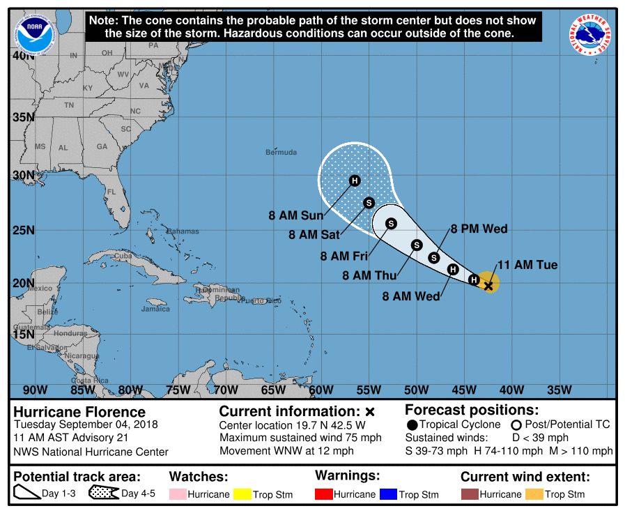
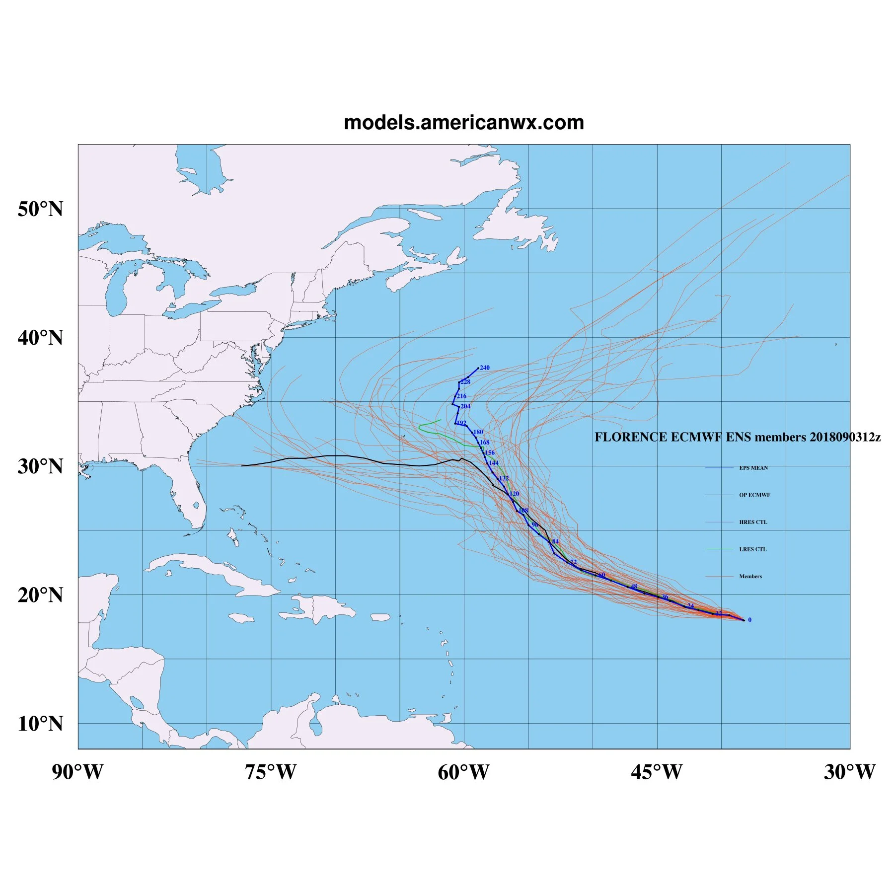
9/3/18 4PM EDT EPS model track spread for Florence.
Active Tropical Atlantic: Invest 92L was declared by the NHC today near the coast of Africa. This system has been given a 40% chance of development through the next five days as it tracks west. This system is forecasted by most models to become "Helene". Behind the system, yet another strong wave is forecasted to move off Africa during the next several days and could become "Isaac". The latest data shows that if these two systems were to form, they would most likely head west or west-northwest across the tropical Atlantic. We will keep you updated on the progress of these two systems.
Whew! It sure is busy. If you are in the path of Gordon, please stay safe. Thank you for using the Hurricane Tracker App and for trusting us as one of your sources for tropical weather information. We will have another discussion sometime tomorrow.