7/10/17 - Watching EX TD 4 For Possible Re-development
Remember TD 4 from a few days ago? The remnants have been hanging around and the NHC has reactivated it as an invest as the system is gradually becoming better organized. Not likely to become a TD or TS in the very near future, but it's something worth watching as the remnants are generally headed towards S Florida & the Eastern Gulf later this week. The NHC will update us all at 2 PM and release their official development chances. No immediate threat anyone, but worth watching as the environment is semi- favorable. The Hurricane Hunters are scheduled to investigate this system tomorrow afternoon. We will keep you updated as more information is available.
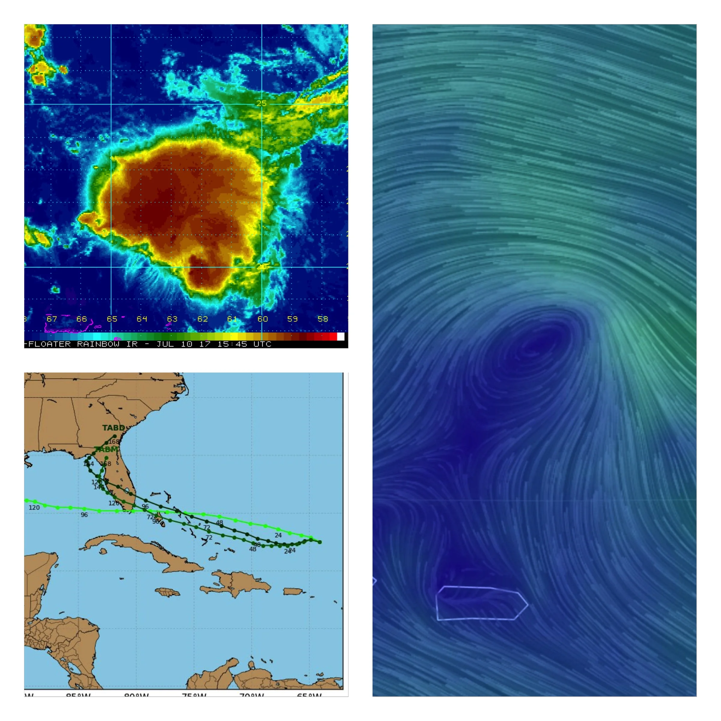
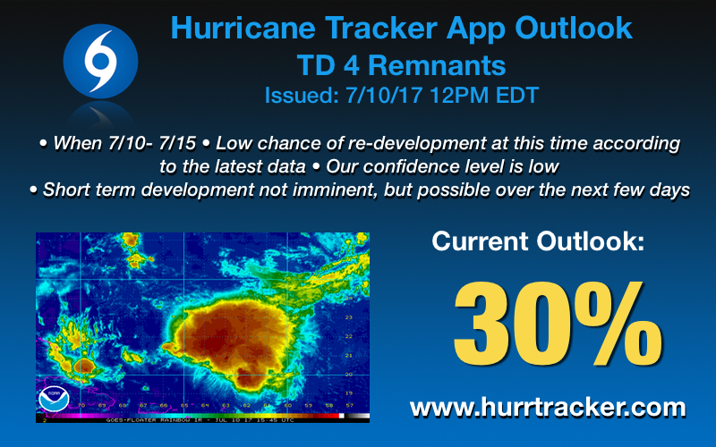
Non-official outlook from us here at the Hurricane Tracker App
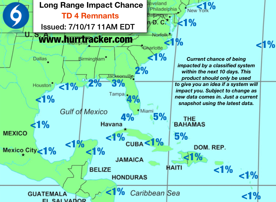
At this time, realistically, chances of the Bahamas, FL & SE Gulf being affected by this system as a tropical cyclone are generally 5% or less. Will update this image in app as new data comes in.