Hurricane Matthew Is Expected To Intensify & Head Towards Jamaica/Cuba
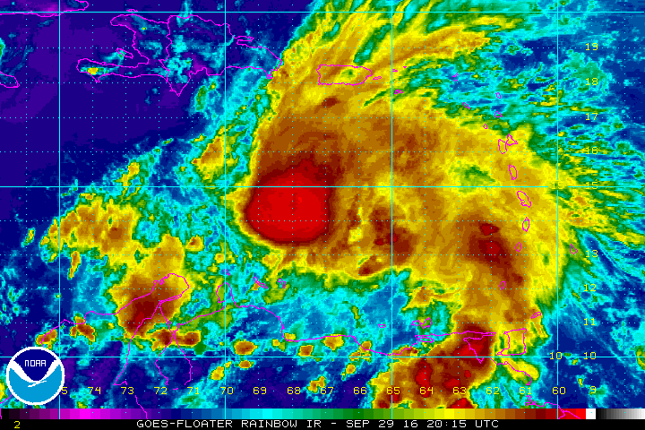
Matthew has strengthened into a Category 4 hurricane very quickly today. Check the storm page under "Current Storms" for all the latest information, maps & advisories. This section is not meant to provide real time information. This is where we post our analysis each evening. We will have a new detailed discussion on Matthew later this evening. Please see our most recent discussion below:
Matthew has strengthened into the 5th hurricane of the 2016 Atlantic season. Confidence in the forecast over the next 2 to 3 days is high as Matthew is expected to move towards the west-southwest and gradually strengthen into a category 4 hurricane. This weekend, the steering currents will weaken and Matthew will dramatically slow down somewhere south or east of Jamaica and begin a turn towards the north or northwest.
If you would like to receive these updates the moment they are published, please click here to sign up for email updates.


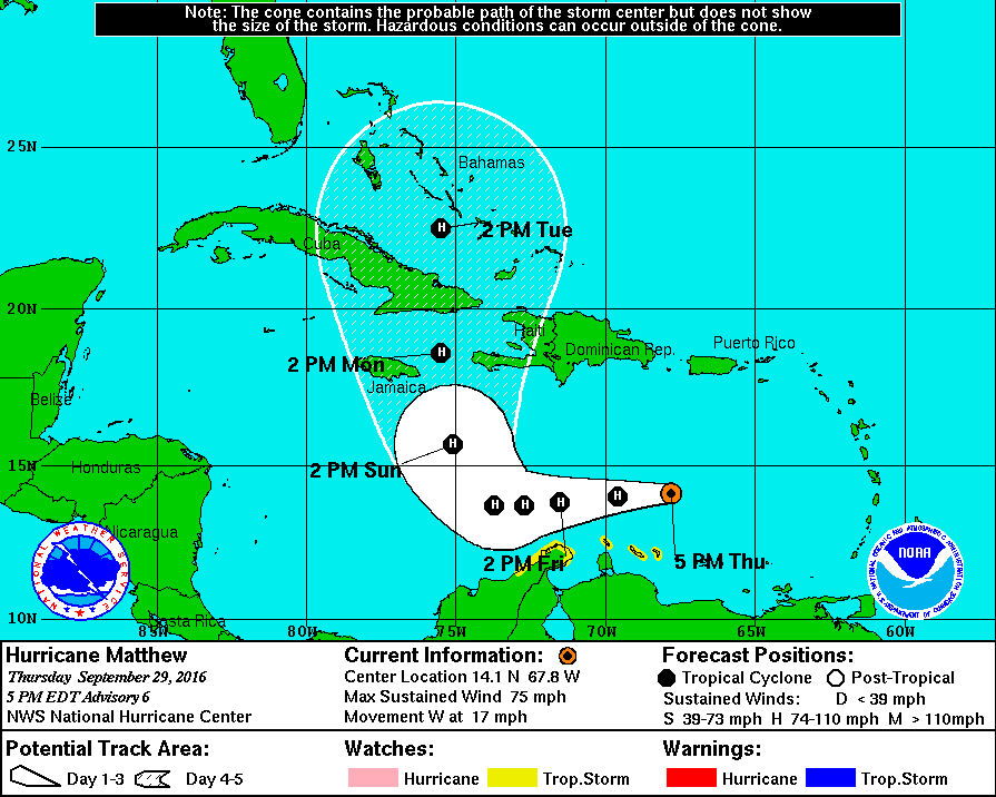
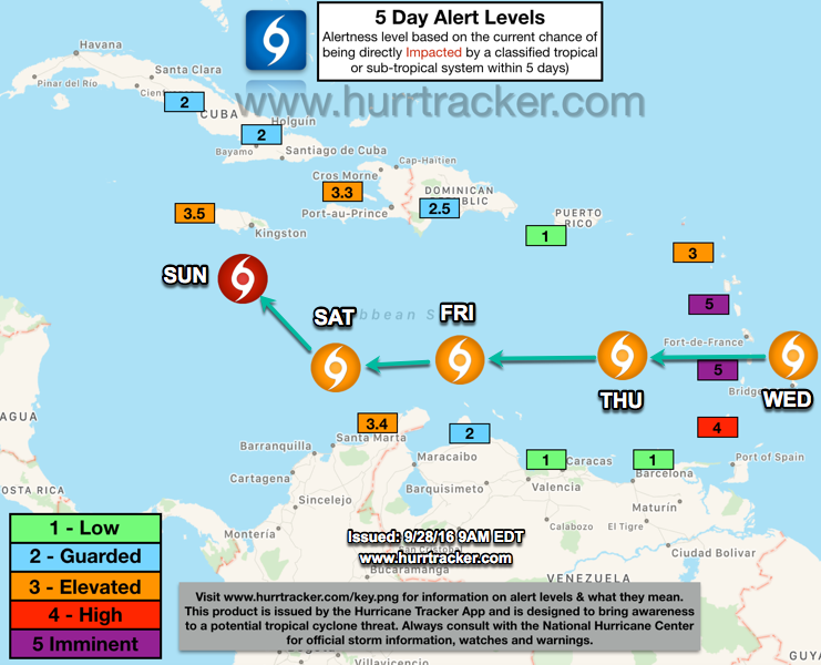
Once the the hurricane makes the turn north, we are very concerned about a powerful hurricane impacting possibly Jamaica, eastern Cuba, the Bahamas and maybe even Haiti in about 4-5 days. At this time, the National Hurricane Center is currently forecasting a strong category 2 hurricane and a category 3 is not out of the question due to the very warm waters in the Caribbean Sea. Along with warm waters, it appears the environment will be very favorable for Matthew to become an intense, powerful hurricane. If you are in the forecast cone of Matthew, please see our recent Alert Level Map below to determine what actions you should be thinking about taking if watches or warnings are issued for your area.

Beyond 5 days, the outlook gets very murky as computer models have not yet settled on the final track of Matthew and whether or not the United States will have a landfall. Based on the latest trends in the models, if Matthew doesn't move any faster than the current National Hurricane Center’s forecast then there is a chance that in the 6 to 10 day range and upper-level trough moving towards the east coast could help push Matthew out into the open Atlantic. However, if Matthew moves faster than the current forecast, it would have a greater chance of out running an incoming trough of low pressure and we could have a track right up the east coast or very close.
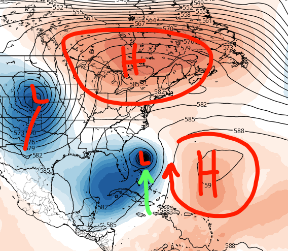
Very complicated steering pattern setting up in the 6-10 day range. Areas of high and low pressure determine where hurricanes track.
We are feeling a lot better about the Gulf of Mexico, the chances of Matthew coming to the gulf have been lowering the last 36 hours. All residents and interests from Florida all the way to the Canadian Maritimes, including the entire eastern seaboard, is not yet out of the woods and needs to follow the system and future forecasts from the NHC very closely. There are some models that are showing the potential for a U.S. landfall anywhere along the eastern United States in the 6 to 10 day range. It will be something we will be keeping a very close eye on over the next few model cycles.
We hope that in about 3 to 4 days the models will finally have a good grasp on the upper level steering pattern and whether or not Matthew will pose a threat to the United States. We hope everyone along the path of Matthew in the Caribbean takes the correct action to prepare for the storm and to stay safe as it will be a dangerous hurricane, sadly.
We will be back with another written discussion as conditions warrant. Thank you for using the hurricane tracker app service.
Follow our Twitter feed @hurrtrackerapp for more detailed and frequent updates on the models and real time data.