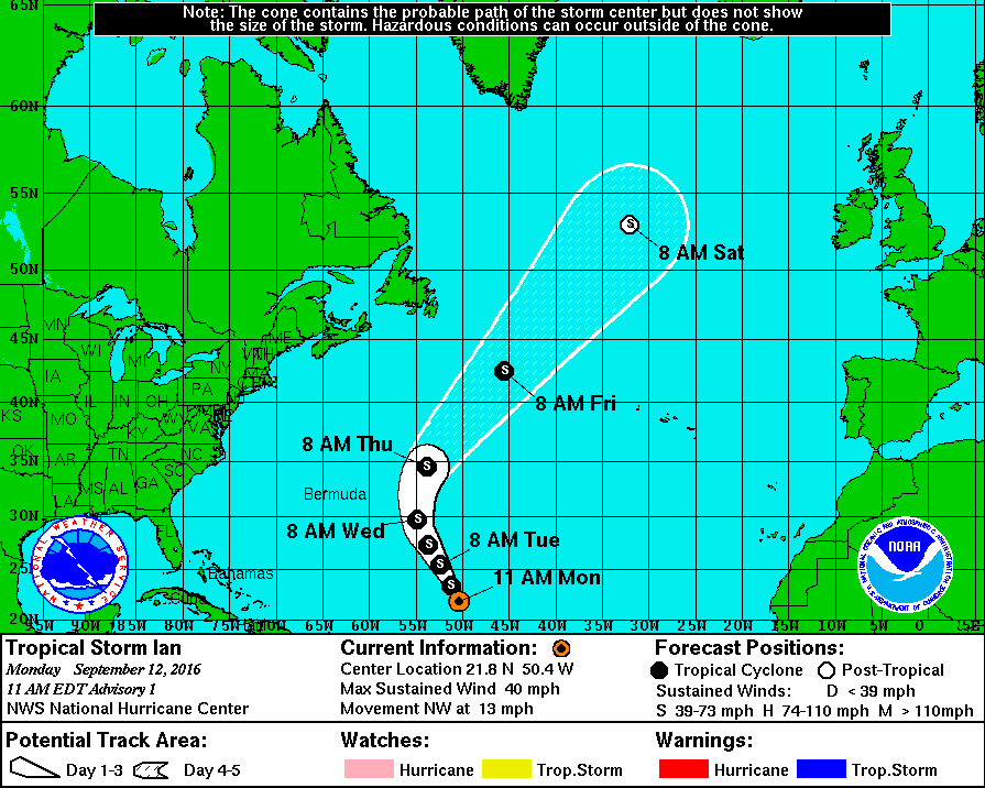
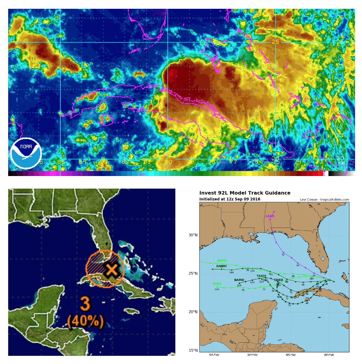
Remember Invest 92L? It came off of Africa well over a week ago and never developed due to the Saharan Air Layer in the Atlantic. The system has stayed weak and has tracked pretty far west. It has formed a circulation, but thunderstorms are being blown away (sheared) due to unfavorable upper level winds at the moment. There is a chance conditions could become a bit more favorable and a depression could form by this weekend. There is a 40% chance of development over the next 5 days. High pressure to the north should steer this system west-west northwest across the Gulf of Mexico. All interests from SW LA to Mexico should monitor the progress of this system. This system is not a threat to the north or eastern Gulf coast.
Check the outlook section of our app for the latest updates from the NHC through the weekend. If there are any significant changes, we will let you know here. Thanks for using Hurricane Tracker!