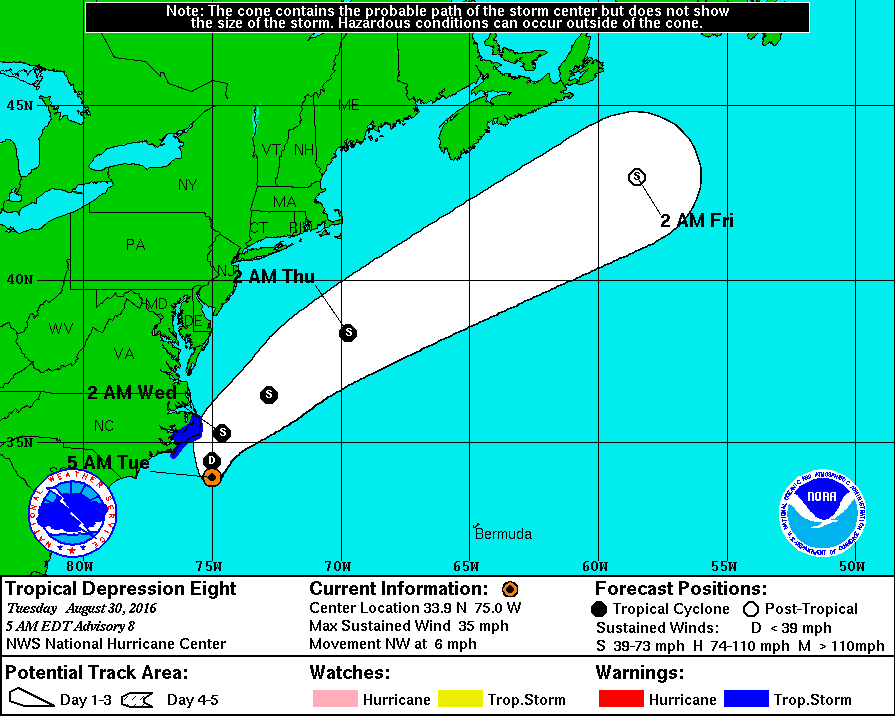
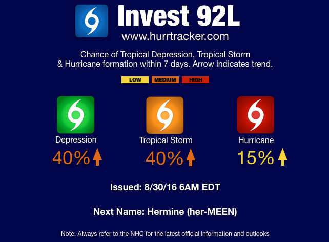
8/31/16 - TD 9 Is Almost TS Hermine and Could Reach Hurricane Status Before Landfall
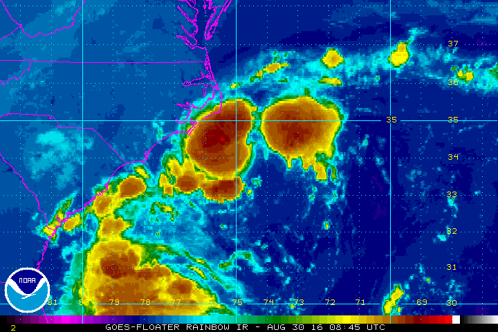
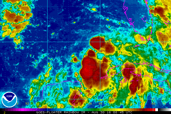
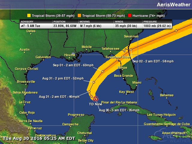
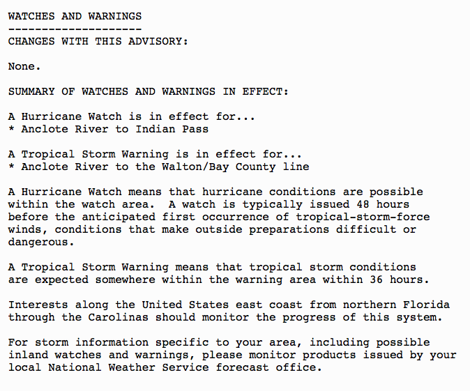
Tropical Depression Nine is organizing and should become Tropical Storm Hermine within the next 12 hours. The storm is slowly moving towards the north and later today it should begin to turn north-northeast and accelerate towards the big Bend region of Florida. A tropical storm warning and a hurricane watch is in effect for a portion of the Florida Gulf Coast (see image below for details). Additional watches and warnings will likely be required for the northeast Florida coast, Georgia, and the SC/NC coastlines soon.
If you would like to receive these updates the moment they are published, please click here to sign up for email updates.


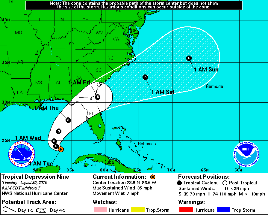
The official forecast from the National Hurricane Center is for this storm to make landfall as a 65 mph tropical storm. However, many of the global computer models including the European, are forecasting category one hurricane intensity. At this time, we think there's about a 60% chance this system will make landfall as a hurricane. it has been 10+ years since a hurricane has made landfall in FL.
Based on the current forecast track, several states could feel the effects from future Hermine. At the very least, tropical storm conditions are forecasted to occur over portions of north-northeastern Florida, southeast Georgia and the coastal Carolinas. Once the system is east of Cape Hatteras, some of the guidance is trying to turn the storm towards New England as a strong area of high pressure builds over southeast Canada preventing an easy route out to sea. While this is currently not in the forecast, all interests and residents along the east coast need to monitor the progress of the system.

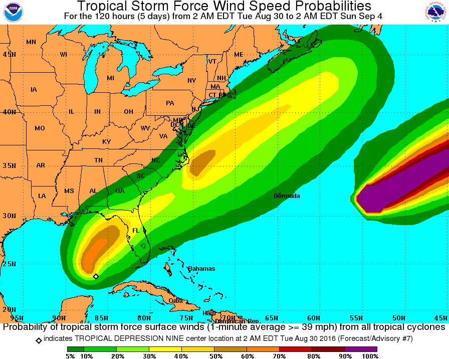
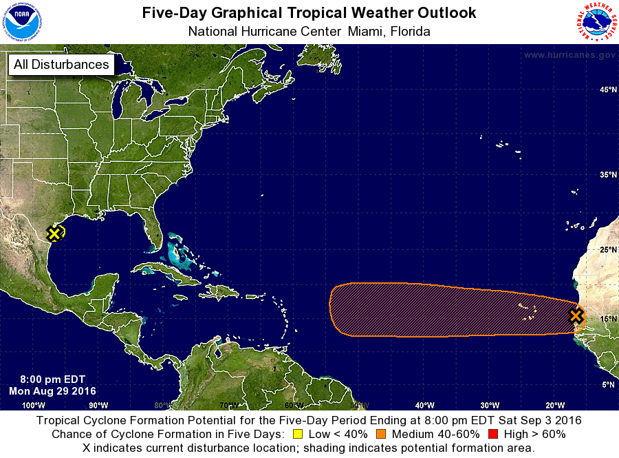
Latest wind swath projection by the NHC.
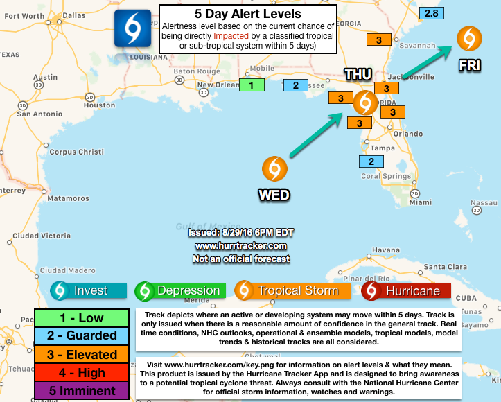
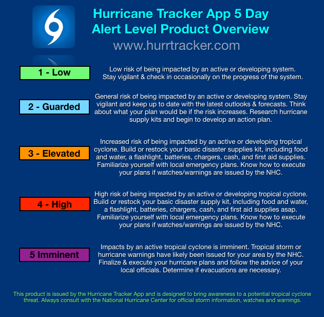
Please review our latest 5-day Alert Level Map below (we will issue an updated one this afternoon). If you live in a region marked by high alert levels (4), please read below which actions you should take today to prepare for this system. Power outages are expected through north-northeast Florida and in southeast Georgia as the system tracks north northeast.


Storm surge up to 5 feet, 65-85 mph winds and rainfall up to 10 inches will be the primary hazards. Please read more information below from the NHC.


We will be back with another email update this evening to report if there's any changes in the forecast track or intensity of the system. Thank you for using the Hurricane Tracker App service and have a great Wednesday. ~ Hurricane Tracker App Team.