
10/6/17 - Hurricane Warnings Issued For Portions of the Gulf Coast
All eyes are on Tropical Storm Nate today as significant impacts are appearing likely for parts of the U.S. Gulf coast. We have everything you need to know on Nate below.
Tropical Storm Nate:
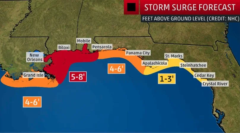
Nate remains as a tropical storm. It is currently back over the water north of Honduras. Today is a crucial day in determining how strong Nate may get. Wind shear is pretty low and water temperatures are extremely warm in this area, so how strong it gets today can help determine its strength before landfall on the U.S. Tonight, Nate may make landfall on the northeastern Yucatan Peninsula as a stronger tropical storm than it currently is. Maximum winds may get up to 60 mph. Then this weekend, Nate will move into the Gulf. Environmental conditions are expected to be conducive for further strengthening of the storm. Therefore, the National Hurricane Center is expecting Nate to become an 80 mph hurricane upon landfall on southeastern Louisiana, Mississippi, or Alabama. The hurricane models have been in tremendous agreement the past 24 hours or so, taking Nate right into the area described above. Storm surge of 4-7 feet is forecasted to the east of where the center makes land fall. At this time, significant storm surge is not expected for the New Orleans metro. Rainfall and flooding is another significant threat. Isolated locations may pick up to a foot of rain, which will likely cause flooding. Most areas will receive 3-6" inches of rain. This isn’t only a coastal storm, as much of the Eastern U.S. will deal with heavy rain from the remnants of Nate, so there is the chance for flooding inland as well. Portions of the interior southeast will also experience tropical storm force winds (SE MS, southern & central AL & parts of northern GA). Please review your local forecast from the National Weather Service for the expected impacts in your area at weather.gov.
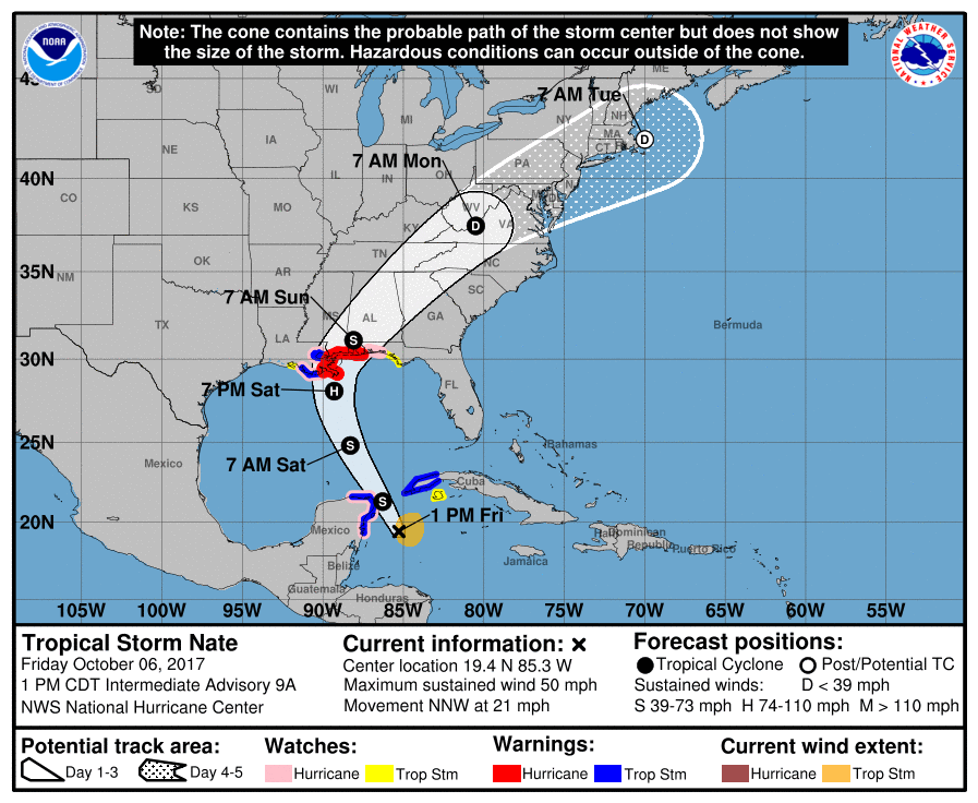
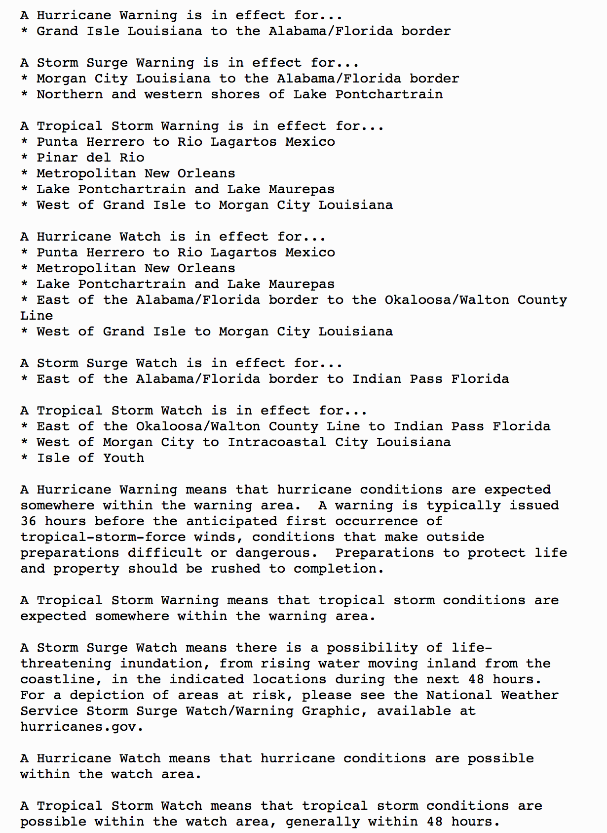
Watches & Warnings:
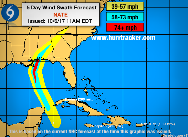
Latest wind swath forecast from the NHC.
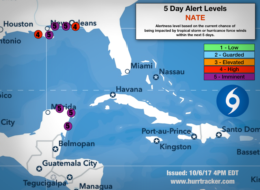
Impacts are imminent for portions of the Yucatan & the northern Gulf coast.
We will have another update as conditions warrant. Thank you for using our service and application.
-- Jackson Dill, Hurricane Tracker Team