10/3/17 - Newly Formed Invest 90L May Develop & Head Towards The Gulf
The tropics have finally quieted down with no active storms in the Atlantic basin. However, there is one area to watch (Invest 90L), which is our focus in today’s tropical discussion.
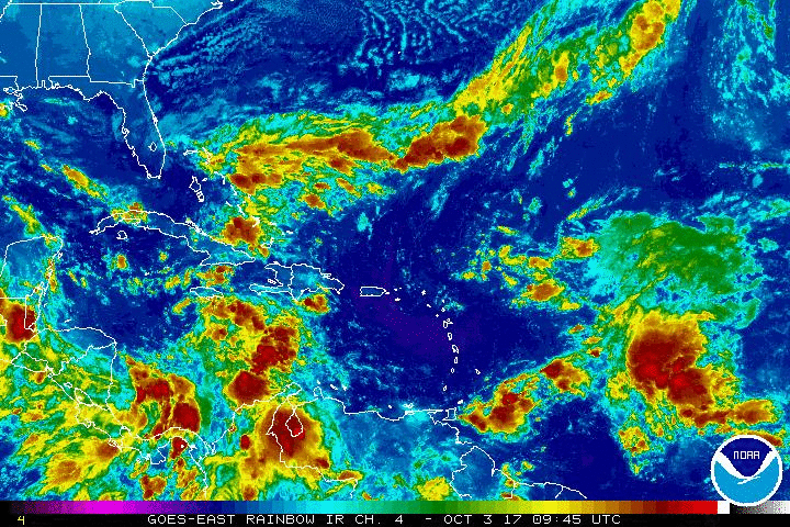
Tropical Outlook:
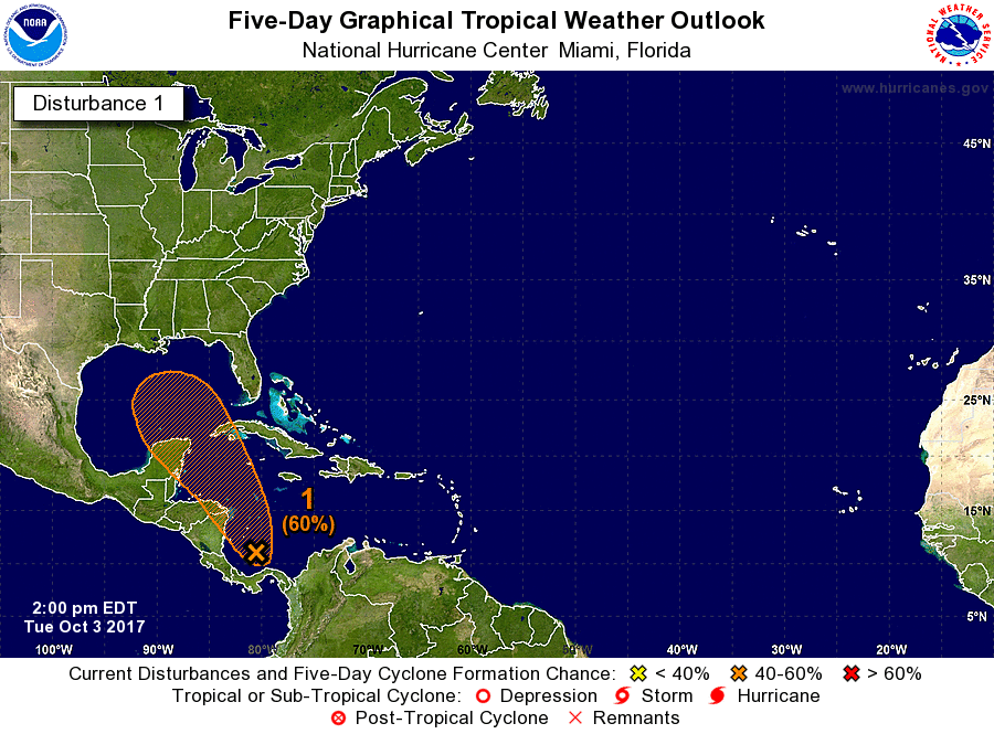
Invest 90L is currently located in the SW Caribbean Sea. The National Hurricane Center is giving it a near 40% chance for development within the next two days and a 60% chance within the next five. The question is will a more defined area of low pressure organize from this very large, broad area of low pressure. If it were to develop, it may impact land somewhere on the central or eastern Gulf Coast of the United States in about 5-7 days. Conditions may be favorable later this week for TS Nate to form and there's even a chance it could become a hurricane as the latest GFS and EURO model runs are showing.
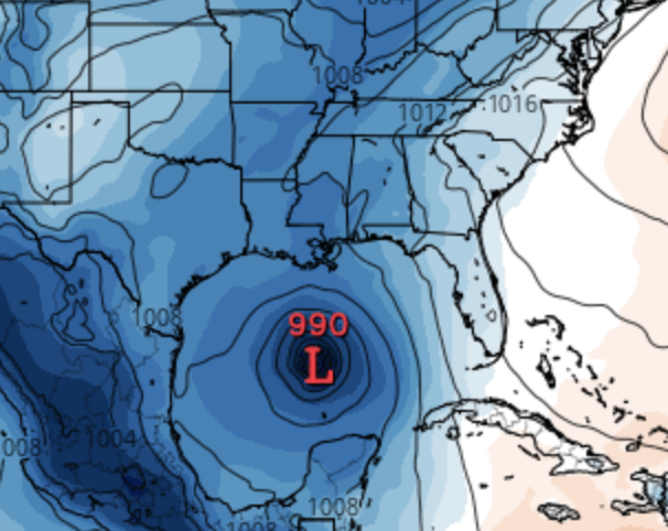
12Z EURO Valid SAT 10/7/17
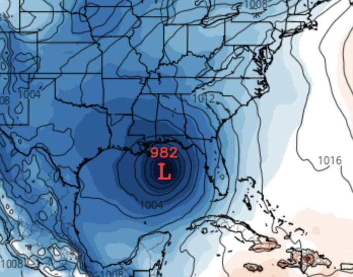
12Z EURO Valid SUN 10/8/17
Whether it forms or not, there is the potential for heavy rain due to deep tropical moisture for portions of the Gulf Coast, especially for the states: Florida, Mississippi, and Alabama. Anytime you have a potential tropical system in the West Caribbean or Gulf in early October it has to bee watched closely and we will keep you updated.
We will have another update as conditions warrant. Thank you for using our service and application.
-- Jackson Dill & Steve Parker, Hurricane Tracker App Team